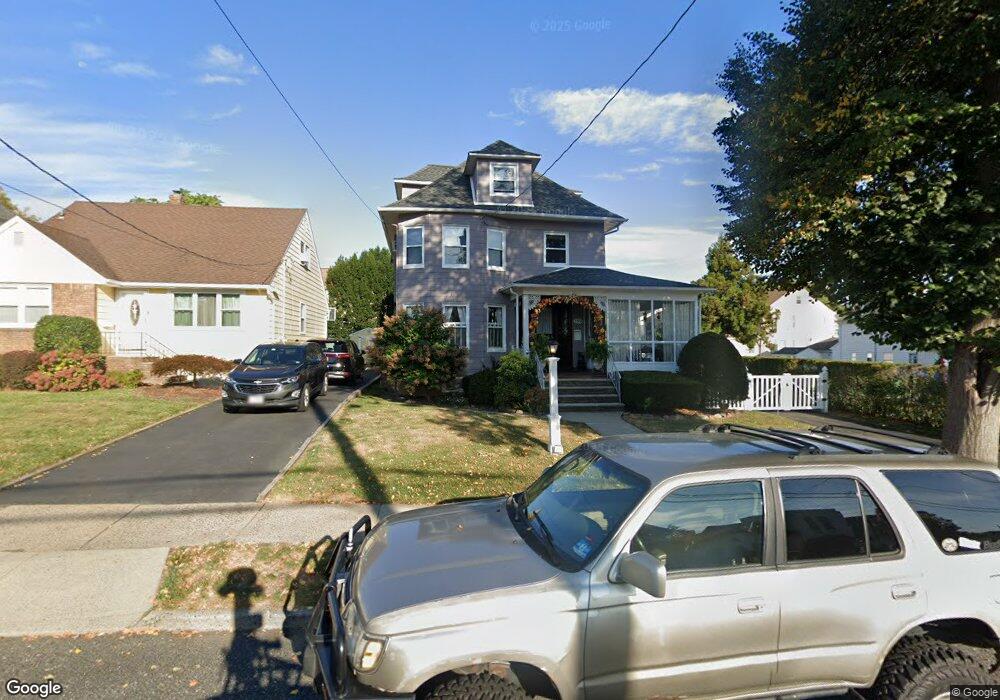
159 Burton Ave Hasbrouck Heights, NJ 07604
Estimated Value: $547,000 - $700,000
--
Bed
--
Bath
1,588
Sq Ft
$386/Sq Ft
Est. Value
About This Home
This home is located at 159 Burton Ave, Hasbrouck Heights, NJ 07604 and is currently estimated at $612,882, approximately $385 per square foot. 159 Burton Ave is a home located in Bergen County with nearby schools including Hasbrouck Heights High School and Corpus Christi School.
Ownership History
Date
Name
Owned For
Owner Type
Purchase Details
Closed on
Jun 27, 2001
Sold by
Buckley Miriam E
Bought by
Desics Paul S and Desics Nexhiope
Current Estimated Value
Home Financials for this Owner
Home Financials are based on the most recent Mortgage that was taken out on this home.
Original Mortgage
$162,500
Outstanding Balance
$62,942
Interest Rate
7.21%
Estimated Equity
$549,940
Purchase Details
Closed on
May 8, 2000
Sold by
Buckley John W and Buckley Miriam E
Bought by
Buckley Miriam E
Create a Home Valuation Report for This Property
The Home Valuation Report is an in-depth analysis detailing your home's value as well as a comparison with similar homes in the area
Home Values in the Area
Average Home Value in this Area
Purchase History
| Date | Buyer | Sale Price | Title Company |
|---|---|---|---|
| Desics Paul S | $222,500 | -- | |
| Buckley Miriam E | -- | -- |
Source: Public Records
Mortgage History
| Date | Status | Borrower | Loan Amount |
|---|---|---|---|
| Open | Desics Paul S | $162,500 |
Source: Public Records
Tax History Compared to Growth
Tax History
| Year | Tax Paid | Tax Assessment Tax Assessment Total Assessment is a certain percentage of the fair market value that is determined by local assessors to be the total taxable value of land and additions on the property. | Land | Improvement |
|---|---|---|---|---|
| 2025 | $10,838 | $424,200 | $227,000 | $197,200 |
| 2024 | $10,476 | $424,200 | $227,000 | $197,200 |
| 2023 | $10,138 | $406,500 | $217,000 | $189,500 |
| 2022 | $10,138 | $376,600 | $197,000 | $179,600 |
| 2021 | $9,844 | $348,600 | $184,500 | $164,100 |
| 2020 | $9,830 | $341,800 | $174,500 | $167,300 |
| 2019 | $9,556 | $335,900 | $172,000 | $163,900 |
| 2018 | $9,409 | $329,900 | $169,500 | $160,400 |
| 2017 | $9,253 | $324,000 | $167,000 | $157,000 |
| 2016 | $9,093 | $299,600 | $157,000 | $142,600 |
| 2015 | $8,946 | $299,600 | $157,000 | $142,600 |
| 2014 | $8,700 | $299,600 | $157,000 | $142,600 |
Source: Public Records
Map
Nearby Homes
- 208 Jefferson Ave
- 417 Franklin Ave
- 8800 Boulevard Unit 5F
- 8800 Boulevard Unit 7K
- 8800 Boulevard Unit 4B
- 18 Hasbrouck Ave
- 48 Hasbrouck Ave
- 444 Washington Place
- 233 Lasalle Ave
- 74 Kipp Ave
- 140 Prospect St
- 35 Franklin Ave
- 252 Paterson Ave
- 14 Jefferson Ave Unit 16
- 485 Hasbrouck Ave
- 212 Paterson Ave
- 243 Cleveland Ave
- 460 Boulevard
- 238 Bell Ave
- 34 Lasalle Ave
- 155 Burton Ave
- 263 Kipp Ave
- 263 Kipp Ave Unit 1st Floor
- 263 Kipp Ave Unit 2
- 264 Washington Place
- 259 Kipp Ave
- 260 Washington Place
- 305 Kipp Ave
- 305 Kipp Ave Unit 1
- 160 Burton Ave
- 255 Kipp Ave
- 252 Washington Place
- 145 Burton Ave
- 251 Kipp Ave
- 309 Kipp Ave
- 250 Washington Place
- 260 Kipp Ave
- 173 Burton Ave
- 313 Kipp Ave
- 313 Kipp Ave Unit 2nd