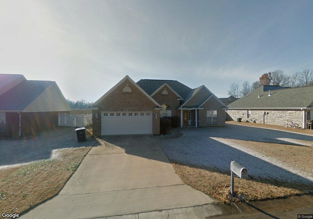
159 Colt Ln Guntown, MI 38849
Estimated Value: $225,000 - $255,000
3
Beds
2
Baths
1,770
Sq Ft
$138/Sq Ft
Est. Value
About This Home
This home is located at 159 Colt Ln, Guntown, MI 38849 and is currently estimated at $243,961, approximately $137 per square foot. 159 Colt Ln is a home located in Lee County with nearby schools including Saltillo Primary School, Saltillo Elementary School, and Guntown Middle School.
Ownership History
Date
Name
Owned For
Owner Type
Purchase Details
Closed on
Mar 6, 2009
Sold by
Pridmore Kevin and Pridmore Cindy
Bought by
Baker John T and Baker Tiffany R
Current Estimated Value
Home Financials for this Owner
Home Financials are based on the most recent Mortgage that was taken out on this home.
Original Mortgage
$140,800
Outstanding Balance
$89,903
Interest Rate
5.29%
Estimated Equity
$154,058
Purchase Details
Closed on
May 11, 2007
Sold by
Fowler Jimmy
Bought by
Pridmore Kevin and Pridemore Cindy
Home Financials for this Owner
Home Financials are based on the most recent Mortgage that was taken out on this home.
Original Mortgage
$107,920
Interest Rate
6.17%
Create a Home Valuation Report for This Property
The Home Valuation Report is an in-depth analysis detailing your home's value as well as a comparison with similar homes in the area
Home Values in the Area
Average Home Value in this Area
Purchase History
| Date | Buyer | Sale Price | Title Company |
|---|---|---|---|
| Baker John T | -- | -- | |
| Pridmore Kevin | -- | -- |
Source: Public Records
Mortgage History
| Date | Status | Borrower | Loan Amount |
|---|---|---|---|
| Open | Baker John T | $140,800 | |
| Previous Owner | Pridmore Kevin | $107,920 |
Source: Public Records
Tax History Compared to Growth
Tax History
| Year | Tax Paid | Tax Assessment Tax Assessment Total Assessment is a certain percentage of the fair market value that is determined by local assessors to be the total taxable value of land and additions on the property. | Land | Improvement |
|---|---|---|---|---|
| 2025 | $2,093 | $15,531 | $0 | $0 |
| 2024 | $2,093 | $15,531 | $0 | $0 |
| 2023 | $1,879 | $14,154 | $0 | $0 |
| 2022 | $1,579 | $14,154 | $0 | $0 |
| 2021 | $1,579 | $14,154 | $0 | $0 |
| 2020 | $1,875 | $14,154 | $0 | $0 |
| 2019 | $1,499 | $13,541 | $0 | $0 |
| 2018 | $1,510 | $13,541 | $0 | $0 |
| 2017 | $1,454 | $13,541 | $0 | $0 |
| 2016 | $1,399 | $13,541 | $0 | $0 |
| 2015 | $1,261 | $12,493 | $0 | $0 |
| 2014 | $1,261 | $12,493 | $0 | $0 |
Source: Public Records
Map
Nearby Homes
- 143 Eunice Dr
- 161 Benelli Dr
- 210 Pam Ave
- 0 0 Cr 911 (Hwy 45)
- 191 Greenhill Dr
- 172 Mike Ave
- 1056 County Road 833
- 125 Mike Ave
- 145 Lakeview Dr
- 0 Cr 2790 Lot 7
- 0 Cr 2790 Lot 8
- 0 Cr 2790 Lot 10
- 0 Cr 2790 Lot 6
- 0 Cr 2790 Lot 9
- 0 Cr 2790 Lot 5
- 0 Cr 2790 Lot 4
- 154 Cathryn Dr
- 0 Cr 833 - Lot 2 Unit 25-2582
- 117 Deerfield Rd
- 0