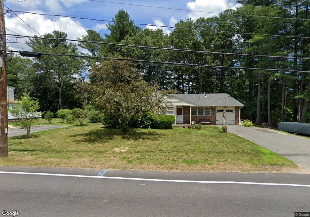
159 Dunstable Rd North Chelmsford, MA 01863
North Chelmsford NeighborhoodEstimated Value: $605,349 - $625,000
3
Beds
2
Baths
1,365
Sq Ft
$451/Sq Ft
Est. Value
About This Home
This home is located at 159 Dunstable Rd, North Chelmsford, MA 01863 and is currently estimated at $615,587, approximately $450 per square foot. 159 Dunstable Rd is a home located in Middlesex County with nearby schools including Parker Middle School, Innovation Academy Charter School, and Collegiate Charter School of Lowell.
Ownership History
Date
Name
Owned For
Owner Type
Purchase Details
Closed on
Nov 20, 2018
Sold by
Abbott David R
Bought by
Abbott John A
Current Estimated Value
Purchase Details
Closed on
Aug 25, 2014
Sold by
Abbott John E
Bought by
159 Rt and Abbott
Purchase Details
Closed on
Jul 18, 2013
Sold by
Abbott David R
Bought by
Abbott John E
Create a Home Valuation Report for This Property
The Home Valuation Report is an in-depth analysis detailing your home's value as well as a comparison with similar homes in the area
Home Values in the Area
Average Home Value in this Area
Purchase History
| Date | Buyer | Sale Price | Title Company |
|---|---|---|---|
| Abbott John A | -- | -- | |
| Abbott John A | -- | -- | |
| 159 Rt | -- | -- | |
| 159 Rt | -- | -- | |
| Abbott John E | -- | -- | |
| Abbott John E | -- | -- |
Source: Public Records
Tax History Compared to Growth
Tax History
| Year | Tax Paid | Tax Assessment Tax Assessment Total Assessment is a certain percentage of the fair market value that is determined by local assessors to be the total taxable value of land and additions on the property. | Land | Improvement |
|---|---|---|---|---|
| 2025 | $7,135 | $513,300 | $252,800 | $260,500 |
| 2024 | $6,884 | $505,400 | $252,800 | $252,600 |
| 2023 | $6,609 | $459,900 | $269,000 | $190,900 |
| 2022 | $6,516 | $413,200 | $232,300 | $180,900 |
| 2021 | $5,909 | $375,400 | $213,200 | $162,200 |
| 2020 | $5,772 | $350,900 | $193,900 | $157,000 |
| 2019 | $5,567 | $340,500 | $192,000 | $148,500 |
| 2018 | $4,634 | $317,900 | $173,000 | $144,900 |
| 2017 | $5,328 | $297,300 | $162,200 | $135,100 |
| 2016 | $5,072 | $281,300 | $164,900 | $116,400 |
| 2015 | $4,954 | $264,900 | $149,900 | $115,000 |
| 2014 | $4,794 | $252,600 | $142,400 | $110,200 |
Source: Public Records
Map
Nearby Homes
- 5 Mission Rd Unit 203
- 1 Hope St
- 863 Wellman Ave Unit 863
- 180 Tyngsboro Rd Unit 3
- 48 Mission Rd
- 415 Wellman Ave
- 10 Butterfield St
- 10 Worden Rd
- 436 Wellman Ave
- 330 Wellman Ave
- 271 Wellman Ave
- 251 Wellman Ave Unit 251
- 348 Wellman Ave
- 739 Wellman Ave
- 126 Groton Rd
- 30 Russell Rd
- 730 Wellman Ave
- 38 Scotty Hollow Dr Unit E
- 10 Mansur St
- 16 Middlesex St Unit 4
- 160 Dunstable Rd
- 167 Dunstable Rd
- 164 Dunstable Rd
- 158 Dunstable Rd
- 151 Dunstable Rd
- 166 Dunstable Rd
- 154 Dunstable Rd
- 169 Dunstable Rd
- 168 Dunstable Rd
- 37 Dunshire Dr
- 147 Dunstable Rd
- 35 Dunshire Dr
- 39 Dunshire Dr
- 3 Mission Rd
- 1 Mission Rd
- 3 Mission Rd Unit 3
- 4 Glendale Rd
- 152 Dunstable Rd
- 1 Glendale Rd
- 150 Dunstable Rd