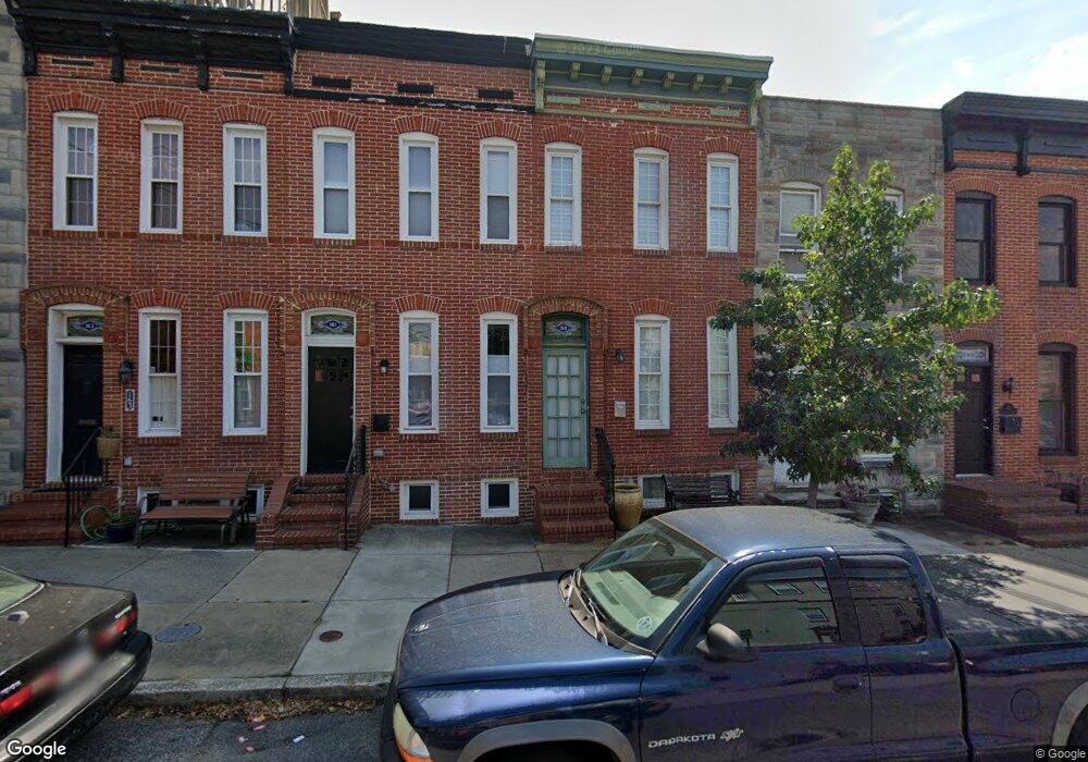
159 E Randall St Baltimore, MD 21230
Riverside NeighborhoodEstimated Value: $329,464 - $617,000
2
Beds
3
Baths
1,126
Sq Ft
$420/Sq Ft
Est. Value
About This Home
This home is located at 159 E Randall St, Baltimore, MD 21230 and is currently estimated at $473,232, approximately $420 per square foot. 159 E Randall St is a home located in Baltimore City with nearby schools including Thomas Johnson Elementary School, Booker T. Washington Middle School, and Digital Harbor High School.
Ownership History
Date
Name
Owned For
Owner Type
Purchase Details
Closed on
Mar 29, 2004
Sold by
Cox Elena M
Bought by
Snodgrass Robert N
Current Estimated Value
Purchase Details
Closed on
Apr 7, 2003
Sold by
Fay Martin Henry
Bought by
Cox Elena M and Williams John W
Purchase Details
Closed on
Feb 2, 1995
Sold by
Propst Eva V
Bought by
Lemay Curtis
Home Financials for this Owner
Home Financials are based on the most recent Mortgage that was taken out on this home.
Original Mortgage
$34,500
Interest Rate
9.13%
Create a Home Valuation Report for This Property
The Home Valuation Report is an in-depth analysis detailing your home's value as well as a comparison with similar homes in the area
Home Values in the Area
Average Home Value in this Area
Purchase History
| Date | Buyer | Sale Price | Title Company |
|---|---|---|---|
| Snodgrass Robert N | $269,900 | -- | |
| Cox Elena M | $140,000 | -- | |
| Lemay Curtis | $36,800 | -- |
Source: Public Records
Mortgage History
| Date | Status | Borrower | Loan Amount |
|---|---|---|---|
| Previous Owner | Lemay Curtis | $34,500 |
Source: Public Records
Tax History
| Year | Tax Paid | Tax Assessment Tax Assessment Total Assessment is a certain percentage of the fair market value that is determined by local assessors to be the total taxable value of land and additions on the property. | Land | Improvement |
|---|---|---|---|---|
| 2025 | $6,261 | $303,067 | -- | -- |
| 2024 | $6,261 | $292,333 | -- | -- |
| 2023 | $6,077 | $281,600 | $80,000 | $201,600 |
| 2022 | $6,002 | $277,967 | $0 | $0 |
| 2021 | $6,474 | $274,333 | $0 | $0 |
| 2020 | $5,849 | $270,700 | $80,000 | $190,700 |
| 2019 | $5,819 | $270,700 | $80,000 | $190,700 |
| 2018 | $5,912 | $270,700 | $80,000 | $190,700 |
| 2017 | $6,056 | $274,600 | $0 | $0 |
| 2016 | $5,413 | $265,833 | $0 | $0 |
| 2015 | $5,413 | $257,067 | $0 | $0 |
| 2014 | $5,413 | $248,300 | $0 | $0 |
Source: Public Records
Map
Nearby Homes
- 1523 William St
- 1520 Byrd St
- 1720 Byrd St
- 214 E Fort Ave
- 1601 Marshall St
- 117 Bloomsberry St
- 230 E Barney St
- 232 E Barney St
- 130 E Barney St
- 1728 Light St
- 1519 Henry St
- 1436 Light St
- 1434 Light St
- 40 E Barney St
- 1622 Patapsco St
- 27 Birckhead St
- 17 Birckhead St
- 405 E Clement St
- 442 E Fort Ave
- 1613 S Charles St
- 161 E Randall St
- 157 E Randall St
- 163 E Randall St
- 155 E Randall St
- 153 E Randall St
- 151 E Randall St
- 149 E Randall St
- 165 E Randall St
- 147 E Randall St
- 1606 Johnson St
- 1602 Johnson St
- 1600 Johnson St
- 1604 Johnson St
- 141 E Randall St
- 1548 William St
- 139 E Randall St
- 137 E Randall St
- 1544 William St
- 135 E Randall St
- 200 E Randall St
Your Personal Tour Guide
Ask me questions while you tour the home.