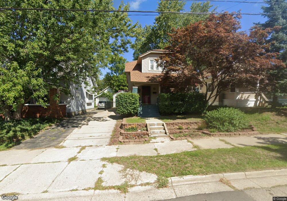
159 Elmwood St NE Grand Rapids, MI 49505
Creston NeighborhoodEstimated Value: $260,000 - $336,000
3
Beds
2
Baths
1,260
Sq Ft
$235/Sq Ft
Est. Value
About This Home
This home is located at 159 Elmwood St NE, Grand Rapids, MI 49505 and is currently estimated at $295,571, approximately $234 per square foot. 159 Elmwood St NE is a home located in Kent County with nearby schools including Palmer School, Riverside Middle School, and Union High School.
Ownership History
Date
Name
Owned For
Owner Type
Purchase Details
Closed on
May 25, 2023
Sold by
Lahaie Amy L
Bought by
Lahaie Amy L
Current Estimated Value
Purchase Details
Closed on
Feb 14, 2011
Sold by
Borrink David and Borrink Sallie Ann
Bought by
Lahaie Amy
Home Financials for this Owner
Home Financials are based on the most recent Mortgage that was taken out on this home.
Original Mortgage
$75,200
Interest Rate
4.81%
Mortgage Type
New Conventional
Purchase Details
Closed on
May 31, 1989
Purchase Details
Closed on
Mar 22, 1985
Bought by
Lahaie Amy
Purchase Details
Closed on
Mar 21, 1985
Bought by
Lahaie Amy
Create a Home Valuation Report for This Property
The Home Valuation Report is an in-depth analysis detailing your home's value as well as a comparison with similar homes in the area
Home Values in the Area
Average Home Value in this Area
Purchase History
| Date | Buyer | Sale Price | Title Company |
|---|---|---|---|
| Lahaie Amy L | -- | None Listed On Document | |
| Lahaie Amy | $94,350 | Multiple | |
| -- | $51,900 | -- | |
| Lahaie Amy | $33,000 | -- | |
| Lahaie Amy | $18,000 | -- |
Source: Public Records
Mortgage History
| Date | Status | Borrower | Loan Amount |
|---|---|---|---|
| Previous Owner | Lahaie Amy | $75,200 |
Source: Public Records
Tax History Compared to Growth
Tax History
| Year | Tax Paid | Tax Assessment Tax Assessment Total Assessment is a certain percentage of the fair market value that is determined by local assessors to be the total taxable value of land and additions on the property. | Land | Improvement |
|---|---|---|---|---|
| 2025 | $1,508 | $117,500 | $0 | $0 |
| 2024 | $1,508 | $104,600 | $0 | $0 |
| 2023 | $1,530 | $95,100 | $0 | $0 |
| 2022 | $1,452 | $85,200 | $0 | $0 |
| 2021 | $1,420 | $75,200 | $0 | $0 |
| 2020 | $1,357 | $66,700 | $0 | $0 |
| 2019 | $1,373 | $60,700 | $0 | $0 |
| 2018 | $1,373 | $53,800 | $0 | $0 |
| 2017 | $1,337 | $46,700 | $0 | $0 |
| 2016 | $1,353 | $42,700 | $0 | $0 |
| 2015 | $1,258 | $42,700 | $0 | $0 |
| 2013 | -- | $37,000 | $0 | $0 |
Source: Public Records
Map
Nearby Homes
- 1922 Coit Ave NE
- 225 Burr Oak St NE
- 142 Burr Oak St NE
- 143 Dean St NE
- 22 Elmwood St NE
- 2060 Swensberg Ave NE
- 16 Graceland St NE
- 2107 Prospect Ave NE
- 240 Eleanor St NE
- 122 Bowne St NE
- 68 Bowne St NE
- 30 Palmer St NW
- 465 Kenwood St NE
- 310 Sweet St NE
- 483 Kenwood St NE
- 212 Saunders Ct NE
- 1530 Queen Ave NE
- 2033 Melita Ave NE
- 327 Quimby St NE
- 1516 Cole Ave NE
- 165 Elmwood St NE
- 155 Elmwood St NE
- 1945 Coit Ave NE
- 151 Elmwood St NE
- 1949 Coit Ave NE
- 147 Elmwood St NE
- 1925 Coit Ave NE
- 1953 Coit Ave NE
- 154 Knapp St NE
- 143 Elmwood St NE
- 1936 Coit Ave NE
- 1932 Coit Ave NE
- 150 Knapp St NE
- 154 Elmwood St NE
- 1917 Coit Ave NE
- 1940 Coit Ave NE
- 150 Elmwood St NE
- 148 Knapp St NE
- 1957 Coit Ave NE
- 1948 Coit Ave NE Unit Bldg-Unit