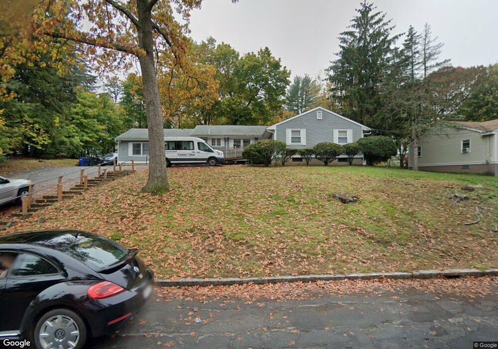
159 Hopkins St Reading, MA 01867
3
Beds
3
Baths
2,258
Sq Ft
0.6
Acres
About This Home
This home is located at 159 Hopkins St, Reading, MA 01867. 159 Hopkins St is a home located in Middlesex County with nearby schools including Joshua Eaton Elementary School, Walter S. Parker Middle School, and Reading Memorial High School.
Ownership History
Date
Name
Owned For
Owner Type
Purchase Details
Closed on
Jul 26, 2001
Sold by
E Middlesex Assoc
Bought by
Hopkins St Hsng Corp
Home Financials for this Owner
Home Financials are based on the most recent Mortgage that was taken out on this home.
Original Mortgage
$331,500
Outstanding Balance
$129,593
Interest Rate
7.18%
Mortgage Type
Commercial
Purchase Details
Closed on
Dec 30, 1996
Sold by
Willesen Marjorie Est and Latham
Bought by
East Middlesex Assn
Home Financials for this Owner
Home Financials are based on the most recent Mortgage that was taken out on this home.
Original Mortgage
$164,000
Interest Rate
7.55%
Mortgage Type
Commercial
Create a Home Valuation Report for This Property
The Home Valuation Report is an in-depth analysis detailing your home's value as well as a comparison with similar homes in the area
Home Values in the Area
Average Home Value in this Area
Purchase History
| Date | Buyer | Sale Price | Title Company |
|---|---|---|---|
| Hopkins St Hsng Corp | $146,000 | -- | |
| East Middlesex Assn | $205,000 | -- |
Source: Public Records
Mortgage History
| Date | Status | Borrower | Loan Amount |
|---|---|---|---|
| Open | East Middlesex Assn | $331,500 | |
| Previous Owner | East Middlesex Assn | $164,000 |
Source: Public Records
Tax History Compared to Growth
Tax History
| Year | Tax Paid | Tax Assessment Tax Assessment Total Assessment is a certain percentage of the fair market value that is determined by local assessors to be the total taxable value of land and additions on the property. | Land | Improvement |
|---|---|---|---|---|
| 2025 | -- | $842,000 | $476,200 | $365,800 |
| 2024 | -- | $793,900 | $449,000 | $344,900 |
| 2023 | $0 | $756,100 | $427,600 | $328,500 |
| 2022 | $0 | $687,400 | $388,800 | $298,600 |
| 2021 | $0 | $638,900 | $362,800 | $276,100 |
| 2020 | $0 | $604,900 | $343,500 | $261,400 |
| 2019 | $0 | $576,100 | $327,100 | $249,000 |
| 2018 | $0 | $547,300 | $310,800 | $236,500 |
| 2017 | -- | $523,700 | $297,400 | $226,300 |
| 2016 | -- | $427,800 | $244,300 | $183,500 |
| 2015 | -- | $407,500 | $232,700 | $174,800 |
| 2014 | -- | $388,000 | $221,600 | $166,400 |
Source: Public Records
Map
Nearby Homes
- 7 Leaning Elm Dr Unit 7
- 2 Summit Dr Unit 18
- 62 Abigail Way Unit 2007
- 62 Abigail Way Unit 3004
- 313 South St
- 114 Parker Rd
- 237 Main St Unit A4
- 89 Walnut St
- 64 Main St Unit 41B
- 4 Mcdonald Farm Rd
- 43 Friend St
- 68 Main St Unit 36C
- 4 Adams St
- 97 Oak St
- 133 Pine Ridge Rd
- 90 Prospect St
- 13 Elaine Rd
- 97 Macarthur Rd
- 35 Park Ave
- 246 Walnut St