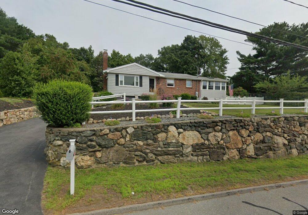
159 Hosmer St Marlborough, MA 01752
Estimated Value: $504,000 - $560,000
3
Beds
1
Bath
1,070
Sq Ft
$501/Sq Ft
Est. Value
About This Home
This home is located at 159 Hosmer St, Marlborough, MA 01752 and is currently estimated at $535,558, approximately $500 per square foot. 159 Hosmer St is a home located in Middlesex County with nearby schools including Marlborough High School, New Covenant Christian School, and Glenhaven Academy - JRI School.
Ownership History
Date
Name
Owned For
Owner Type
Purchase Details
Closed on
Oct 1, 2010
Sold by
Bryant William B and Bryant Kathleen M
Bought by
Bryant William B and Bryant Kathleen M
Current Estimated Value
Home Financials for this Owner
Home Financials are based on the most recent Mortgage that was taken out on this home.
Original Mortgage
$25,000
Outstanding Balance
$16,573
Interest Rate
4.44%
Mortgage Type
Purchase Money Mortgage
Estimated Equity
$518,985
Create a Home Valuation Report for This Property
The Home Valuation Report is an in-depth analysis detailing your home's value as well as a comparison with similar homes in the area
Home Values in the Area
Average Home Value in this Area
Purchase History
| Date | Buyer | Sale Price | Title Company |
|---|---|---|---|
| Bryant William B | -- | -- |
Source: Public Records
Mortgage History
| Date | Status | Borrower | Loan Amount |
|---|---|---|---|
| Open | Bryant William B | $25,000 |
Source: Public Records
Tax History Compared to Growth
Tax History
| Year | Tax Paid | Tax Assessment Tax Assessment Total Assessment is a certain percentage of the fair market value that is determined by local assessors to be the total taxable value of land and additions on the property. | Land | Improvement |
|---|---|---|---|---|
| 2025 | $4,265 | $432,600 | $228,100 | $204,500 |
| 2024 | $4,308 | $420,700 | $207,400 | $213,300 |
| 2023 | $4,704 | $407,600 | $178,100 | $229,500 |
| 2022 | $4,616 | $351,800 | $169,500 | $182,300 |
| 2021 | $4,579 | $331,800 | $141,400 | $190,400 |
| 2020 | $4,532 | $319,600 | $134,600 | $185,000 |
| 2019 | $4,440 | $315,600 | $131,900 | $183,700 |
| 2018 | $4,140 | $283,000 | $113,400 | $169,600 |
| 2017 | $3,861 | $252,000 | $110,900 | $141,100 |
| 2016 | $3,718 | $242,400 | $110,900 | $131,500 |
| 2015 | $3,604 | $228,700 | $113,200 | $115,500 |
Source: Public Records
Map
Nearby Homes
- 38 Airport Blvd
- 37 Hosmer St Unit 10
- 37 Hosmer St Unit 20
- 45 Raffaele Rd
- 323 Robert Rd
- 24 Clinton St
- 16 Clinton St
- 110 Boston Post Rd E Unit 104
- 97 Cook Ln
- 96 Cook Ln
- 256 Robert Rd
- 41 Kane Dr
- 25 Walnut St
- 114 Lodi Rd
- 93 E Main St
- 181 Boston Post Rd E Unit 26
- 53 Phelps St
- Lot 1 Quinn Rd
- 211 Stevens St
- 53 Hillcrest Rd
- 169 Hosmer St
- 40 Briarwood Ln Unit 8
- 39 Briarwood Ln
- 39 Briarwood Ln Unit 3
- 39 Briarwood Ln Unit 11
- 39 Briarwood Ln Unit 1
- 177 Hosmer St
- 42 Briarwood Ln Unit 4
- 42 Briarwood Ln Unit 10
- 133 Hosmer St
- 133 Hosmer St Unit A
- 37 Briarwood Ln Unit 3
- 37 Briarwood Ln Unit 2
- 38 Briarwood Ln Unit 1
- 43 Briarwood Ln Unit 1
- 43 Briarwood Ln Unit 12
- 186 Hosmer St
- 191 Hosmer St
- 44 Briarwood Ln Unit 1
- 44 Briarwood Ln Unit 7