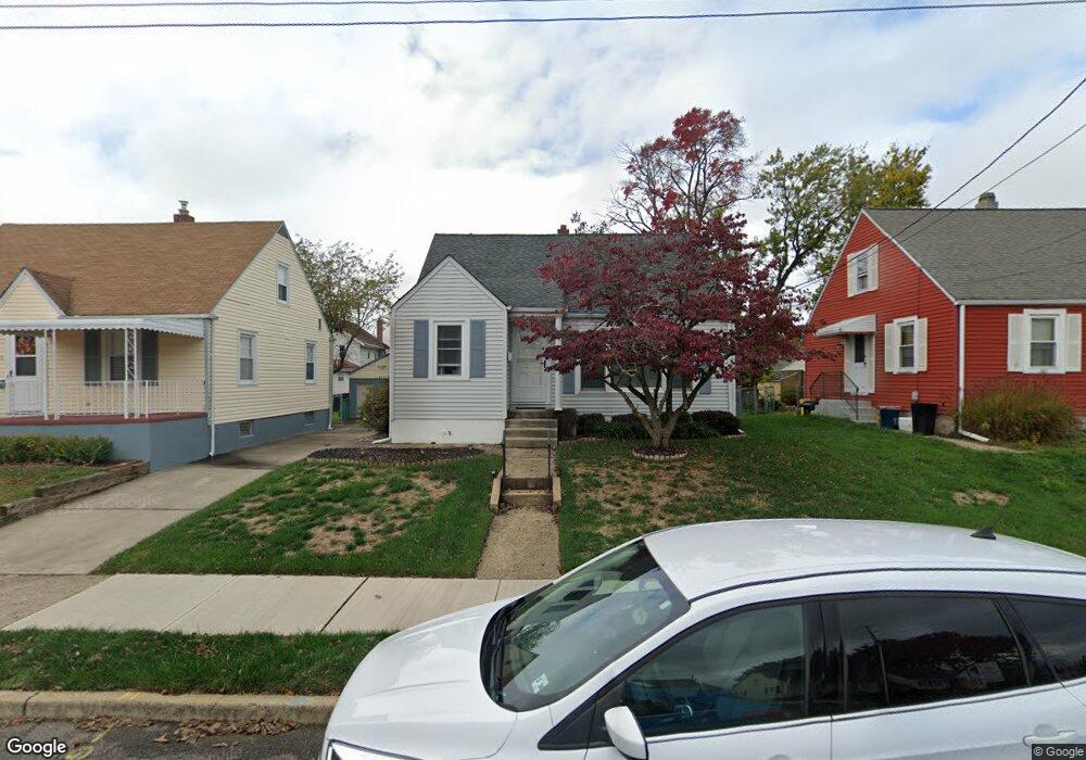
159 Irvington Place Trenton, NJ 08610
Estimated Value: $244,684 - $331,000
--
Bed
--
Bath
1,058
Sq Ft
$286/Sq Ft
Est. Value
About This Home
This home is located at 159 Irvington Place, Trenton, NJ 08610 and is currently estimated at $302,921, approximately $286 per square foot. 159 Irvington Place is a home located in Mercer County with nearby schools including George E. Wilson Elementary School, Albert E. Grice Middle School, and Hamilton West-Watson High School.
Ownership History
Date
Name
Owned For
Owner Type
Purchase Details
Closed on
Dec 14, 2005
Current Estimated Value
Purchase Details
Closed on
Dec 13, 1994
Sold by
Decd Eleanor E Boney
Bought by
Mctamney Beth A Barnabe
Home Financials for this Owner
Home Financials are based on the most recent Mortgage that was taken out on this home.
Original Mortgage
$75,000
Interest Rate
9%
Mortgage Type
Purchase Money Mortgage
Create a Home Valuation Report for This Property
The Home Valuation Report is an in-depth analysis detailing your home's value as well as a comparison with similar homes in the area
Home Values in the Area
Average Home Value in this Area
Purchase History
| Date | Buyer | Sale Price | Title Company |
|---|---|---|---|
| -- | -- | -- | |
| Mctamney Beth A Barnabe | $85,000 | -- |
Source: Public Records
Mortgage History
| Date | Status | Borrower | Loan Amount |
|---|---|---|---|
| Previous Owner | Mctamney Beth A Barnabe | $75,000 |
Source: Public Records
Tax History Compared to Growth
Tax History
| Year | Tax Paid | Tax Assessment Tax Assessment Total Assessment is a certain percentage of the fair market value that is determined by local assessors to be the total taxable value of land and additions on the property. | Land | Improvement |
|---|---|---|---|---|
| 2025 | $5,173 | $146,800 | $54,200 | $92,600 |
| 2024 | $4,849 | $146,800 | $54,200 | $92,600 |
| 2023 | $4,849 | $146,800 | $54,200 | $92,600 |
| 2022 | $4,772 | $146,800 | $54,200 | $92,600 |
| 2021 | $5,920 | $146,800 | $54,200 | $92,600 |
| 2020 | $5,392 | $146,800 | $54,200 | $92,600 |
| 2019 | $5,233 | $146,800 | $54,200 | $92,600 |
| 2018 | $5,194 | $146,800 | $54,200 | $92,600 |
| 2017 | $4,921 | $146,800 | $54,200 | $92,600 |
| 2016 | $3,969 | $146,800 | $54,200 | $92,600 |
| 2015 | $4,884 | $93,400 | $39,100 | $54,300 |
| 2014 | $4,783 | $93,400 | $39,100 | $54,300 |
Source: Public Records
Map
Nearby Homes
- 164 Lillian Ave
- 118 Hunter Ave
- 158 Churchill Ave
- 252 Churchill Ave
- 204 Thropp Ave
- 109 E Park Ave
- 234 Thropp Ave
- 28 Thropp Ave
- 949 Schiller Ave
- 156 Maddock Ave
- 2033 Genesee St
- 624 Hunt Ave
- 429 Wilfred Ave
- 533 Hunt Ave
- 316 W Park Ave
- 408 Berg Ave
- 529 Hunt Ave
- 323 Wilfred Ave
- 1961 S Broad St
- 604 Schiller Ave
- 153 Irvington Place
- 165 Irvington Place
- 171 Irvington Place
- 147 Irvington Place
- 152 Lillian Ave
- 146 Lillian Ave
- 158 Lillian Ave
- 142 Lillian Ave
- 135 Irvington Place
- 203 Irvington Place
- 202 Lillian Ave
- 154 Edward Ave
- 148 Edward Ave
- 160 Edward Ave
- 130 Lillian Ave
- 142 Edward Ave
- 127 Irvington Place
- 166 Edward Ave
- 136 Irvington Place
- 209 Irvington Place