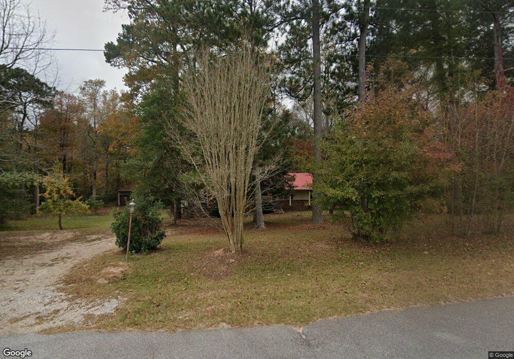
159 Meriwether Park Dr Hogansville, GA 30230
Estimated Value: $202,501 - $369,000
3
Beds
1
Bath
1,914
Sq Ft
$144/Sq Ft
Est. Value
About This Home
This home is located at 159 Meriwether Park Dr, Hogansville, GA 30230 and is currently estimated at $275,125, approximately $143 per square foot. 159 Meriwether Park Dr is a home located in Meriwether County with nearby schools including Unity Elementary School.
Ownership History
Date
Name
Owned For
Owner Type
Purchase Details
Closed on
Apr 1, 2015
Sold by
Bain William Kenneth
Bought by
Meriwether Llc and Tar Heel Land Llc
Current Estimated Value
Home Financials for this Owner
Home Financials are based on the most recent Mortgage that was taken out on this home.
Original Mortgage
$64,000
Interest Rate
3.84%
Mortgage Type
New Conventional
Purchase Details
Closed on
Jan 1, 1976
Sold by
Dodson Marilyn Pb 13
Bought by
Bain Wm Kenneth and Bain Ma
Purchase Details
Closed on
Jan 1, 1963
Sold by
Odell Odell W and Odell R
Bought by
Dodson Marilyn Pb 13
Create a Home Valuation Report for This Property
The Home Valuation Report is an in-depth analysis detailing your home's value as well as a comparison with similar homes in the area
Home Values in the Area
Average Home Value in this Area
Purchase History
| Date | Buyer | Sale Price | Title Company |
|---|---|---|---|
| Meriwether Llc | $80,000 | -- | |
| Bain Wm Kenneth | $33,600 | -- | |
| Dodson Marilyn Pb 13 | -- | -- |
Source: Public Records
Mortgage History
| Date | Status | Borrower | Loan Amount |
|---|---|---|---|
| Closed | Meriwether Llc | $64,000 |
Source: Public Records
Tax History Compared to Growth
Tax History
| Year | Tax Paid | Tax Assessment Tax Assessment Total Assessment is a certain percentage of the fair market value that is determined by local assessors to be the total taxable value of land and additions on the property. | Land | Improvement |
|---|---|---|---|---|
| 2024 | $2,213 | $66,620 | $4,880 | $61,740 |
| 2023 | $1,570 | $45,500 | $4,880 | $40,620 |
| 2022 | $1,570 | $45,500 | $4,880 | $40,620 |
| 2021 | $1,595 | $45,500 | $4,880 | $40,620 |
| 2020 | $1,608 | $45,500 | $4,880 | $40,620 |
| 2019 | $1,612 | $45,500 | $4,880 | $40,620 |
| 2018 | $1,628 | $45,500 | $4,880 | $40,620 |
| 2017 | $1,646 | $45,500 | $4,880 | $40,620 |
| 2016 | $1,498 | $45,500 | $4,880 | $40,620 |
| 2015 | $1,025 | $45,500 | $4,880 | $40,620 |
| 2014 | $1,026 | $45,500 | $4,880 | $40,620 |
| 2013 | -- | $45,500 | $4,880 | $40,620 |
Source: Public Records
Map
Nearby Homes
- 1501 E Main St
- 133 Percheron Rd
- 133 Percheron Rd Unit 95
- 603 Haflinger Rd Unit 22
- 131 Percheron Rd
- 131 Percheron Rd Unit 96
- 605 Haflinger Rd Unit 21
- 605 Halflinger Rd
- 605 Percheron Rd
- 129 Percheron Rd
- 129 Percheron Rd Unit 97
- 127 Percheron Rd
- 128 Percheron Rd Unit 18
- 125 Percheron Rd
- 125 Percheron Rd Unit 99
- 123 Percheron Rd Unit 100
- 124 Percheron Rd Unit 16
- 106 Percheron Rd Unit LOT 10
- Jodeco Front Porch Plan at Jones Crossing
- Jodeco Box Bay Plan at Jones Crossing
- 7790 Lone Oak Rd
- 1678 Sims Rd
- 7418 Lone Oak Rd
- 49 Emmaus Rd
- 1669 Sims Rd
- 7506 Lone Oak Rd
- 1651 Sims Rd
- 12580 Highway 100
- 1540 Sims Rd
- 0 Highway 54 Unit I85 8303608
- 0 Hwy 54 at I85 Unit 2799817
- 0 Highway 54 Unit I85 7329612
- 0 Highway 54 Unit 7434049
- 0 Highway 54 Unit 7525628
- 0 Highway 54 Unit 7640431
- 0 Highway 54 Unit 10 ACRES 8917980
- 0 Highway 54 Unit 20116849
- 0 Highway 54 Unit 7468723
- 0 Highway 54 Unit 7202875
- 0 Highway 54 Unit 7028305
