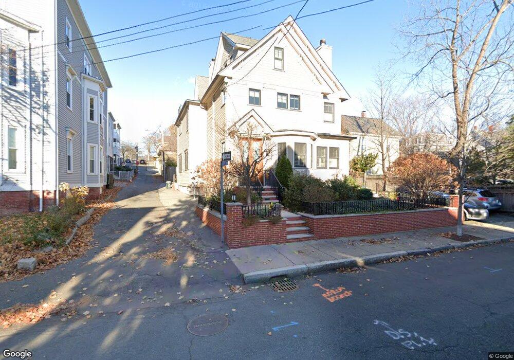
159 Morrison Ave Unit 1 Somerville, MA 02144
Davis Square NeighborhoodEstimated Value: $1,612,000 - $1,948,000
3
Beds
3
Baths
3,228
Sq Ft
$570/Sq Ft
Est. Value
About This Home
This home is located at 159 Morrison Ave Unit 1, Somerville, MA 02144 and is currently estimated at $1,840,796, approximately $570 per square foot. 159 Morrison Ave Unit 1 is a home located in Middlesex County with nearby schools including Somerville High School, St. Clement Elementary School, and Wild Rose Montessori School.
Ownership History
Date
Name
Owned For
Owner Type
Purchase Details
Closed on
Feb 17, 2015
Sold by
Radvany Paul and Radvany Anna M
Bought by
Radvany Rt and Radvany Paul
Current Estimated Value
Purchase Details
Closed on
Jun 27, 2011
Sold by
Waters Vaughn and Greenough Paul G
Bought by
Radvany Anna M and Radvany Paul
Purchase Details
Closed on
Jun 13, 2007
Sold by
Waypoint Dev Llc
Bought by
Greenough Paul Gregg and Waters Vaughn
Home Financials for this Owner
Home Financials are based on the most recent Mortgage that was taken out on this home.
Original Mortgage
$739,999
Interest Rate
6.19%
Mortgage Type
Purchase Money Mortgage
Purchase Details
Closed on
May 10, 2007
Sold by
Champy Edward P
Bought by
Waypoint Dev Llc
Home Financials for this Owner
Home Financials are based on the most recent Mortgage that was taken out on this home.
Original Mortgage
$739,999
Interest Rate
6.19%
Mortgage Type
Purchase Money Mortgage
Purchase Details
Closed on
Jan 30, 2004
Sold by
Glass David C and Glass Lisa M
Bought by
Champy Edward P
Home Financials for this Owner
Home Financials are based on the most recent Mortgage that was taken out on this home.
Original Mortgage
$472,000
Interest Rate
5.82%
Mortgage Type
Purchase Money Mortgage
Purchase Details
Closed on
Aug 5, 1999
Sold by
Mclean David M and Mclean Tracey L
Bought by
Glass David C and Glass Lisa M
Home Financials for this Owner
Home Financials are based on the most recent Mortgage that was taken out on this home.
Original Mortgage
$290,700
Interest Rate
7.54%
Mortgage Type
Purchase Money Mortgage
Purchase Details
Closed on
Mar 21, 1996
Sold by
Mclean Wallace B and Mclean Rita M
Bought by
Mclean David M and Mclean Tracey L
Home Financials for this Owner
Home Financials are based on the most recent Mortgage that was taken out on this home.
Original Mortgage
$149,500
Interest Rate
6.99%
Mortgage Type
Purchase Money Mortgage
Create a Home Valuation Report for This Property
The Home Valuation Report is an in-depth analysis detailing your home's value as well as a comparison with similar homes in the area
Home Values in the Area
Average Home Value in this Area
Purchase History
| Date | Buyer | Sale Price | Title Company |
|---|---|---|---|
| Radvany Rt | -- | -- | |
| Radvany Anna M | $1,001,000 | -- | |
| Greenough Paul Gregg | $925,000 | -- | |
| Waypoint Dev Llc | -- | -- | |
| Champy Edward P | $590,000 | -- | |
| Glass David C | $323,000 | -- | |
| Mclean David M | $187,000 | -- |
Source: Public Records
Mortgage History
| Date | Status | Borrower | Loan Amount |
|---|---|---|---|
| Previous Owner | Greenough Paul Gregg | $739,999 | |
| Previous Owner | Champy Edward P | $472,000 | |
| Previous Owner | Mclean David M | $290,700 | |
| Previous Owner | Mclean David M | $146,000 | |
| Previous Owner | Mclean David M | $149,500 |
Source: Public Records
Tax History
| Year | Tax Paid | Tax Assessment Tax Assessment Total Assessment is a certain percentage of the fair market value that is determined by local assessors to be the total taxable value of land and additions on the property. | Land | Improvement |
|---|---|---|---|---|
| 2025 | $21,349 | $1,956,800 | $0 | $1,956,800 |
| 2024 | $19,709 | $1,873,500 | $0 | $1,873,500 |
| 2023 | $19,209 | $1,857,700 | $0 | $1,857,700 |
| 2022 | $18,368 | $1,804,300 | $0 | $1,804,300 |
| 2021 | $18,013 | $1,767,700 | $0 | $1,767,700 |
| 2020 | $17,466 | $1,731,000 | $0 | $1,731,000 |
| 2019 | $16,905 | $1,571,100 | $0 | $1,571,100 |
| 2018 | $16,203 | $1,432,600 | $0 | $1,432,600 |
| 2017 | $15,184 | $1,301,100 | $0 | $1,301,100 |
| 2016 | $14,938 | $1,192,200 | $0 | $1,192,200 |
| 2015 | $13,075 | $1,036,900 | $0 | $1,036,900 |
Source: Public Records
Map
Nearby Homes
- 68 Winslow Ave
- 371 Highland Ave
- 355 Highland Ave Unit 3
- 353 Summer St Unit 310
- 17 Holland St Unit 301
- 49 Cherry St Unit 1
- 26 Warner St
- 69 Boston Ave
- 1004 Broadway Unit 3
- 7 Russell St Unit 1
- 13 Warwick St
- 7 Beech St Unit 319
- 7 Beech St Unit 317
- 622 Boston Ave Unit 7A
- 50 Howard St Unit 5
- 156 Albion St Unit B
- 156 Albion St Unit 1
- 34 Elmwood St Unit 2
- 595 Broadway Unit 302
- 595 Broadway Unit 101
- 159 Morrison Ave
- 159 Morrison Ave Unit 2
- 159 Morrison Ave Unit 3
- 159 Morrison Ave
- 130 Liberty Rd Unit 2
- 130 Liberty Rd Unit 130
- 51 Stearns
- 163 Morrison Ave Unit 3
- 9 Clifton St
- 9 Clifton St Unit 1
- 9 & 11 Clifton St
- 5 Clifton St Unit 2
- 5 Clifton St Unit 2
- 5 Clifton St Unit 1
- 5 Clifton St
- 100 Super Serial Ave
- 100 Sesame St
- 111 Sesame St
- 371 Sesame St
- 24 A & B Cherry St
Your Personal Tour Guide
Ask me questions while you tour the home.