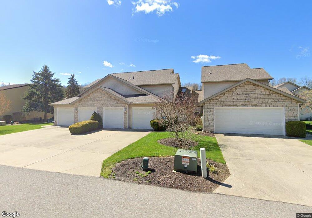
159 Mulberry Ln Munroe Falls, OH 44262
Estimated Value: $256,798 - $269,000
3
Beds
2
Baths
1,782
Sq Ft
$147/Sq Ft
Est. Value
About This Home
This home is located at 159 Mulberry Ln, Munroe Falls, OH 44262 and is currently estimated at $262,700, approximately $147 per square foot. 159 Mulberry Ln is a home located in Summit County with nearby schools including Stow-Munroe Falls High School, Holy Family Elementary School, and Walsh Jesuit High School.
Ownership History
Date
Name
Owned For
Owner Type
Purchase Details
Closed on
Jul 23, 2021
Sold by
Given Not
Bought by
Smith Arzetta
Current Estimated Value
Purchase Details
Closed on
Aug 19, 2004
Sold by
Falls River Crossing Ltd
Bought by
Smith Arzetta
Home Financials for this Owner
Home Financials are based on the most recent Mortgage that was taken out on this home.
Original Mortgage
$92,900
Interest Rate
6.08%
Mortgage Type
Purchase Money Mortgage
Create a Home Valuation Report for This Property
The Home Valuation Report is an in-depth analysis detailing your home's value as well as a comparison with similar homes in the area
Home Values in the Area
Average Home Value in this Area
Purchase History
| Date | Buyer | Sale Price | Title Company |
|---|---|---|---|
| Smith Arzetta | -- | -- | |
| Smith Arzetta | $143,900 | Kent Title Agency Inc |
Source: Public Records
Mortgage History
| Date | Status | Borrower | Loan Amount |
|---|---|---|---|
| Previous Owner | Smith Arzetta | $92,900 |
Source: Public Records
Tax History Compared to Growth
Tax History
| Year | Tax Paid | Tax Assessment Tax Assessment Total Assessment is a certain percentage of the fair market value that is determined by local assessors to be the total taxable value of land and additions on the property. | Land | Improvement |
|---|---|---|---|---|
| 2025 | $3,240 | $67,362 | $11,869 | $55,493 |
| 2024 | $3,240 | $67,362 | $11,869 | $55,493 |
| 2023 | $3,240 | $67,362 | $11,869 | $55,493 |
| 2022 | $2,804 | $52,221 | $9,202 | $43,019 |
| 2021 | $2,435 | $52,221 | $9,202 | $43,019 |
| 2020 | $2,392 | $52,220 | $9,200 | $43,020 |
| 2019 | $2,272 | $46,820 | $9,200 | $37,620 |
| 2018 | $2,235 | $46,820 | $9,200 | $37,620 |
| 2017 | $1,892 | $46,820 | $9,200 | $37,620 |
| 2016 | $2,019 | $42,430 | $9,200 | $33,230 |
| 2015 | $1,892 | $42,430 | $9,200 | $33,230 |
| 2014 | $1,894 | $42,430 | $9,200 | $33,230 |
| 2013 | $2,132 | $44,620 | $10,670 | $33,950 |
Source: Public Records
Map
Nearby Homes
- 82 Silver Valley Blvd Unit B82
- 75 River Ridge Ln
- 64 River Ridge Ln Unit H64
- 100 Trudy Ave
- 2919 Thomas Dr
- 226 Gaylord Dr
- 3005 Kent Rd
- 70 Richard Dr
- 3366 Darrow Rd
- 1974 Hawthorne Ave
- 1861 Gorge Park Blvd
- 135 Guise Park Dr
- 3063 Lake Rd
- 400 Cathy Dr
- 44 S River Rd
- 2375 Plymouth Ln
- 2072 Issaquah St
- 3058 N Oak Hill Rd
- 3054 Englewood Dr
- 284 Northmoreland Ave
- 157 Mulberry Ln Unit 23
- 163 Mulberry Ln Unit 21
- 230 Chase Dr Unit 10
- 160 Falls River Dr
- 158 Falls River Dr Unit 14
- 228 Chase Dr
- 160 Mulberry Ln
- 166 Falls River Dr
- 164 Mulberry Ln Unit 25
- 166 Mulberry Ln Unit 24
- 146 Falls River Dr Unit 15
- 142 Falls River Dr Unit 16
- 237 Chase Dr Unit 6
- 239 Chase Dr Unit 5
- 243 Chase Dr
- 137 Mulberry Ln
- 145 Mulberry Ln
- 143 Mulberry Ln
- 137 Mulberry Ln Unit W137
- 133 Mulberry Ln