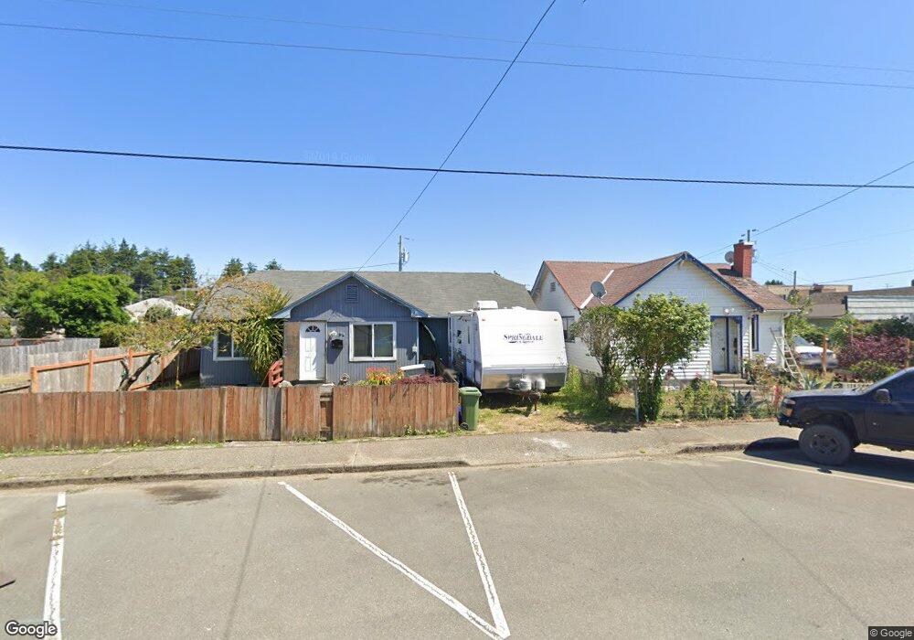
159 N Wall St Coos Bay, OR 97420
Estimated Value: $249,000 - $255,097
2
Beds
1
Bath
752
Sq Ft
$335/Sq Ft
Est. Value
About This Home
This home is located at 159 N Wall St, Coos Bay, OR 97420 and is currently estimated at $252,049, approximately $335 per square foot. 159 N Wall St is a home located in Coos County with nearby schools including Sunset School, Madison Elementary School, and Marshfield Senior High School.
Ownership History
Date
Name
Owned For
Owner Type
Purchase Details
Closed on
Jan 21, 2009
Sold by
Hinds John and Hinds Mary
Bought by
Tavernier Bobbie Jo
Current Estimated Value
Purchase Details
Closed on
Jun 24, 2004
Sold by
Green Zena D
Bought by
Hinds John and Hinds Mary
Home Financials for this Owner
Home Financials are based on the most recent Mortgage that was taken out on this home.
Original Mortgage
$44,304
Interest Rate
6.29%
Mortgage Type
FHA
Create a Home Valuation Report for This Property
The Home Valuation Report is an in-depth analysis detailing your home's value as well as a comparison with similar homes in the area
Home Values in the Area
Average Home Value in this Area
Purchase History
| Date | Buyer | Sale Price | Title Company |
|---|---|---|---|
| Tavernier Bobbie Jo | -- | None Available | |
| Hinds John | $45,000 | Fidelity National Title Co |
Source: Public Records
Mortgage History
| Date | Status | Borrower | Loan Amount |
|---|---|---|---|
| Previous Owner | Hinds John | $44,304 |
Source: Public Records
Tax History Compared to Growth
Tax History
| Year | Tax Paid | Tax Assessment Tax Assessment Total Assessment is a certain percentage of the fair market value that is determined by local assessors to be the total taxable value of land and additions on the property. | Land | Improvement |
|---|---|---|---|---|
| 2024 | $1,585 | $91,200 | -- | -- |
| 2023 | $1,537 | $88,550 | $0 | $0 |
| 2022 | $1,512 | $85,980 | $0 | $0 |
| 2021 | $1,473 | $83,480 | $0 | $0 |
| 2020 | $1,432 | $83,480 | $0 | $0 |
| 2019 | $1,374 | $78,690 | $0 | $0 |
| 2018 | $1,327 | $76,400 | $0 | $0 |
| 2017 | $1,176 | $74,180 | $0 | $0 |
| 2016 | $1,123 | $72,020 | $0 | $0 |
| 2015 | $1,047 | $69,930 | $0 | $0 |
| 2014 | $1,047 | $67,900 | $0 | $0 |
Source: Public Records
Map
Nearby Homes
- 235 N Wall St
- 242 N Wasson St
- 0 2185800 Unit 225689067
- 274 N Cammann St
- 715 Jackson Ave
- 293 N Empire Blvd
- 1022 Newmark Ave
- 993 Salmon Ave
- 0 N Cammann St
- 283 N Main St
- 1088 Newmark Ave
- 437 N Wasson St
- 369 S Marple St
- 0 Michigan Ave Unit 24639238
- 375 S Marple St
- 407 S Empire Blvd
- 610 Pacific Ave
- 01500 Cape Arago Hwy
- 245/247 Ackerman Ave
- 536 S Marple St
- 145 N Wall St
- 173 N Wall St
- 135 N Wall St
- 174 N Wasson St
- 183 N Wall St
- 138 N Wasson St
- 176 N Wasson St
- 195 N Wall St
- 132 N Wasson St
- 192 N Wasson St
- 136 N Wall St
- 114 N Wasson St
- 580 Newmark Ave
- 562 Newmark Ave
- 0 Schetter Ave Unit 4400 22613195
- 0 Schetter Ave Unit 4400 22458905
- 0 Schetter Ave Unit 1&2
- 0 Schetter Ave Unit 1&2
- 0 Schetter Unit 22541902
- 153 N Marple St