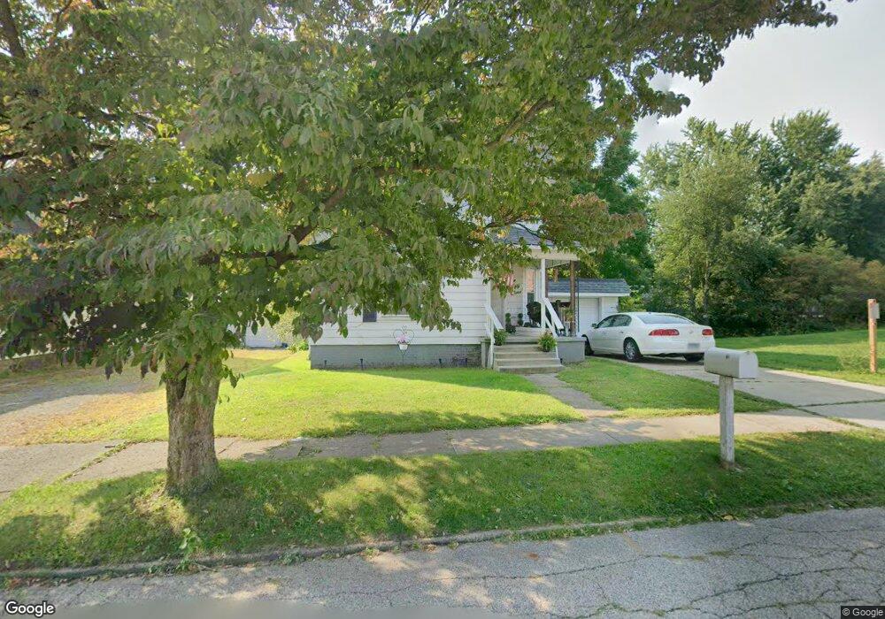
159 Poplar St Conneaut, OH 44030
Estimated Value: $62,000 - $103,000
3
Beds
1
Bath
1,187
Sq Ft
$75/Sq Ft
Est. Value
About This Home
This home is located at 159 Poplar St, Conneaut, OH 44030 and is currently estimated at $88,517, approximately $74 per square foot. 159 Poplar St is a home located in Ashtabula County with nearby schools including Lakeshore Primary Elementary School, Gateway Elementary School, and Conneaut Middle School.
Ownership History
Date
Name
Owned For
Owner Type
Purchase Details
Closed on
Aug 23, 2025
Sold by
Weingarten Salomon
Bought by
Neubauer Properties Llc
Current Estimated Value
Purchase Details
Closed on
Jul 1, 2019
Sold by
Bassett Donna
Bought by
Weingarten Sal
Purchase Details
Closed on
Sep 22, 2008
Sold by
Secretary Of Housing & Urban Development
Bought by
Bassett Donna and 159 Conneaut Trust
Purchase Details
Closed on
Apr 19, 2007
Sold by
Mckinley Steven C and Mckinley Cara L
Bought by
Gmac Mortgage Corp
Purchase Details
Closed on
Mar 5, 2007
Sold by
Gmac Mortgage Corp
Bought by
Hud
Purchase Details
Closed on
Jan 15, 2002
Sold by
Mahaney Janet M
Bought by
Mckinley Steven C and Mckinley Cara L
Home Financials for this Owner
Home Financials are based on the most recent Mortgage that was taken out on this home.
Original Mortgage
$70,600
Interest Rate
7.07%
Mortgage Type
FHA
Purchase Details
Closed on
Feb 10, 1997
Sold by
Sompii Elmer A
Bought by
Larry and Griswold Janice
Create a Home Valuation Report for This Property
The Home Valuation Report is an in-depth analysis detailing your home's value as well as a comparison with similar homes in the area
Home Values in the Area
Average Home Value in this Area
Purchase History
| Date | Buyer | Sale Price | Title Company |
|---|---|---|---|
| Neubauer Properties Llc | $60,000 | None Listed On Document | |
| Weingarten Sal | -- | Stewart Title | |
| Bassett Donna | $10,500 | Lakeside Title | |
| Gmac Mortgage Corp | $77,137 | Buckeye Title | |
| Hud | -- | Buckeye Title | |
| Mckinley Steven C | $71,200 | -- | |
| Larry | $25,000 | -- |
Source: Public Records
Mortgage History
| Date | Status | Borrower | Loan Amount |
|---|---|---|---|
| Previous Owner | Mckinley Steven C | $70,600 |
Source: Public Records
Tax History Compared to Growth
Tax History
| Year | Tax Paid | Tax Assessment Tax Assessment Total Assessment is a certain percentage of the fair market value that is determined by local assessors to be the total taxable value of land and additions on the property. | Land | Improvement |
|---|---|---|---|---|
| 2024 | $1,030 | $14,080 | $2,070 | $12,010 |
| 2023 | $672 | $14,080 | $2,070 | $12,010 |
| 2022 | $628 | $11,590 | $1,580 | $10,010 |
| 2021 | $639 | $11,590 | $1,580 | $10,010 |
| 2020 | $639 | $11,590 | $1,580 | $10,010 |
| 2019 | $467 | $8,270 | $950 | $7,320 |
| 2018 | $446 | $8,270 | $950 | $7,320 |
| 2017 | $557 | $8,270 | $950 | $7,320 |
| 2016 | $604 | $12,330 | $1,440 | $10,890 |
| 2015 | $1,563 | $12,330 | $1,440 | $10,890 |
| 2014 | $4,440 | $20,590 | $1,440 | $19,150 |
| 2013 | $3,081 | $9,910 | $1,330 | $8,580 |
Source: Public Records
Map
Nearby Homes
- 153 Poplar St
- 336 Poplar St
- 145 Poplar St
- 160 Poplar St
- 173 Poplar St
- 152 Poplar St
- 164 Poplar St
- 168 Poplar St
- 150 Poplar St
- 139 Poplar St
- 177 Poplar St
- 144 Poplar St
- 172 Poplar St
- 178 Poplar St
- 133 Poplar St
- 158 Nickle Plate Ave
- 154 Nickle Plate Ave
- 169 Marshall St
- 134 Poplar St
- 142 Nickle Plate Ave