J
Seller's Agent in 2025
Jessica Robichaud
White Water Realty Group/Franklin
(603) 568-1987
3 in this area
38 Total Sales
Estimated Value: $588,000 - $660,000
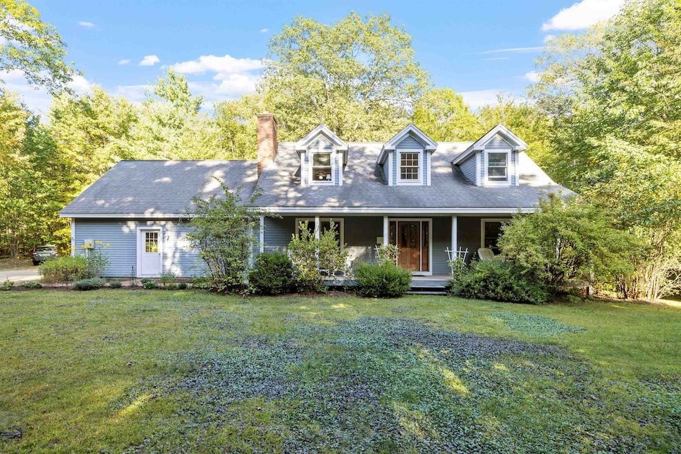
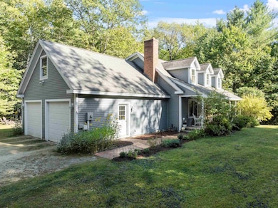
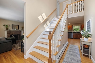
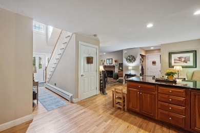
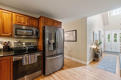
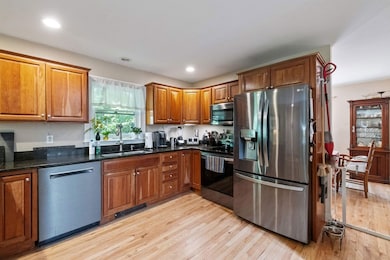
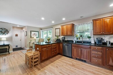
Step into this charming cape and prepare to be wowed! From the inviting front porch to the abundant natural light streaming in, this home exudes warmth and character. The beautiful wood floors on the main level set the stage for stylish living. The kitchen is a dream, complete with a eat in dining area that leads out to the backyard oasis through a glass slider. The formal dining room flows seamlessly into the living room, making entertaining a breeze. The wood fireplace with brick hearth in the cozy family room adds a touch of warmth on chilly nights. The foyer is elegant, leading to a hallway and staircase adorned with wood accents that ascend to the second floor. Upstairs, you'll find a spacious primary bedroom with ample closet space and built ins and two other lovely bedrooms. Spacious full bathroom featuring a double sink vanity. Need more space? The finished basement offers endless possibilities - think extra living area, office, or a wonderful hideaway. Nestled in a prime location close to walking trails and Sawyer Lake, this home is a serene escape while still being within easy reach of all the Lakes Region has to offer. Don't let this opportunity slip away - come see it for yourself!
Last Agent to Sell the Property
White Water Realty Group/Franklin License #071669 Listed on: 09/22/2025
We collect this data history from publicly available records. To have your information removed, we recommend requesting removal directly through your county’s website.
| Date | Buyer | Sale Price | Title Company |
|---|---|---|---|
| Walsh Michael J | $590,000 | -- | |
| Walsh Michael J | $590,000 | -- | |
| Hunt Gerald | $350,000 | -- | |
| Hunt Gerald | $350,000 | -- | |
| Hunt Robert D | $299,900 | -- |
We collect this data history from publicly available records. To have your information removed, we recommend requesting removal directly through your county’s website.
| Date | Status | Borrower | Loan Amount |
|---|---|---|---|
| Open | Walsh Michael J | $472,000 | |
| Closed | Hunt Gerald | $472,000 | |
| Previous Owner | Hunt Robert D | $239,900 |
| Date | Event | Price | List to Sale | Price per Sq Ft |
|---|---|---|---|---|
| 12/30/2025 12/30/25 | Sold | $590,000 | -1.7% | $229 / Sq Ft |
| 09/22/2025 09/22/25 | For Sale | $599,999 | -- | $233 / Sq Ft |
| Year | Tax Paid | Tax Assessment Tax Assessment Total Assessment is a certain percentage of the fair market value that is determined by local assessors to be the total taxable value of land and additions on the property. | Land | Improvement |
|---|---|---|---|---|
| 2025 | $8,613 | $564,800 | $133,200 | $431,600 |
| 2024 | $8,325 | $564,800 | $133,200 | $431,600 |
| 2023 | $7,085 | $302,900 | $74,100 | $228,800 |
| 2022 | $7,261 | $302,900 | $74,100 | $228,800 |
| 2021 | $7,118 | $302,900 | $74,100 | $228,800 |
| 2020 | $7,027 | $302,900 | $74,100 | $228,800 |
| 2019 | $6,903 | $302,900 | $74,100 | $228,800 |
| 2018 | $6,642 | $262,100 | $63,700 | $198,400 |
| 2017 | $6,500 | $262,100 | $63,700 | $198,400 |
| 2016 | $6,267 | $262,100 | $63,700 | $198,400 |
| 2015 | $6,799 | $262,100 | $63,700 | $198,400 |
| 2014 | $6,010 | $262,100 | $63,700 | $198,400 |
| 2013 | $5,867 | $277,400 | $70,300 | $207,100 |
J
Seller's Agent in 2025
Jessica Robichaud
White Water Realty Group/Franklin
(603) 568-1987
3 in this area
38 Total Sales

Buyer's Agent in 2025
Amanda Butler
REAL Broker NH, LLC
(603) 247-5830
1 in this area
134 Total Sales
Source: PrimeMLS
MLS Number: 5062438
APN: GILM-000123-000000-005000
Disclaimer: Certain information contained herein is derived from information provided by parties other than Homes.com. All information provided is deemed reliable, but is not guaranteed to be accurate and should be independently verified.
![]() Copyright 2026 PrimeMLS, Inc. All rights reserved. This information is deemed reliable, but not guaranteed. The data relating to real estate displayed on this display comes in part from the IDX Program of PrimeMLS. The information being provided is for consumers’ personal, non-commercial use and may not be used for any purpose other than to identify prospective properties consumers may be interested in purchasing.
Copyright 2026 PrimeMLS, Inc. All rights reserved. This information is deemed reliable, but not guaranteed. The data relating to real estate displayed on this display comes in part from the IDX Program of PrimeMLS. The information being provided is for consumers’ personal, non-commercial use and may not be used for any purpose other than to identify prospective properties consumers may be interested in purchasing.
Ask me questions while you tour the home.