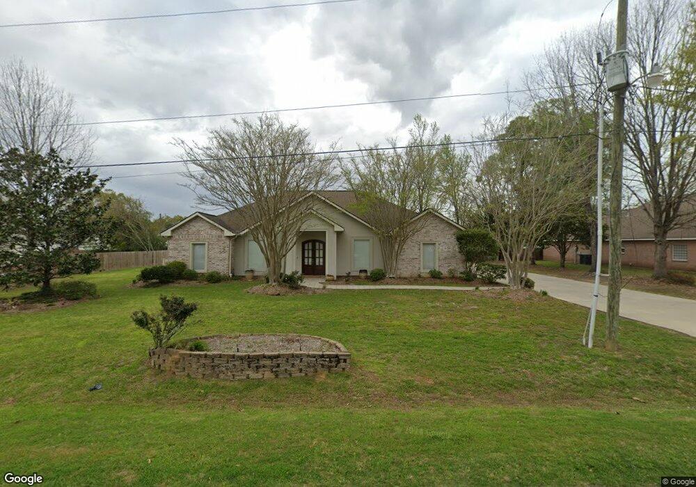
159 Redbird Ln Independence, LA 70443
Estimated Value: $286,000 - $399,000
4
Beds
3
Baths
3,136
Sq Ft
$117/Sq Ft
Est. Value
About This Home
This home is located at 159 Redbird Ln, Independence, LA 70443 and is currently estimated at $367,678, approximately $117 per square foot. 159 Redbird Ln is a home located in Tangipahoa Parish with nearby schools including Independence Leadership Academy, Independence High Magnet, and Mater Dolorosa Catholic School.
Ownership History
Date
Name
Owned For
Owner Type
Purchase Details
Closed on
Jun 14, 2005
Sold by
Dickson Salvador Thomas and Dickson Barbara Whitley
Bought by
Durnin Paul W and Durnin Frances Messina
Current Estimated Value
Purchase Details
Closed on
May 27, 2005
Sold by
Dickson Geraldine Thomas
Bought by
Dickson Salvador Thomas and Dickson Barbara Whitley
Create a Home Valuation Report for This Property
The Home Valuation Report is an in-depth analysis detailing your home's value as well as a comparison with similar homes in the area
Purchase History
| Date | Buyer | Sale Price | Title Company |
|---|---|---|---|
| Durnin Paul W | $14,000 | Delta Title Corp | |
| Dickson Salvador Thomas | -- | Delta Title Corp | |
| Dickson Salvador Thomas | -- | Delta Title Corp |
Source: Public Records
Tax History
| Year | Tax Paid | Tax Assessment Tax Assessment Total Assessment is a certain percentage of the fair market value that is determined by local assessors to be the total taxable value of land and additions on the property. | Land | Improvement |
|---|---|---|---|---|
| 2024 | $1,626 | $25,172 | $1,944 | $23,228 |
| 2023 | $1,657 | $25,265 | $1,800 | $23,465 |
| 2022 | $1,657 | $25,265 | $1,800 | $23,465 |
| 2021 | $1,536 | $25,265 | $1,800 | $23,465 |
| 2020 | $2,256 | $25,265 | $1,800 | $23,465 |
| 2019 | $2,269 | $25,265 | $1,800 | $23,465 |
| 2018 | $2,245 | $25,265 | $1,800 | $23,465 |
| 2017 | $2,264 | $25,265 | $1,800 | $23,465 |
| 2016 | $2,407 | $25,265 | $1,800 | $23,465 |
| 2015 | $1,886 | $25,265 | $1,800 | $23,465 |
| 2014 | $1,883 | $25,265 | $1,800 | $23,465 |
Source: Public Records
Map
Nearby Homes
- 0 U S 51
- 55241 U S Highway 51
- TBD Tract 4 Ragusa Rd
- 157 U S 51
- 0 U S Highway 51
- 569 W 5th St
- 282 Pine St
- 435 Pine St
- 00000 Pine St
- 369 Pine St
- 120 Tulane Ave
- 106 Oak St
- 705 Pine St
- 207 & 217 W Railroad Ave
- 246 Cypress St
- 719 Pine St
- 286 Alessi Rd
- 29189 Louisiana 40
- 50314 Louisiana 1063
- 157 Hwy 51 None