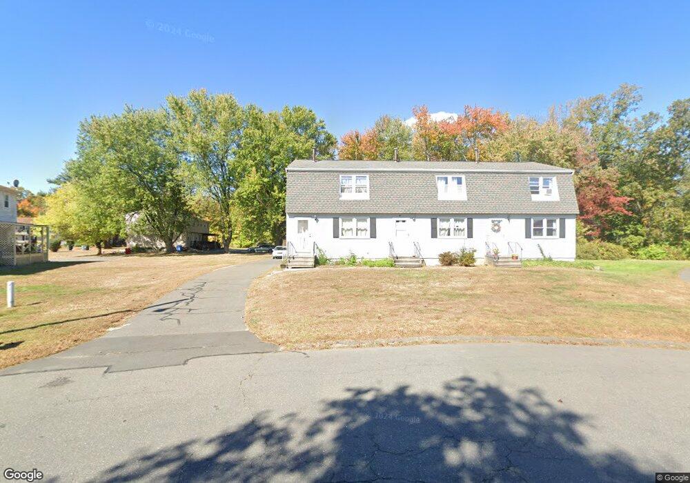
159 Robertson St Bristol, CT 06010
Forestville NeighborhoodEstimated Value: $223,916 - $232,000
3
Beds
2
Baths
1,080
Sq Ft
$211/Sq Ft
Est. Value
About This Home
This home is located at 159 Robertson St, Bristol, CT 06010 and is currently estimated at $227,479, approximately $210 per square foot. 159 Robertson St is a home located in Hartford County with nearby schools including Northeast Middle School, Bristol Eastern High School, and St Matthew School.
Ownership History
Date
Name
Owned For
Owner Type
Purchase Details
Closed on
Sep 11, 2015
Sold by
Sturges Gregory D
Bought by
Sturges Kim A
Current Estimated Value
Purchase Details
Closed on
Jun 21, 2002
Sold by
Wathen Robert J and Wathen Roberta A
Bought by
Sturges Gregory D and Sturges Kim A
Home Financials for this Owner
Home Financials are based on the most recent Mortgage that was taken out on this home.
Original Mortgage
$78,600
Interest Rate
6.81%
Create a Home Valuation Report for This Property
The Home Valuation Report is an in-depth analysis detailing your home's value as well as a comparison with similar homes in the area
Home Values in the Area
Average Home Value in this Area
Purchase History
| Date | Buyer | Sale Price | Title Company |
|---|---|---|---|
| Sturges Kim A | -- | -- | |
| Sturges Gregory D | $98,600 | -- |
Source: Public Records
Mortgage History
| Date | Status | Borrower | Loan Amount |
|---|---|---|---|
| Previous Owner | Sturges Gregory D | $97,000 | |
| Previous Owner | Sturges Gregory D | $87,800 | |
| Previous Owner | Sturges Gregory D | $78,600 | |
| Previous Owner | Sturges Gregory D | $85,000 |
Source: Public Records
Tax History Compared to Growth
Tax History
| Year | Tax Paid | Tax Assessment Tax Assessment Total Assessment is a certain percentage of the fair market value that is determined by local assessors to be the total taxable value of land and additions on the property. | Land | Improvement |
|---|---|---|---|---|
| 2025 | $3,310 | $98,070 | $0 | $98,070 |
| 2024 | $3,124 | $98,070 | $0 | $98,070 |
| 2023 | $2,976 | $98,070 | $0 | $98,070 |
| 2022 | $2,754 | $71,820 | $0 | $71,820 |
| 2021 | $2,754 | $71,820 | $0 | $71,820 |
| 2020 | $2,754 | $71,820 | $0 | $71,820 |
| 2019 | $2,733 | $71,820 | $0 | $71,820 |
| 2018 | $2,649 | $71,820 | $0 | $71,820 |
| 2017 | $2,482 | $68,880 | $0 | $68,880 |
| 2016 | $2,482 | $68,880 | $0 | $68,880 |
| 2015 | $2,384 | $68,880 | $0 | $68,880 |
| 2014 | $2,384 | $68,880 | $0 | $68,880 |
Source: Public Records
Map
Nearby Homes
- 73 Grove Ave
- 35 Buckley Ave
- 245 Mark St
- 3 Bushel Rd Unit 3
- 46 Pleasant Ave
- 336 Washington St
- 418 Washington St
- 0 Overlook Dr Unit Lot 4 24092448
- 0 Overlook Dr Unit Lot 3 24092446
- 44 Cabot St
- 205 Camp St
- 18 Timber Hill Rd
- 5 Peach Orchard Hill
- 25 Oakwood Cir Unit 7
- 27 Oakwood Cir Unit 8
- 109 Glenwood Dr
- 302 Brook St
- 158 E Main St
- 12 Currey Ct
- 226 E Main St Unit 4
- 161 Robertson St
- 169 Robertson St
- 6 Nicholas Ct
- 6 Nicholas Ct Unit C
- 8 Nicholas Ct
- 165 Robertson St
- 167 Robertson St
- 10 Nicholas Ct
- 150 Robertson St
- 150 Robertson St Unit A
- 150 Robertson St Unit 150
- 146 Robertson St
- 146 Robertson St Unit C
- 148 Robertson St
- 34 Nicholas Ct
- 171 Robertson St
- 171 Robertson St Unit 1-A
- 163 Robertson St
- 163 Robertson St Unit C