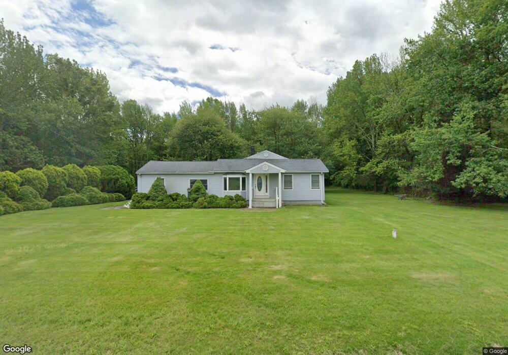
159 Route 526 Allentown, NJ 08501
Estimated Value: $471,000 - $999,000
3
Beds
2
Baths
1,396
Sq Ft
$464/Sq Ft
Est. Value
About This Home
This home is located at 159 Route 526, Allentown, NJ 08501 and is currently estimated at $647,488, approximately $463 per square foot. 159 Route 526 is a home located in Monmouth County with nearby schools including Newell Elementary School, Stonebridge Middle School, and Allentown High School.
Create a Home Valuation Report for This Property
The Home Valuation Report is an in-depth analysis detailing your home's value as well as a comparison with similar homes in the area
Home Values in the Area
Average Home Value in this Area
Tax History
| Year | Tax Paid | Tax Assessment Tax Assessment Total Assessment is a certain percentage of the fair market value that is determined by local assessors to be the total taxable value of land and additions on the property. | Land | Improvement |
|---|---|---|---|---|
| 2025 | $6,196 | $369,500 | $218,000 | $151,500 |
| 2024 | $6,481 | $287,400 | $135,200 | $152,200 |
| 2023 | $6,481 | $291,800 | $135,000 | $156,800 |
| 2022 | $6,244 | $274,400 | $125,100 | $149,300 |
| 2021 | $6,244 | $258,700 | $125,100 | $133,600 |
| 2020 | $6,153 | $254,900 | $125,100 | $129,800 |
| 2019 | $6,074 | $253,400 | $125,100 | $128,300 |
| 2018 | $6,440 | $264,700 | $125,100 | $139,600 |
| 2017 | $6,271 | $261,200 | $125,000 | $136,200 |
| 2016 | $6,113 | $257,700 | $125,000 | $132,700 |
| 2015 | $6,494 | $276,700 | $150,000 | $126,700 |
| 2014 | $6,423 | $275,800 | $175,000 | $100,800 |
Source: Public Records
Map
Nearby Homes
- 40 Gina Dr
- 41 Gina Dr
- 47 Imlaystown Rd
- 20 Yeger Dr
- 703 Route 524
- 151 Walnford Rd
- 110 Imlaystown Hightstown Rd
- 467 Gordon Rd
- 3 Allyson Way
- 20 Hluchy Rd
- 163 Sharon Station Rd
- 30 Ridgeview Way
- 43 S Main St
- 22 Route 524
- 38 Herbert Rd
- 1400 Old York Rd
- 16 Heritage Dr
- 0 Route 537 Unit 22533818
- 10 Minuteman Cir
- 0-63-65 Walters Rd
Your Personal Tour Guide
Ask me questions while you tour the home.