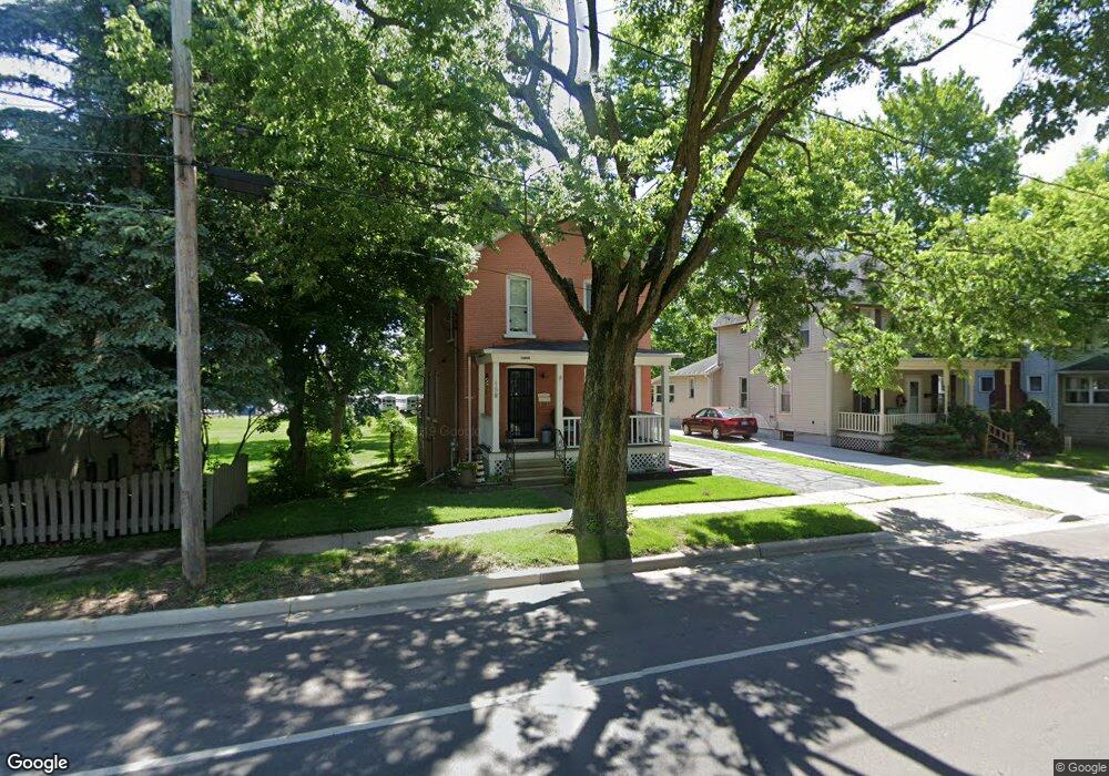
159 S Mckenzie St Adrian, MI 49221
Estimated Value: $143,000 - $162,451
--
Bed
--
Bath
1,232
Sq Ft
$126/Sq Ft
Est. Value
About This Home
This home is located at 159 S Mckenzie St, Adrian, MI 49221 and is currently estimated at $154,817, approximately $125 per square foot. 159 S Mckenzie St is a home located in Lenawee County with nearby schools including Adrian High School, Berean Baptist Academy, and Trenton Hills Learning Center.
Ownership History
Date
Name
Owned For
Owner Type
Purchase Details
Closed on
Jul 28, 2006
Sold by
Barnes Catherine J and Mccoy Catherine J
Bought by
Suydam Kyle E and Ross Alicia N
Current Estimated Value
Home Financials for this Owner
Home Financials are based on the most recent Mortgage that was taken out on this home.
Original Mortgage
$89,500
Outstanding Balance
$53,647
Interest Rate
6.73%
Mortgage Type
New Conventional
Estimated Equity
$101,170
Create a Home Valuation Report for This Property
The Home Valuation Report is an in-depth analysis detailing your home's value as well as a comparison with similar homes in the area
Home Values in the Area
Average Home Value in this Area
Purchase History
| Date | Buyer | Sale Price | Title Company |
|---|---|---|---|
| Suydam Kyle E | $111,900 | None Available |
Source: Public Records
Mortgage History
| Date | Status | Borrower | Loan Amount |
|---|---|---|---|
| Open | Suydam Kyle E | $89,500 | |
| Closed | Suydam Kyle E | $16,700 |
Source: Public Records
Tax History Compared to Growth
Tax History
| Year | Tax Paid | Tax Assessment Tax Assessment Total Assessment is a certain percentage of the fair market value that is determined by local assessors to be the total taxable value of land and additions on the property. | Land | Improvement |
|---|---|---|---|---|
| 2025 | $2,448 | $62,700 | $0 | $0 |
| 2024 | $1,607 | $58,800 | $0 | $0 |
| 2023 | $1,818 | $54,600 | $0 | $0 |
| 2022 | $1,516 | $51,200 | $0 | $0 |
| 2021 | $1,488 | $47,300 | $0 | $0 |
| 2020 | $1,483 | $43,100 | $0 | $0 |
| 2019 | $95,715 | $41,100 | $0 | $0 |
| 2018 | $1,434 | $48,057 | $0 | $0 |
| 2017 | $1,388 | $39,783 | $0 | $0 |
| 2016 | $1,377 | $36,561 | $0 | $0 |
| 2014 | -- | $32,300 | $0 | $0 |
Source: Public Records
Map
Nearby Homes
- 705 College Ave
- 143 Park St
- 914 W Maumee St
- 903 Michigan Ave
- 146 Budlong St
- 416 Allis St
- 446 Allis St
- 227 Greenly St
- 962 Vine St
- 333 Greenly St
- 1136 Michigan Ave
- 228 W Church St
- 1144 W Maumee St
- 306 Summer St
- 422 S Winter St
- 1035 Scottdale Dr
- 227 Jordan St
- 421 S Madison St
- 842 Burr St
- 443 Stockford Dr
- 153 S Mckenzie St
- 165 S Mckenzie St
- 171 S Mckenzie St
- 147 S Mckenzie St
- 177 S Mckenzie St
- 143 S Mckenzie St
- 774 College Ave
- 774 College Ave Unit COLLEGE
- 770 College Ave
- 764 College Ave
- 778 College Ave
- 137 S Mckenzie St
- 158 S Mckenzie St
- 168 S Mckenzie St
- 166 S Mckenzie St
- 150 S Mckenzie St
- 172 S Mckenzie St
- 146 S Mckenzie St
- 131 S Mckenzie St
- 758 College Ave