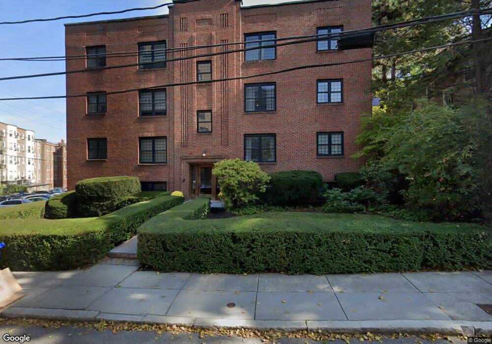
159 Saint Paul St Unit 3 Brookline, MA 02446
Coolidge Corner NeighborhoodEstimated Value: $871,313 - $942,000
2
Beds
2
Baths
1,104
Sq Ft
$821/Sq Ft
Est. Value
About This Home
This home is located at 159 Saint Paul St Unit 3, Brookline, MA 02446 and is currently estimated at $906,828, approximately $821 per square foot. 159 Saint Paul St Unit 3 is a home located in Norfolk County with nearby schools including Amos A. Lawrence School, Brookline High School, and St. Mary of the Assumption Elementary School.
Ownership History
Date
Name
Owned For
Owner Type
Purchase Details
Closed on
Jul 29, 2009
Sold by
Silverman Daniel J and Silverman Ruth M
Bought by
Lescohiere Daniel
Current Estimated Value
Home Financials for this Owner
Home Financials are based on the most recent Mortgage that was taken out on this home.
Original Mortgage
$331,875
Outstanding Balance
$218,800
Interest Rate
5.43%
Mortgage Type
Purchase Money Mortgage
Estimated Equity
$688,028
Purchase Details
Closed on
Oct 21, 1988
Sold by
Himmelstein Sherry
Bought by
Rourke Richard B
Home Financials for this Owner
Home Financials are based on the most recent Mortgage that was taken out on this home.
Original Mortgage
$125,000
Interest Rate
10.48%
Mortgage Type
Purchase Money Mortgage
Create a Home Valuation Report for This Property
The Home Valuation Report is an in-depth analysis detailing your home's value as well as a comparison with similar homes in the area
Home Values in the Area
Average Home Value in this Area
Purchase History
| Date | Buyer | Sale Price | Title Company |
|---|---|---|---|
| Lescohiere Daniel | $442,500 | -- | |
| Rourke Richard B | $170,000 | -- |
Source: Public Records
Mortgage History
| Date | Status | Borrower | Loan Amount |
|---|---|---|---|
| Open | Lescohiere Daniel | $331,875 | |
| Previous Owner | Rourke Richard B | $125,000 |
Source: Public Records
Tax History
| Year | Tax Paid | Tax Assessment Tax Assessment Total Assessment is a certain percentage of the fair market value that is determined by local assessors to be the total taxable value of land and additions on the property. | Land | Improvement |
|---|---|---|---|---|
| 2025 | $8,061 | $816,700 | $0 | $816,700 |
| 2024 | $7,822 | $800,600 | $0 | $800,600 |
| 2023 | $7,765 | $778,800 | $0 | $778,800 |
| 2022 | $7,780 | $763,500 | $0 | $763,500 |
| 2021 | $7,409 | $756,000 | $0 | $756,000 |
| 2020 | $7,073 | $748,500 | $0 | $748,500 |
| 2019 | $6,680 | $712,900 | $0 | $712,900 |
| 2018 | $6,323 | $668,400 | $0 | $668,400 |
| 2017 | $6,115 | $618,900 | $0 | $618,900 |
| 2016 | $5,862 | $562,600 | $0 | $562,600 |
| 2015 | $5,463 | $511,500 | $0 | $511,500 |
| 2014 | $5,230 | $459,200 | $0 | $459,200 |
Source: Public Records
Map
Nearby Homes
- 1243 Beacon St Unit 5A
- 100 Sewall Ave Unit 5
- 50 Longwood Ave Unit 518
- 50 Longwood Ave Unit 611
- 60 Longwood Ave Unit 802
- 60 Longwood Ave Unit 307
- 14 James St Unit 3
- 131 Sewall Ave Unit 61
- 45 Longwood Ave Unit 712
- 45 Longwood Ave Unit 812
- 16 Parkman St Unit 1
- 221 Saint Paul St
- 79 Pleasant St Unit 4
- 63-65 Green St Unit 1
- 63-65 Green St Unit PH-3
- 26 John St Unit 3
- 21 Green St Unit 3
- 81 Francis St Unit 2
- 65 Francis St Unit A
- 14 Green St Unit PHA
- 159 St Paul St Unit FURN
- 159 Saint Paul St Unit 1
- 159 Saint Paul St Unit 7
- 159 Saint Paul St Unit 6
- 159 Saint Paul St Unit 5
- 159 Saint Paul St Unit 4
- 159 Saint Paul St Unit 2
- 159 Saint Paul St Unit 1A
- 159 Saint Paul St Unit 1,159
- 159 Saint Paul St Unit 159
- 159 St Paul St
- 159 Saint Paul St
- 159 St Paul St Unit 1
- 159 St Paul St Unit 7
- 159 St Paul St Unit 5
- 153 Saint Paul St
- 153 Saint Paul St Unit 322-1
- 153 Saint Paul St Unit 322-2
- 153 Saint Paul St Unit 80-3
- 153 Saint Paul St Unit 72-6
Your Personal Tour Guide
Ask me questions while you tour the home.