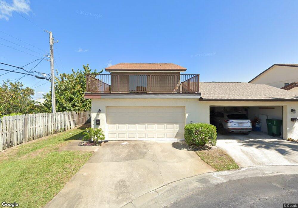
159 Seawind Dr Unit 19 Satellite Beach, FL 32937
Estimated Value: $314,000 - $398,000
3
Beds
2
Baths
1,620
Sq Ft
$225/Sq Ft
Est. Value
About This Home
This home is located at 159 Seawind Dr Unit 19, Satellite Beach, FL 32937 and is currently estimated at $364,687, approximately $225 per square foot. 159 Seawind Dr Unit 19 is a home located in Brevard County with nearby schools including Satellite Senior High School, Surfside Elementary School, and DeLaura Middle School.
Ownership History
Date
Name
Owned For
Owner Type
Purchase Details
Closed on
Feb 15, 2021
Sold by
Sabino Richard A
Bought by
Sabino Richard A
Current Estimated Value
Purchase Details
Closed on
Apr 21, 1994
Sold by
Wrbas Linda L and Hill James E
Bought by
Sabino Richard A
Home Financials for this Owner
Home Financials are based on the most recent Mortgage that was taken out on this home.
Original Mortgage
$64,000
Interest Rate
7.81%
Mortgage Type
Purchase Money Mortgage
Create a Home Valuation Report for This Property
The Home Valuation Report is an in-depth analysis detailing your home's value as well as a comparison with similar homes in the area
Home Values in the Area
Average Home Value in this Area
Purchase History
| Date | Buyer | Sale Price | Title Company |
|---|---|---|---|
| Sabino Richard A | -- | Accommodation | |
| Sabino Richard A | $80,000 | -- |
Source: Public Records
Mortgage History
| Date | Status | Borrower | Loan Amount |
|---|---|---|---|
| Closed | Sabino Richard A | $64,000 |
Source: Public Records
Tax History Compared to Growth
Tax History
| Year | Tax Paid | Tax Assessment Tax Assessment Total Assessment is a certain percentage of the fair market value that is determined by local assessors to be the total taxable value of land and additions on the property. | Land | Improvement |
|---|---|---|---|---|
| 2025 | $1,501 | $117,810 | -- | -- |
| 2024 | $1,463 | $114,490 | -- | -- |
| 2023 | $1,463 | $111,160 | $0 | $0 |
| 2022 | $1,350 | $107,930 | $0 | $0 |
| 2021 | $1,373 | $104,790 | $0 | $0 |
| 2020 | $1,362 | $103,350 | $0 | $0 |
| 2019 | $1,342 | $101,030 | $0 | $0 |
| 2018 | $1,335 | $99,150 | $0 | $0 |
| 2017 | $1,245 | $97,120 | $0 | $0 |
| 2016 | $1,241 | $95,130 | $30,000 | $65,130 |
| 2015 | $1,268 | $94,470 | $30,000 | $64,470 |
| 2014 | $1,265 | $93,720 | $30,000 | $63,720 |
Source: Public Records
Map
Nearby Homes
- 129 Seawind Dr Unit 25
- 130 Roosevelt Ave Unit 207
- 240 Sheridan Ave
- 1175 Highway A1a Unit 506
- 200 Jason Ct
- 348 Sherwood Ave
- 1273 Highway A1a Unit 308
- 310 Glenwood Ave
- 320 Glenwood Ave
- 325 Park Ave
- 1125 Highway A1a Unit 903
- 1125 Highway A1a Unit 501
- 1125 Highway A1a Unit 504
- 1303 Highway A1a Unit 401
- 230 Harwood Ave
- 298 Harwood Ave
- 1326 Highway A1a
- 170 Norwood Ave
- 295 Cinnamon Dr
- 1369 Highway A1a Unit 8
- 155 Seawind Dr Unit 20
- 165 Seawind Dr Unit 18
- 149 Seawind Dr Unit 21
- 169 Seawind Dr
- 169 Seawind Dr
- 145 Seawind Dr Unit 22
- 175 Seawind Dr Unit 16
- 179 Seawind Dr Unit 15
- 139 Seawind Dr Unit 23
- 139 Seawind Dr
- 146 Seawind Dr Unit 1
- 156 Seawind Dr Unit 3
- 135 Seawind Dr Unit 24
- 135 Seawind Dr
- 150 Seawind Dr Unit 2
- 160 Seawind Dr Unit 4
- 185 Seawind Dr Unit 14
- 166 Seawind Dr Unit 5
- 170 Seawind Dr Unit 6
- 189 Seawind Dr Unit 13