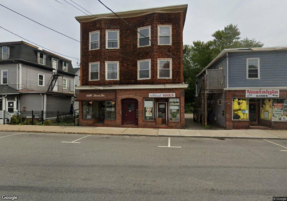
159 Union St Rockland, MA 02370
Estimated Value: $1,331,722
--
Bed
--
Bath
7,029
Sq Ft
$189/Sq Ft
Est. Value
About This Home
This home is located at 159 Union St, Rockland, MA 02370 and is currently estimated at $1,331,722, approximately $189 per square foot. 159 Union St is a home located in Plymouth County with nearby schools including Rockland Senior High School.
Ownership History
Date
Name
Owned For
Owner Type
Purchase Details
Closed on
Nov 23, 2004
Sold by
159 Union Street Rt
Bought by
Union Street T
Current Estimated Value
Home Financials for this Owner
Home Financials are based on the most recent Mortgage that was taken out on this home.
Original Mortgage
$540,000
Outstanding Balance
$269,837
Interest Rate
5.8%
Mortgage Type
Commercial
Estimated Equity
$1,061,885
Purchase Details
Closed on
Apr 12, 2002
Sold by
Mustafa Golam and Mustafa Nasima
Bought by
Union St Rt and Mcgee Kevin R
Create a Home Valuation Report for This Property
The Home Valuation Report is an in-depth analysis detailing your home's value as well as a comparison with similar homes in the area
Home Values in the Area
Average Home Value in this Area
Purchase History
| Date | Buyer | Sale Price | Title Company |
|---|---|---|---|
| Union Street T | $675,000 | -- | |
| Union St Rt | $252,000 | -- |
Source: Public Records
Mortgage History
| Date | Status | Borrower | Loan Amount |
|---|---|---|---|
| Open | Union St Rt | $35,000 | |
| Open | Union St Rt | $540,000 | |
| Previous Owner | Union St Rt | $175,000 | |
| Previous Owner | Union St Rt | $233,000 |
Source: Public Records
Tax History Compared to Growth
Tax History
| Year | Tax Paid | Tax Assessment Tax Assessment Total Assessment is a certain percentage of the fair market value that is determined by local assessors to be the total taxable value of land and additions on the property. | Land | Improvement |
|---|---|---|---|---|
| 2025 | $10,221 | $747,700 | $152,800 | $594,900 |
| 2024 | $10,014 | $712,200 | $145,500 | $566,700 |
| 2023 | $9,560 | $628,100 | $138,600 | $489,500 |
| 2022 | $9,836 | $587,200 | $129,600 | $457,600 |
| 2021 | $9,812 | $567,800 | $125,800 | $442,000 |
| 2020 | $9,644 | $551,100 | $122,100 | $429,000 |
| 2019 | $9,489 | $529,500 | $117,100 | $412,400 |
| 2018 | $9,161 | $502,800 | $110,000 | $392,800 |
| 2017 | $9,157 | $495,500 | $108,600 | $386,900 |
| 2016 | $8,984 | $485,900 | $106,500 | $379,400 |
| 2015 | $9,376 | $492,700 | $105,000 | $387,700 |
| 2014 | $9,583 | $522,500 | $102,900 | $419,600 |
Source: Public Records
Map
Nearby Homes
- 23 Payson Ave
- 94-96 Crescent St
- 103 Grove St Unit 337
- 122 Reed St
- 119 Grove St Unit 238
- 119 Grove St Unit 231
- 225 W Water St
- 44 Albion St
- 440 Market St
- 49 Liberty St
- 68 Liberty Square
- 149 Concord St
- 59 Spring St
- 6 Chestnut Cir
- 17-23 Dyer St Unit 17
- 13 Dyer St Unit 13
- 11 Dyer St Unit 11
- 5 Clark Rd
- 14 Dyer St Unit 14
- 12 Dyer St Unit 12
- 167 Union St
- 149 Union St Unit 151
- 149 Union St Unit 1
- 156 Union St
- 8-16 W Water St
- 16 W Water St
- 16 W Water St
- 16 W Water St Unit 16
- 154 Union St
- 148 Union St
- 140 Union St Unit Suite 2
- 140 Union St Unit 2
- 140 Union St Unit 1
- 140 Union St Unit 3
- 140 Union St
- 21 E Water St
- 30 Vernon St
- 28 W Water St
- 28 W Water St Unit 2
- 28 W Water St Unit 3