Estimated Value: $1,013,000 - $1,223,459
4
Beds
4
Baths
2,923
Sq Ft
$374/Sq Ft
Est. Value
About This Home
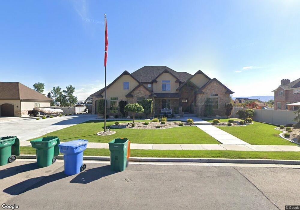
This home is located at 1590 E 1860 N Unit 213, Lehi, UT 84043 and is currently estimated at $1,094,365, approximately $374 per square foot. 1590 E 1860 N Unit 213 is a home located in Utah County with nearby schools including Freedom Elementary School, Lehi Junior High School, and Skyridge High School.
Ownership History
Date
Name
Owned For
Owner Type
Purchase Details
Closed on
Apr 2, 2020
Sold by
Cook Allan S and Cook Cathe
Bought by
Cook Allen S and Cook Cathe
Current Estimated Value
Home Financials for this Owner
Home Financials are based on the most recent Mortgage that was taken out on this home.
Original Mortgage
$474,000
Outstanding Balance
$425,164
Interest Rate
3.5%
Mortgage Type
New Conventional
Estimated Equity
$648,339
Purchase Details
Closed on
May 9, 2014
Sold by
Burningham Aaron and Burningham Tracey
Bought by
Cook Allan S and Cook Cathe
Home Financials for this Owner
Home Financials are based on the most recent Mortgage that was taken out on this home.
Original Mortgage
$417,000
Interest Rate
4.35%
Mortgage Type
New Conventional
Purchase Details
Closed on
Dec 30, 2008
Sold by
Alvey Jared and Alvey Valerie K
Bought by
Burningham Aaron and Burningham Tracey
Home Financials for this Owner
Home Financials are based on the most recent Mortgage that was taken out on this home.
Original Mortgage
$417,000
Interest Rate
5.6%
Mortgage Type
Purchase Money Mortgage
Purchase Details
Closed on
Sep 4, 2007
Sold by
Alvey Jared and Alvey Valerie
Bought by
Alvey Jared and Alvey Valerie K
Home Financials for this Owner
Home Financials are based on the most recent Mortgage that was taken out on this home.
Original Mortgage
$417,000
Interest Rate
6.35%
Mortgage Type
Unknown
Purchase Details
Closed on
Jan 31, 2007
Sold by
Alvey Jared
Bought by
Alvey Jared and Alvey Valerie
Purchase Details
Closed on
Jun 28, 2006
Sold by
Thorstenson Daniel A
Bought by
Alvey Jared
Home Financials for this Owner
Home Financials are based on the most recent Mortgage that was taken out on this home.
Original Mortgage
$592,000
Interest Rate
6.7%
Mortgage Type
Purchase Money Mortgage
Purchase Details
Closed on
Apr 20, 2006
Sold by
Cooper Corp
Bought by
Thorstenson Daniel A
Home Financials for this Owner
Home Financials are based on the most recent Mortgage that was taken out on this home.
Original Mortgage
$200,000
Interest Rate
6.29%
Mortgage Type
Purchase Money Mortgage
Create a Home Valuation Report for This Property
The Home Valuation Report is an in-depth analysis detailing your home's value as well as a comparison with similar homes in the area
Home Values in the Area
Average Home Value in this Area
Purchase History
| Date | Buyer | Sale Price | Title Company |
|---|---|---|---|
| Cook Allen S | -- | None Available | |
| Cook Allan S | -- | Pro Title & Escrow Inc | |
| Burningham Aaron | -- | First American | |
| Alvey Jared | -- | Provo Land Title Company | |
| Alvey Jared | -- | None Available | |
| Alvey Jared | -- | Utah First Title Insurance | |
| Thorstenson Daniel A | -- | None Available |
Source: Public Records
Mortgage History
| Date | Status | Borrower | Loan Amount |
|---|---|---|---|
| Open | Cook Allan S | $474,000 | |
| Closed | Cook Allan S | $417,000 | |
| Closed | Cook Allan S | $109,000 | |
| Previous Owner | Burningham Aaron | $407,000 | |
| Previous Owner | Burningham Aaron | $417,000 | |
| Previous Owner | Alvey Jared I | $417,000 | |
| Previous Owner | Alvey Jared I | $300,000 | |
| Previous Owner | Alvey Jared | $75,684 | |
| Previous Owner | Alvey Jared | $592,000 | |
| Previous Owner | Thorstenson Daniel A | $200,000 |
Source: Public Records
Tax History Compared to Growth
Tax History
| Year | Tax Paid | Tax Assessment Tax Assessment Total Assessment is a certain percentage of the fair market value that is determined by local assessors to be the total taxable value of land and additions on the property. | Land | Improvement |
|---|---|---|---|---|
| 2025 | $4,322 | $1,049,800 | $420,100 | $629,700 |
| 2024 | $4,322 | $505,780 | $0 | $0 |
| 2023 | $3,985 | $506,385 | $0 | $0 |
| 2022 | $4,601 | $566,720 | $0 | $0 |
| 2021 | $4,112 | $765,800 | $243,100 | $522,700 |
| 2020 | $3,877 | $713,600 | $225,100 | $488,500 |
| 2019 | $3,729 | $713,600 | $225,100 | $488,500 |
| 2018 | $3,733 | $675,400 | $212,800 | $462,600 |
| 2017 | $3,126 | $300,685 | $0 | $0 |
| 2016 | $3,215 | $286,880 | $0 | $0 |
| 2015 | $3,173 | $268,785 | $0 | $0 |
| 2014 | $2,802 | $235,950 | $0 | $0 |
Source: Public Records
Map
Nearby Homes
- 6833 W 9600 N
- 9967 N 6670 W
- 9924 N 6630 W Unit 9
- 6862 W 10205 N
- 1616 N Summer Crest Dr
- 2273 N 1060 E
- 2208 N 825 E
- 6481 W 9600 N
- 1175 E 900 N
- 10453 Canterbury Place
- 1438 N 400 W
- 3932 W 1000 N Unit 434
- 3936 W 1000 N Unit 433
- 3962 W 1000 N Unit 428
- 3944 W 1000 N Unit 431
- 3940 W 1000 N Unit 432
- 3968 W 1000 N Unit 427
- 3983 W 1000 N Unit 442
- 3947 W 1000 N Unit 439
- 3956 W 1000 N Unit 429
- 1590 E 1860 N
- 1616 E 1860 N
- 1840 N 1550 E
- 1656 E 1860 St N Unit 211
- 6976 W 9770 N
- 6946 W 9770 N
- 1601 E 1860 N
- 1601 E 1860 N Unit 212
- 1642 E 1860 N
- 1581 E 1860 N
- 1623 E 1860 N
- 1553 E 1860 N
- 1530 E 1860 N
- 6918 W 9770 N
- 10147 N 7000 W Unit 24
- 10121 N 7000 W Unit 25
- 6947 W 9770 N Unit 209
- 1649 E 1860 N
- 1649 E 1860 N Unit 210
- 9783 N 7000 W