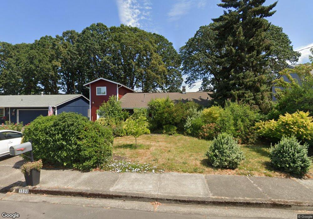
1590 SW 204th Ave Beaverton, OR 97006
Estimated Value: $537,000 - $572,453
3
Beds
3
Baths
2,272
Sq Ft
$246/Sq Ft
Est. Value
About This Home
This home is located at 1590 SW 204th Ave, Beaverton, OR 97006 and is currently estimated at $559,113, approximately $246 per square foot. 1590 SW 204th Ave is a home located in Washington County with nearby schools including L.C. Tobias Elementary School, R.A. Brown Middle School, and Century High School.
Ownership History
Date
Name
Owned For
Owner Type
Purchase Details
Closed on
Sep 25, 1998
Sold by
Nelson David A and Nelson Catherine M
Bought by
Nelson David Alan and Nelson Catherine Marie
Current Estimated Value
Home Financials for this Owner
Home Financials are based on the most recent Mortgage that was taken out on this home.
Original Mortgage
$120,000
Interest Rate
6.88%
Mortgage Type
Purchase Money Mortgage
Create a Home Valuation Report for This Property
The Home Valuation Report is an in-depth analysis detailing your home's value as well as a comparison with similar homes in the area
Home Values in the Area
Average Home Value in this Area
Purchase History
| Date | Buyer | Sale Price | Title Company |
|---|---|---|---|
| Nelson David Alan | -- | First American Title Ins Co |
Source: Public Records
Mortgage History
| Date | Status | Borrower | Loan Amount |
|---|---|---|---|
| Closed | Nelson David Alan | $120,000 |
Source: Public Records
Tax History Compared to Growth
Tax History
| Year | Tax Paid | Tax Assessment Tax Assessment Total Assessment is a certain percentage of the fair market value that is determined by local assessors to be the total taxable value of land and additions on the property. | Land | Improvement |
|---|---|---|---|---|
| 2026 | $4,079 | $278,350 | -- | -- |
| 2025 | $4,079 | $270,250 | -- | -- |
| 2024 | $3,959 | $262,380 | -- | -- |
| 2023 | $3,959 | $254,740 | $0 | $0 |
| 2022 | $3,810 | $254,740 | $0 | $0 |
| 2021 | $3,738 | $240,130 | $0 | $0 |
| 2020 | $3,658 | $233,140 | $0 | $0 |
| 2019 | $3,549 | $226,350 | $0 | $0 |
| 2018 | $2,868 | $185,130 | $0 | $0 |
| 2017 | $2,607 | $169,500 | $0 | $0 |
| 2016 | $2,539 | $164,570 | $0 | $0 |
| 2015 | $2,457 | $159,780 | $0 | $0 |
| 2014 | $2,414 | $155,130 | $0 | $0 |
Source: Public Records
Map
Nearby Homes
- 1553 SW 203rd Ave
- 20490 SW Frances St
- 1730 SW 203rd Ave
- 1439 SW 208th Ave
- 19805 SW Rock Rd
- 2125 SW Leewood Dr
- 20382 SW Monson St
- 20140 SW Augusta Ct
- 1297 SW 209th Ave
- 20935 SW Anthony Ct
- 19820 SW Jette Ln
- 20035 SW Monson St
- 19468 SW Euclid Ln
- 887 SW 198th Place
- 21240 SW Lenore Ct
- 778 SW 198th Place
- 19340 SW Blaine St
- 0 W Baseline Rd
- 20175 SW Clarion St
- 21512 SW Jay St
- 1600 SW 204th Ave
- 1570 SW 204th Ave
- 1565 SW 203rd Ave
- 1539 SW 203rd Ave
- 1540 SW 204th Ave
- 1575 SW 204th Ave
- 20425 SW Rock Rd
- 1527 SW 203rd Ave
- 1515 SW 203rd Ave
- 20394 SW Rock Rd
- 1510 SW 204th Ave
- 20378 SW Rock Rd
- 1597 SW 203rd Ave
- 20460 SW Frances St
- 20455 SW Rock Rd
- 20435 SW Frances St
- 1570 SW 203rd Ave
- 20360 SW Rock Rd
- 20360 SW Rock Rd
- 1503 SW 203rd Ave