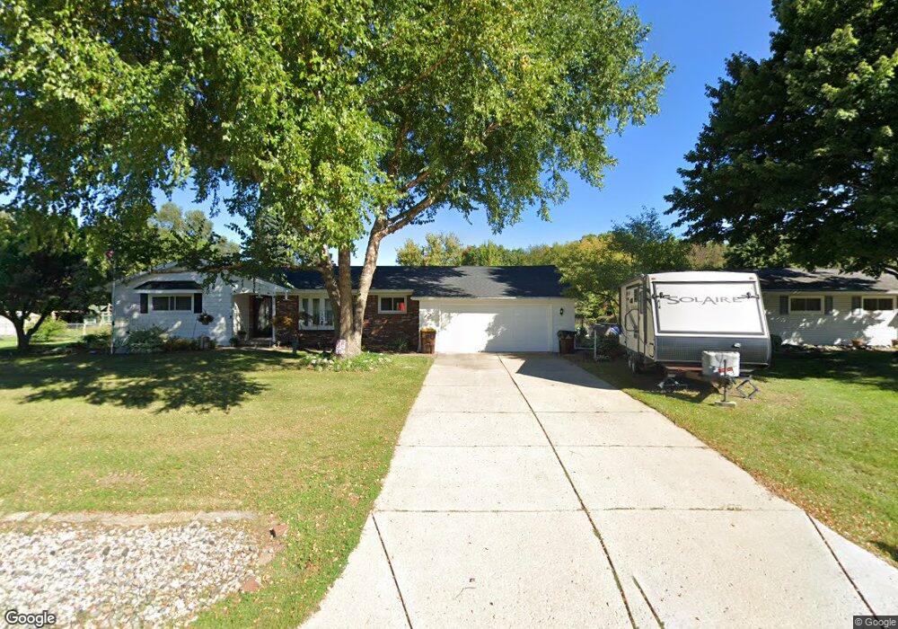
1591 Craig St Lansing, MI 48906
Estimated Value: $287,489 - $343,000
3
Beds
2
Baths
1,570
Sq Ft
$198/Sq Ft
Est. Value
About This Home
This home is located at 1591 Craig St, Lansing, MI 48906 and is currently estimated at $310,122, approximately $197 per square foot. 1591 Craig St is a home located in Clinton County with nearby schools including Gier Park School, Pattengill Academy, and Eastern High School.
Ownership History
Date
Name
Owned For
Owner Type
Purchase Details
Closed on
Oct 6, 2006
Sold by
Wolford James L and Wolford Beri L
Bought by
Embury Brenda L and Meints Penny L
Current Estimated Value
Home Financials for this Owner
Home Financials are based on the most recent Mortgage that was taken out on this home.
Original Mortgage
$195,820
Outstanding Balance
$117,108
Interest Rate
6.5%
Mortgage Type
Purchase Money Mortgage
Estimated Equity
$193,014
Create a Home Valuation Report for This Property
The Home Valuation Report is an in-depth analysis detailing your home's value as well as a comparison with similar homes in the area
Home Values in the Area
Average Home Value in this Area
Purchase History
| Date | Buyer | Sale Price | Title Company |
|---|---|---|---|
| Embury Brenda L | $195,820 | Fatic |
Source: Public Records
Mortgage History
| Date | Status | Borrower | Loan Amount |
|---|---|---|---|
| Open | Embury Brenda L | $195,820 |
Source: Public Records
Tax History
| Year | Tax Paid | Tax Assessment Tax Assessment Total Assessment is a certain percentage of the fair market value that is determined by local assessors to be the total taxable value of land and additions on the property. | Land | Improvement |
|---|---|---|---|---|
| 2025 | $3,143 | $144,000 | $22,000 | $122,000 |
| 2024 | $21 | $135,000 | $20,600 | $114,400 |
| 2023 | $1,950 | $121,200 | $0 | $0 |
| 2022 | $2,849 | $107,900 | $18,300 | $89,600 |
| 2021 | $2,756 | $102,000 | $17,400 | $84,600 |
| 2020 | $2,729 | $96,200 | $16,400 | $79,800 |
| 2019 | $2,607 | $89,300 | $15,400 | $73,900 |
| 2018 | $2,284 | $85,200 | $15,000 | $70,200 |
| 2017 | $2,253 | $82,900 | $14,300 | $68,600 |
| 2016 | $2,231 | $78,800 | $13,500 | $65,300 |
| 2015 | $2,175 | $74,600 | $0 | $0 |
| 2011 | -- | $74,800 | $0 | $0 |
Source: Public Records
Map
Nearby Homes
- 1901 E Stoll Rd
- 15378 Chetwyn Dr
- 14150 Wood Rd
- 15710 Oak Lane Dr
- 605 Galahad Dr Unit 374
- 606 Eastgate Dr Unit 384
- 15860 Brook Rd
- 107 Normandy Dr Unit 100
- 1015 Pearl St
- 108 Normandy Dr Unit 77
- 14103 Ambrosia Ave
- E State Rd
- 14211 Myers Rd
- 14070 Pristine Ct
- 14065 Pristine Ct
- 1694 W Solon Rd
- 14055 Pristine Ct
- 15897 Elmira St
- 14174 Myers Rd
- 210 Saint Ives N
Your Personal Tour Guide
Ask me questions while you tour the home.