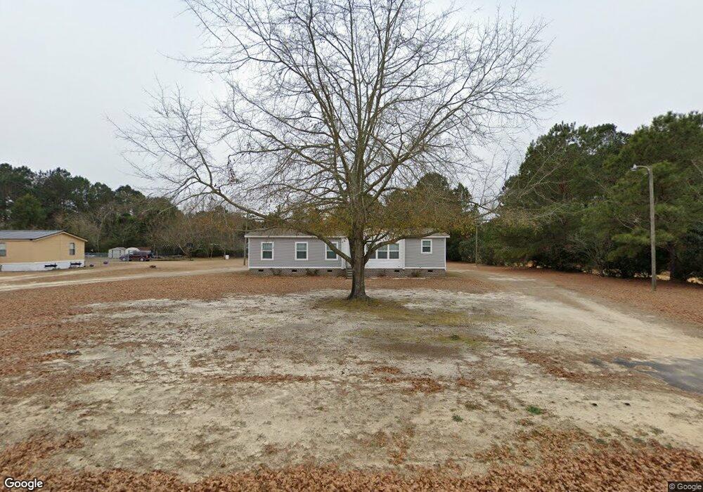
1591 Joann Branch Rd Lake View, SC 29563
Estimated Value: $94,000 - $174,000
--
Bed
--
Bath
1,568
Sq Ft
$84/Sq Ft
Est. Value
About This Home
This home is located at 1591 Joann Branch Rd, Lake View, SC 29563 and is currently estimated at $132,337, approximately $84 per square foot. 1591 Joann Branch Rd is a home located in Dillon County with nearby schools including Lake View Elementary School and Lake View High School.
Ownership History
Date
Name
Owned For
Owner Type
Purchase Details
Closed on
Aug 6, 2020
Sold by
Walters Charles A
Bought by
Love Jakeria M
Current Estimated Value
Home Financials for this Owner
Home Financials are based on the most recent Mortgage that was taken out on this home.
Original Mortgage
$80,750
Outstanding Balance
$71,225
Interest Rate
2.94%
Mortgage Type
Construction
Estimated Equity
$61,112
Purchase Details
Closed on
Feb 18, 2014
Sold by
Williamson Clarence
Bought by
Walters Charles Alan
Create a Home Valuation Report for This Property
The Home Valuation Report is an in-depth analysis detailing your home's value as well as a comparison with similar homes in the area
Home Values in the Area
Average Home Value in this Area
Purchase History
| Date | Buyer | Sale Price | Title Company |
|---|---|---|---|
| Love Jakeria M | $85,000 | -- | |
| Walters Charles Alan | -- | -- |
Source: Public Records
Mortgage History
| Date | Status | Borrower | Loan Amount |
|---|---|---|---|
| Open | Love Jakeria M | $80,750 |
Source: Public Records
Tax History Compared to Growth
Tax History
| Year | Tax Paid | Tax Assessment Tax Assessment Total Assessment is a certain percentage of the fair market value that is determined by local assessors to be the total taxable value of land and additions on the property. | Land | Improvement |
|---|---|---|---|---|
| 2025 | $524 | $3,150 | $120 | $3,030 |
| 2024 | $486 | $3,150 | $120 | $3,030 |
| 2023 | $486 | $3,150 | $120 | $3,030 |
| 2022 | $451 | $3,150 | $120 | $3,030 |
| 2021 | $434 | $3,180 | $120 | $3,060 |
| 2020 | $91 | $290 | $190 | $100 |
| 2019 | $87 | $290 | $190 | $100 |
| 2018 | $166 | $300 | $130 | $170 |
| 2016 | $155 | $300 | $160 | $140 |
| 2015 | $155 | $300 | $160 | $140 |
| 2014 | -- | $240 | $120 | $120 |
| 2013 | -- | $240 | $120 | $120 |
Source: Public Records
Map
Nearby Homes
- 1550 Rone Place
- 1740 Grain Bin Rd
- 0 Tbd Barfield Rd Unit LotWP002 21520542
- 0 Tbd Barfield Rd Unit LotWP004 21520544
- 0 Tbd Barfield Rd Unit LotWP005
- 0 Tbd Barfield Rd Unit LotWP006 21520546
- 148 High Hill Rd
- 1130 Buck Swamp Rd
- 602 S Kemper St
- TBD S Main St
- 000 Schofield Place
- 103 E 2nd Ave
- 806 E 3rd Ave
- 0 Highway 41 Unit LotWP001 14913177
- 0 Winnie Rd
- 1217 Poplar Creek Rd
- 0 Tbd Cowpen Swamp Rd
- 1653 Joann Branch Rd
- 2 Holly St
- 1512 Branchside Cir
- TBD Branchside Cir
- 1560 Joann Branch Rd
- 1542 Branchside Cir
- 1417 Hillcrest Dr
- 1528 Branchside Cir
- 1624 Branchside Cir
- 1324 Baytree Dr
- 1598 Joann Branch Rd
- 1765 Shady Pine Dr
- 2423 Bermuda Rd
- 1755 Fronting On Shady Pine Dr
- 2 Holly St
- 1613 Pineview Dr
- 1533 Branchside Cir
- 1562 Hilltop Acres Dr
- 1435 Hillcrest Dr
- 1723 Joann Branch Rd