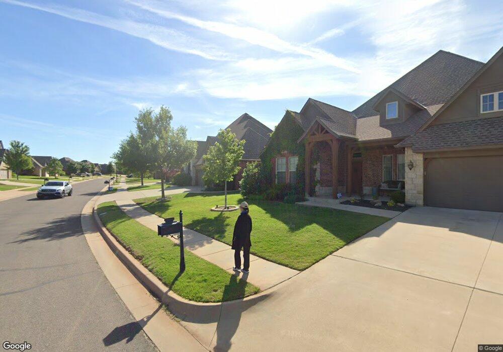
15912 Angie Kaye Ln Edmond, OK 73013
Quail Springs NeighborhoodEstimated Value: $483,360 - $532,000
3
Beds
3
Baths
2,788
Sq Ft
$179/Sq Ft
Est. Value
About This Home
This home is located at 15912 Angie Kaye Ln, Edmond, OK 73013 and is currently estimated at $499,590, approximately $179 per square foot. 15912 Angie Kaye Ln is a home with nearby schools including Angie Debo Elementary School, Summit Middle School, and Santa Fe High School.
Ownership History
Date
Name
Owned For
Owner Type
Purchase Details
Closed on
Apr 21, 2023
Sold by
Faris Keith Franklin and Faris Tonya Denise
Bought by
Faris Family Trust
Current Estimated Value
Purchase Details
Closed on
Jul 25, 2013
Sold by
Shawn Fofth Inc
Bought by
Faris Keith Franklin and Faris Tonya Denise
Home Financials for this Owner
Home Financials are based on the most recent Mortgage that was taken out on this home.
Original Mortgage
$196,000
Interest Rate
3.99%
Mortgage Type
New Conventional
Purchase Details
Closed on
Jan 4, 2013
Sold by
164Th Partners Llc
Bought by
Shawn Forth Inc
Home Financials for this Owner
Home Financials are based on the most recent Mortgage that was taken out on this home.
Original Mortgage
$268,000
Interest Rate
3.34%
Mortgage Type
Construction
Create a Home Valuation Report for This Property
The Home Valuation Report is an in-depth analysis detailing your home's value as well as a comparison with similar homes in the area
Home Values in the Area
Average Home Value in this Area
Purchase History
| Date | Buyer | Sale Price | Title Company |
|---|---|---|---|
| Faris Family Trust | -- | None Listed On Document | |
| Faris Keith Franklin | $351,000 | Stewart Abstract & Title Of | |
| Shawn Forth Inc | $50,000 | Stewart Abstract & Title Of |
Source: Public Records
Mortgage History
| Date | Status | Borrower | Loan Amount |
|---|---|---|---|
| Previous Owner | Faris Keith Franklin | $196,000 | |
| Previous Owner | Shawn Forth Inc | $268,000 |
Source: Public Records
Tax History Compared to Growth
Tax History
| Year | Tax Paid | Tax Assessment Tax Assessment Total Assessment is a certain percentage of the fair market value that is determined by local assessors to be the total taxable value of land and additions on the property. | Land | Improvement |
|---|---|---|---|---|
| 2024 | $5,310 | $46,983 | $8,605 | $38,378 |
| 2023 | $5,310 | $45,615 | $8,116 | $37,499 |
| 2022 | $5,199 | $44,286 | $8,933 | $35,353 |
| 2021 | $4,993 | $42,997 | $9,898 | $33,099 |
| 2020 | $4,915 | $41,745 | $9,951 | $31,794 |
| 2019 | $5,010 | $42,295 | $9,951 | $32,344 |
| 2018 | $5,082 | $41,635 | $0 | $0 |
| 2017 | $5,111 | $42,129 | $8,344 | $33,785 |
| 2016 | $5,050 | $41,854 | $8,344 | $33,510 |
| 2015 | $4,872 | $40,154 | $8,805 | $31,349 |
| 2014 | $4,859 | $40,154 | $8,805 | $31,349 |
Source: Public Records
Map
Nearby Homes
- 16104 Evan Shaw Ct
- 16201 Royal Crest Ln
- 16212 James Thomas Ct
- 16317 Scotland Way
- 1516 Cambria Ct
- 1508 Cambria Ct
- 1517 Cambria Ct
- 3305 NW 160th St
- 3328 NW 159th St
- 15713 James Thomas Ct
- 16304 Iron Ridge Rd
- 16324 Morningside Dr
- 3328 NW 158th Terrace
- 2947 NW 160th St
- 2941 NW 160th St
- 15712 NW 157th Dr
- 3329 NW 162nd St
- 3428 NW 159th Terrace
- 3420 N West 161st St
- 2909 NW 160th St
- 15916 Angie Kaye Ln
- 15908 Angie Kaye Ln
- 16000 Angie Kaye Ln
- 15917 Angie Kaye Ln
- 15904 Angie Kaye Ln
- 15921 Angie Kaye Ln
- 15913 Angie Kaye Ln
- 15909 Angie Kaye Ln
- 16001 Angie Kaye Ln
- 16004 Angie Kaye Ln
- 15900 Angie Kaye Ln
- 16005 Angie Kaye Ln
- 15900 James Thomas Ct
- 15820 Angie Kaye Ln
- 16008 Angie Kaye Ln
- 16016 Evan Shaw Ct
- 16100 Evan Shaw Ct
- 16020 Evan Shaw Ct
- 16012 Evan Shaw Ct
- 16009 Angie Kaye Ln