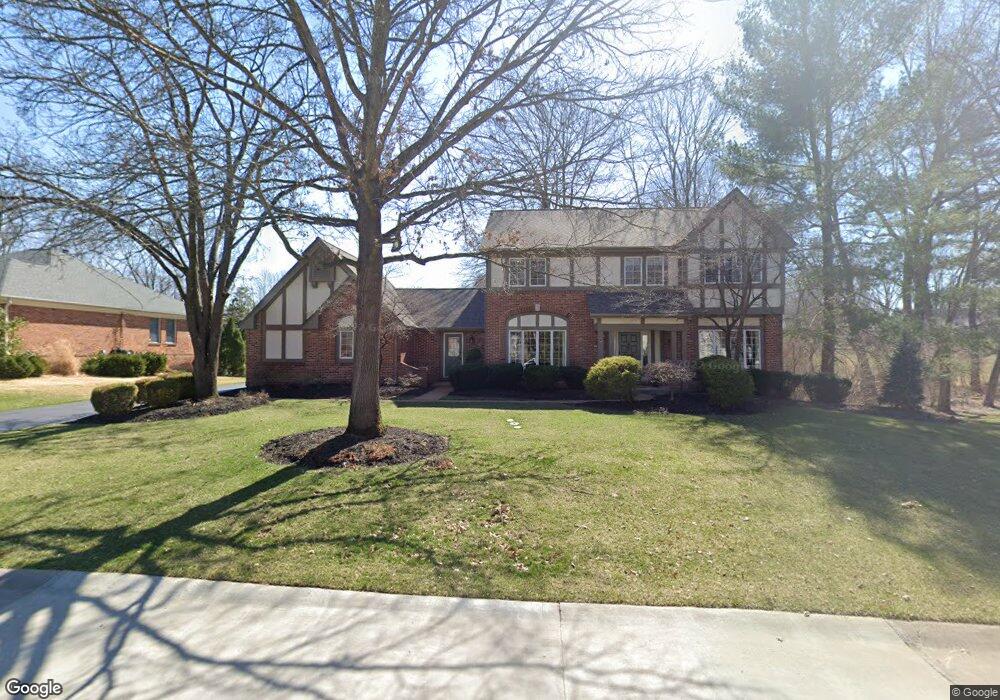
15916 Wetherburn Rd Chesterfield, MO 63017
Estimated Value: $590,000 - $771,000
4
Beds
3
Baths
2,946
Sq Ft
$224/Sq Ft
Est. Value
About This Home
This home is located at 15916 Wetherburn Rd, Chesterfield, MO 63017 and is currently estimated at $659,213, approximately $223 per square foot. 15916 Wetherburn Rd is a home located in St. Louis County with nearby schools including Kehrs Mill Elementary, Crestview Middle School, and Marquette Sr. High School.
Ownership History
Date
Name
Owned For
Owner Type
Purchase Details
Closed on
Dec 9, 2011
Sold by
Macdoniels Jay S
Bought by
Macdoniels Jay Scott and The Jay Scott Macdoniels Agreement Of Tr
Current Estimated Value
Home Financials for this Owner
Home Financials are based on the most recent Mortgage that was taken out on this home.
Original Mortgage
$295,000
Interest Rate
4.03%
Mortgage Type
New Conventional
Purchase Details
Closed on
Mar 10, 1997
Sold by
Scott Macdaniels Jay and Scott Ann Patricia
Bought by
Macdoniels Jay S and Macdoniels Patricia A
Create a Home Valuation Report for This Property
The Home Valuation Report is an in-depth analysis detailing your home's value as well as a comparison with similar homes in the area
Home Values in the Area
Average Home Value in this Area
Purchase History
| Date | Buyer | Sale Price | Title Company |
|---|---|---|---|
| Macdoniels Jay Scott | -- | Investors Title Co Clayton | |
| Macdoniels Jay S | -- | -- |
Source: Public Records
Mortgage History
| Date | Status | Borrower | Loan Amount |
|---|---|---|---|
| Closed | Macdoniels Jay Scott | $295,000 |
Source: Public Records
Tax History Compared to Growth
Tax History
| Year | Tax Paid | Tax Assessment Tax Assessment Total Assessment is a certain percentage of the fair market value that is determined by local assessors to be the total taxable value of land and additions on the property. | Land | Improvement |
|---|---|---|---|---|
| 2025 | $7,056 | $112,560 | $45,700 | $66,860 |
| 2024 | $7,056 | $101,070 | $39,600 | $61,470 |
| 2023 | $7,050 | $101,070 | $39,600 | $61,470 |
| 2022 | $6,793 | $90,440 | $39,600 | $50,840 |
| 2021 | $6,743 | $90,440 | $39,600 | $50,840 |
| 2020 | $6,792 | $86,850 | $33,380 | $53,470 |
| 2019 | $6,819 | $86,850 | $33,380 | $53,470 |
| 2018 | $6,467 | $77,650 | $23,860 | $53,790 |
| 2017 | $6,313 | $77,650 | $23,860 | $53,790 |
| 2016 | $6,373 | $75,390 | $23,860 | $51,530 |
| 2015 | $6,244 | $75,390 | $23,860 | $51,530 |
| 2014 | $5,900 | $69,450 | $21,680 | $47,770 |
Source: Public Records
Map
Nearby Homes
- 925 Camargo Dr
- 155 Forest Club Dr
- 15740 Tambour Ct
- 9 Picardy Hill Dr
- 15921 Picardy Crest Ct
- 927 Claytonbrook Dr Unit 3
- 917 Claytonbrook Dr Unit 3
- 920 Claytonbrook Dr Unit 3
- 10 Forest Club Dr
- 922 Claytonbrook Dr Unit 2
- 910 Claytonbrook Dr Unit 1
- 2259 Sycamore Dr
- 233 Whiting Ln
- 1131 Claytonbrook Ct Unit 1131
- 312 Clayton Crossing Dr Unit 304
- 1025 Bridgeport Dr
- 15575 Meadowbrook Circle Ln
- 15 Meadowbrook Country Club Estate
- 16078 Meadow Oak Dr
- 2300 Sterling Pointe Dr
- 15908 Wetherburn Rd
- 15917 Chowning Ct
- 15928 Wetherburn Rd
- 15925 Chowning Ct
- 15902 Wetherburn Rd
- 15915 Wetherburn Rd
- 15921 Wetherburn Rd
- 15907 Wetherburn Rd
- 2411 Capitol Landing Dr
- 15927 Wetherburn Rd
- 15901 Wetherburn Rd
- 2204 Whitby Rd
- 15936 Wetherburn Rd
- 15951 Trowbridge Rd
- 15920 Chowning Ct
- 15933 Wetherburn Rd
- 2429 Capitol Landing Dr
- 2212 Whitby Rd
- 2363 Westpar Dr
- 2367 Westpar Dr