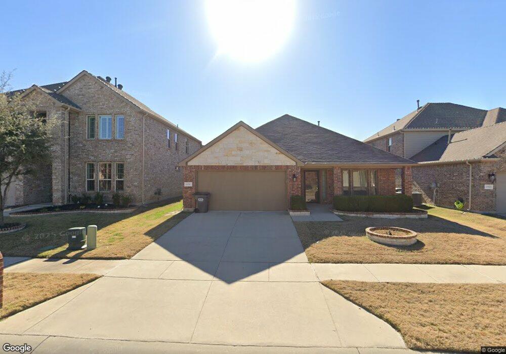
15917 Langsdale St Frisco, TX 75034
Estimated Value: $424,905 - $476,000
4
Beds
2
Baths
2,050
Sq Ft
$221/Sq Ft
Est. Value
About This Home
This home is located at 15917 Langsdale St, Frisco, TX 75034 and is currently estimated at $452,726, approximately $220 per square foot. 15917 Langsdale St is a home located in Denton County with nearby schools including Hackberry Elementary School, Lowell H Strike Middle School, and Little Elm High School.
Ownership History
Date
Name
Owned For
Owner Type
Purchase Details
Closed on
Nov 25, 2014
Sold by
D R Horton Texas Ltd
Bought by
Haygood Margaret
Current Estimated Value
Home Financials for this Owner
Home Financials are based on the most recent Mortgage that was taken out on this home.
Original Mortgage
$209,239
Outstanding Balance
$160,689
Interest Rate
3.99%
Mortgage Type
New Conventional
Estimated Equity
$292,037
Create a Home Valuation Report for This Property
The Home Valuation Report is an in-depth analysis detailing your home's value as well as a comparison with similar homes in the area
Home Values in the Area
Average Home Value in this Area
Purchase History
| Date | Buyer | Sale Price | Title Company |
|---|---|---|---|
| Haygood Margaret | -- | None Available |
Source: Public Records
Mortgage History
| Date | Status | Borrower | Loan Amount |
|---|---|---|---|
| Open | Haygood Margaret | $209,239 |
Source: Public Records
Tax History Compared to Growth
Tax History
| Year | Tax Paid | Tax Assessment Tax Assessment Total Assessment is a certain percentage of the fair market value that is determined by local assessors to be the total taxable value of land and additions on the property. | Land | Improvement |
|---|---|---|---|---|
| 2025 | $5,145 | $340,393 | $90,561 | $359,868 |
| 2024 | $4,373 | $309,448 | $90,561 | $218,887 |
| 2023 | $6,182 | $370,739 | $90,561 | $368,741 |
| 2022 | $5,495 | $337,035 | $90,561 | $289,134 |
| 2021 | $5,266 | $306,395 | $64,491 | $241,904 |
| 2020 | $4,977 | $282,205 | $64,491 | $217,714 |
| 2019 | $5,201 | $278,810 | $64,491 | $214,319 |
| 2018 | $4,820 | $271,139 | $64,491 | $208,987 |
| 2017 | $4,408 | $246,490 | $64,491 | $181,999 |
| 2016 | $4,148 | $231,938 | $43,908 | $188,030 |
| 2015 | -- | $213,448 | $43,908 | $169,540 |
Source: Public Records
Map
Nearby Homes
- 3905 Blessington Dr
- 3812 Fordham St
- 4013 Ellenboro St
- 3721 Blessington Dr
- 3713 Blessington Dr
- 3716 Rumford Rd
- 3900 Moorcroft Rd
- 15608 Cornwallis St
- 15517 Leadenhall St
- 116 Maxwell Rd
- 3905 Shadewell St
- 3512 Trowbridge St
- 7571 Snug Harbor Cir
- 8845 Twin Pines Ln
- 8921 Shore Crest Rd
- 8873 Shore Crest Rd
- 1955 Bishop Hill
- 1932 Marsh Point Dr
- 2111 Bentwater Ln
- 2068 Bentwater Ln
- 15913 Langsdale St
- 15921 Langsdale St
- 15909 Langsdale St
- 15925 Langsdale St
- 15920 Dorrington Dr
- 15912 Dorrington Dr
- 15905 Langsdale St
- 15924 Dorrington Dr
- 15908 Dorrington Dr
- 15916 Dorrington Dr
- 15924 Langsdale St
- 15916 Langsdale St
- 15929 Langsdale St
- 15912 Langsdale St
- 15920 Langsdale St
- 15904 Dorrington Dr
- 15928 Dorrington Dr
- 15908 Langsdale St
- 15901 Langsdale St
- 15933 Langsdale St