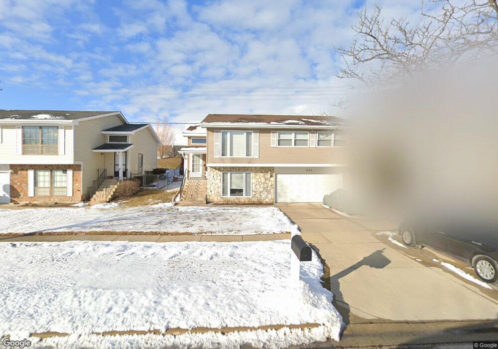
1592 Brookside Dr Hoffman Estates, IL 60169
South Hoffman Estates NeighborhoodEstimated Value: $375,000 - $398,000
4
Beds
3
Baths
1,464
Sq Ft
$266/Sq Ft
Est. Value
About This Home
This home is located at 1592 Brookside Dr, Hoffman Estates, IL 60169 and is currently estimated at $389,562, approximately $266 per square foot. 1592 Brookside Dr is a home located in Cook County with nearby schools including Neil Armstrong Elementary School, Dwight D Eisenhower Junior High School, and Hoffman Estates High School.
Ownership History
Date
Name
Owned For
Owner Type
Purchase Details
Closed on
Oct 4, 2016
Sold by
Siddiqui Sajed H and Siddiqui Mahjabeen
Bought by
West Suburban Bank
Current Estimated Value
Purchase Details
Closed on
Jan 26, 1999
Sold by
Siddiqui Rashid H and Siddiqui Roxanne
Bought by
Siddiqui Sajed H and Siddiqui Mahjabeen
Home Financials for this Owner
Home Financials are based on the most recent Mortgage that was taken out on this home.
Original Mortgage
$124,500
Interest Rate
6.88%
Purchase Details
Closed on
Oct 26, 1993
Sold by
Saghir Syed S and Saghir Nasim
Bought by
Siddiqui Rashid H and Siddiqui Roxanne
Create a Home Valuation Report for This Property
The Home Valuation Report is an in-depth analysis detailing your home's value as well as a comparison with similar homes in the area
Home Values in the Area
Average Home Value in this Area
Purchase History
| Date | Buyer | Sale Price | Title Company |
|---|---|---|---|
| West Suburban Bank | -- | None Available | |
| Siddiqui Sajed H | -- | Chicago Title Insurance Co | |
| Siddiqui Safed H | -- | Chicago Title Insurance Co | |
| Siddiqui Rashid H | $99,666 | -- |
Source: Public Records
Mortgage History
| Date | Status | Borrower | Loan Amount |
|---|---|---|---|
| Previous Owner | Siddiqui Sajed H | $124,500 |
Source: Public Records
Tax History
| Year | Tax Paid | Tax Assessment Tax Assessment Total Assessment is a certain percentage of the fair market value that is determined by local assessors to be the total taxable value of land and additions on the property. | Land | Improvement |
|---|---|---|---|---|
| 2025 | $5,195 | $33,000 | $6,050 | $26,950 |
| 2024 | $5,195 | $30,000 | $5,500 | $24,500 |
| 2023 | $5,187 | $30,000 | $5,500 | $24,500 |
| 2022 | $5,187 | $30,000 | $5,500 | $24,500 |
| 2021 | $5,475 | $23,001 | $8,662 | $14,339 |
| 2020 | $5,440 | $23,001 | $8,662 | $14,339 |
| 2019 | $5,380 | $25,557 | $8,662 | $16,895 |
| 2018 | $6,003 | $25,539 | $7,562 | $17,977 |
| 2017 | $8,179 | $25,539 | $7,562 | $17,977 |
| 2016 | $6,333 | $25,539 | $7,562 | $17,977 |
| 2015 | $6,243 | $22,062 | $6,600 | $15,462 |
| 2014 | $6,150 | $22,062 | $6,600 | $15,462 |
| 2013 | $5,974 | $22,062 | $6,600 | $15,462 |
Source: Public Records
Map
Nearby Homes
- 1587 Brookside Dr
- 1500 Robin Cir Unit 314
- 1776 Bristol Walk Unit 1776
- 1797 Queensbury Cir Unit 5764
- 1760 Bristol Walk Unit F
- 1722 Fayette Walk Unit E
- 1769 Sessions Walk Unit C
- 1840 Huntington Blvd Unit BW511
- 1840 Huntington Blvd Unit 203
- 1792 Williamsburg Dr
- 1836 Stockton Dr Unit 3312
- 1800 Monterey Ct
- 2080 Sutherland Place Unit 1
- 2222 Seaver Ln
- 1576 Poplar Creek Dr
- 2021 Kensington Ln Unit 3004
- 2027 Kensington Ln Unit 3001
- 2025 Kensington Ln Unit 3002
- 2023 Kensington Ln Unit 3003
- 2051 Kettering Rd Unit 2
- 1590 Brookside Dr
- 1594 Brookside Dr
- 1588 Brookside Dr
- 1596 Brookside Dr
- 1593 Brookside Dr
- 1586 Brookside Dr
- 1900 Brookside Ln
- 1895 Brookside Ln Unit 4
- 1584 Brookside Dr
- 1591 Brookside Dr
- 1902 Brookside Ln
- 1583 Brookside Dr
- 1899 Brookside Ln Unit 4
- 1589 Brookside Dr
- 1582 Brookside Dr
- 1585 Brookside Dr
- 1901 Brookside Ln
- 1897 Brookside Ln Unit 4
- 1904 Brookside Ln
- 1581 Brookside Dr
Your Personal Tour Guide
Ask me questions while you tour the home.