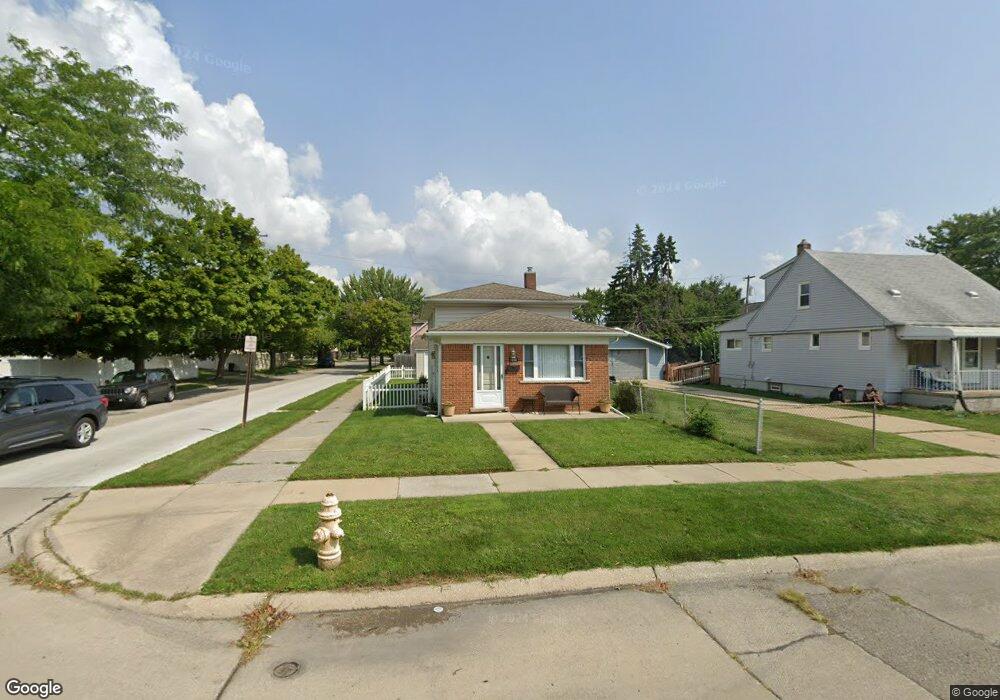
1592 Dee St Wyandotte, MI 48192
Estimated Value: $177,797 - $188,000
3
Beds
2
Baths
1,300
Sq Ft
$140/Sq Ft
Est. Value
About This Home
This home is located at 1592 Dee St, Wyandotte, MI 48192 and is currently estimated at $181,949, approximately $139 per square foot. 1592 Dee St is a home located in Wayne County with nearby schools including Washington Elementary School, Woodrow Wilson School, and Roosevelt High School.
Ownership History
Date
Name
Owned For
Owner Type
Purchase Details
Closed on
Mar 25, 2015
Sold by
Gauci Jeffery
Bought by
1592 Dee Street Llc
Current Estimated Value
Purchase Details
Closed on
Mar 28, 2011
Sold by
Federal Home Loan Mortgage Corporation
Bought by
Gauci Jeff
Purchase Details
Closed on
Feb 18, 2010
Sold by
Sundquist Robert L
Bought by
Federal Home Loan Mortgage Corp
Purchase Details
Closed on
Feb 29, 2000
Sold by
Bailey Dana L
Bought by
Sundquist Robert L
Create a Home Valuation Report for This Property
The Home Valuation Report is an in-depth analysis detailing your home's value as well as a comparison with similar homes in the area
Home Values in the Area
Average Home Value in this Area
Purchase History
| Date | Buyer | Sale Price | Title Company |
|---|---|---|---|
| 1592 Dee Street Llc | -- | None Available | |
| Gauci Jeff | $20,031 | Etitle Agency Inc | |
| Federal Home Loan Mortgage Corp | $38,000 | None Available | |
| Sundquist Robert L | $85,000 | -- |
Source: Public Records
Tax History Compared to Growth
Tax History
| Year | Tax Paid | Tax Assessment Tax Assessment Total Assessment is a certain percentage of the fair market value that is determined by local assessors to be the total taxable value of land and additions on the property. | Land | Improvement |
|---|---|---|---|---|
| 2025 | $2,444 | $76,400 | $0 | $0 |
| 2024 | $2,444 | $73,000 | $0 | $0 |
| 2023 | $2,330 | $65,500 | $0 | $0 |
| 2022 | $2,995 | $58,500 | $0 | $0 |
| 2021 | $2,926 | $54,600 | $0 | $0 |
| 2020 | $2,886 | $48,600 | $0 | $0 |
| 2019 | $2,842 | $45,100 | $0 | $0 |
| 2018 | $2,049 | $48,400 | $0 | $0 |
| 2017 | $1,494 | $48,400 | $0 | $0 |
| 2016 | $2,868 | $44,000 | $0 | $0 |
| 2015 | $3,861 | $40,900 | $0 | $0 |
| 2013 | $3,740 | $37,400 | $0 | $0 |
| 2012 | $2,174 | $38,600 | $4,900 | $33,700 |
Source: Public Records
Map
Nearby Homes