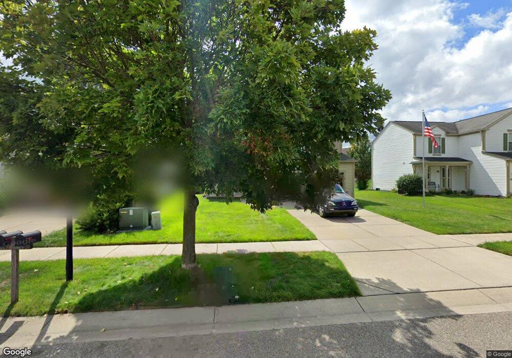
1592 Marshbank Dr Pontiac, MI 48340
Estimated Value: $285,457 - $377,000
4
Beds
4
Baths
1,788
Sq Ft
$184/Sq Ft
Est. Value
About This Home
This home is located at 1592 Marshbank Dr, Pontiac, MI 48340 and is currently estimated at $329,864, approximately $184 per square foot. 1592 Marshbank Dr is a home located in Oakland County with nearby schools including Alcott School, Pontiac Middle School, and Pontiac High School.
Ownership History
Date
Name
Owned For
Owner Type
Purchase Details
Closed on
Jan 26, 2006
Sold by
Footman Robert and Footman Robert J
Bought by
Footman Robert J and Footman Pamela
Current Estimated Value
Home Financials for this Owner
Home Financials are based on the most recent Mortgage that was taken out on this home.
Original Mortgage
$158,000
Outstanding Balance
$100,869
Interest Rate
8.57%
Mortgage Type
Adjustable Rate Mortgage/ARM
Estimated Equity
$228,995
Purchase Details
Closed on
Feb 10, 1999
Sold by
Pulte Land Dev Corp
Bought by
Footman Robert
Home Financials for this Owner
Home Financials are based on the most recent Mortgage that was taken out on this home.
Original Mortgage
$141,700
Interest Rate
6.89%
Create a Home Valuation Report for This Property
The Home Valuation Report is an in-depth analysis detailing your home's value as well as a comparison with similar homes in the area
Home Values in the Area
Average Home Value in this Area
Purchase History
| Date | Buyer | Sale Price | Title Company |
|---|---|---|---|
| Footman Robert J | -- | Title Source Inc | |
| Footman Robert | $40,000 | -- |
Source: Public Records
Mortgage History
| Date | Status | Borrower | Loan Amount |
|---|---|---|---|
| Open | Footman Robert J | $158,000 | |
| Previous Owner | Footman Robert | $141,700 |
Source: Public Records
Tax History Compared to Growth
Tax History
| Year | Tax Paid | Tax Assessment Tax Assessment Total Assessment is a certain percentage of the fair market value that is determined by local assessors to be the total taxable value of land and additions on the property. | Land | Improvement |
|---|---|---|---|---|
| 2024 | $1,617 | $123,300 | $0 | $0 |
| 2023 | $63 | $0 | $0 | $0 |
| 2022 | $63 | $0 | $0 | $0 |
| 2021 | $63 | $0 | $0 | $0 |
| 2020 | $41 | $0 | $0 | $0 |
| 2019 | $41 | $0 | $0 | $0 |
| 2018 | $21 | $0 | $0 | $0 |
| 2017 | $26 | $0 | $0 | $0 |
| 2016 | $57 | $55,330 | $0 | $0 |
| 2015 | -- | $43,680 | $0 | $0 |
| 2014 | -- | $36,690 | $0 | $0 |
| 2011 | -- | $42,390 | $0 | $0 |
Source: Public Records
Map
Nearby Homes
- 2854 Beacham Dr
- 2927 Huntington Park Dr
- 2831 Silverstone Ln
- 405 W Walton Blvd
- 940 Lake Angelus Shores Rd
- 2361 Montroyal Ave
- 2550 W Walton Blvd
- 310 W Princeton Ave
- 228 W Walton Blvd
- 161 W Brooklyn Ave
- 1123 Cherrylawn Dr
- 108 W Brooklyn Ave
- 2830 Dixie Hwy
- 104 W Brooklyn Ave
- 1153 Stanley Ave
- 3411 Wormer Dr
- 64 W Colgate Ave
- 240 W Fairmount Ave
- 37 W Brooklyn Ave
- 1017 Cherrylawn Dr
- 1594 Marshbank Dr
- 1590 Marshbank Dr
- 1596 Marshbank Dr
- 1598 Marshbank Dr
- 1556 Meadow Ridge Dr
- 1554 Meadow Ridge Dr
- 48340 Marshbank
- 1604 Marshbank Dr
- 1558 Meadow Ridge Dr
- 1600 Valdosta Cir
- 1560 Meadow Ridge Dr
- 1600 Marshbank Dr
- 1601 Valdosta Cir
- 1602 Marshbank Dr
- 1599 Marshbank Dr
- 1604 Valdosta Cir
- 1585 Marshbank Dr
- 1603 Valdosta Cir
- 1583 Marshbank Dr
- 1603 Marshbank Dr