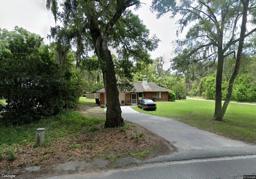
1592 W Euclid Ave Deland, FL 32720
West DeLand NeighborhoodEstimated Value: $242,000 - $344,000
3
Beds
2
Baths
2,156
Sq Ft
$142/Sq Ft
Est. Value
About This Home
This home is located at 1592 W Euclid Ave, Deland, FL 32720 and is currently estimated at $306,263, approximately $142 per square foot. 1592 W Euclid Ave is a home located in Volusia County with nearby schools including Woodward Avenue Elementary School, Deland High School, and Southwestern Middle School.
Ownership History
Date
Name
Owned For
Owner Type
Purchase Details
Closed on
May 30, 2017
Sold by
Saxon Warren H
Bought by
Saxon Lana S and Lana S Saxon Revocable Trust
Current Estimated Value
Purchase Details
Closed on
Mar 15, 2012
Sold by
Greenlee Forrest E and Greenlee Teri Wilder
Bought by
Saxon Warren H and The Warren H Saxon Revocable Trust
Purchase Details
Closed on
Feb 27, 2004
Sold by
Ricci Jeffrey J and Ricci Jeff
Bought by
Greenlee Forrest E
Home Financials for this Owner
Home Financials are based on the most recent Mortgage that was taken out on this home.
Original Mortgage
$118,800
Interest Rate
5.63%
Mortgage Type
Purchase Money Mortgage
Purchase Details
Closed on
Nov 2, 2000
Sold by
Ricci Angela M
Bought by
Ricci Jeffrey J and Ricci Joanne
Purchase Details
Closed on
Jul 15, 1990
Bought by
Saxon Warren H Tr
Purchase Details
Closed on
Mar 15, 1986
Bought by
Saxon Warren H Tr
Create a Home Valuation Report for This Property
The Home Valuation Report is an in-depth analysis detailing your home's value as well as a comparison with similar homes in the area
Home Values in the Area
Average Home Value in this Area
Purchase History
| Date | Buyer | Sale Price | Title Company |
|---|---|---|---|
| Saxon Lana S | -- | Attorney | |
| Saxon Warren H | $65,000 | Watson Title Services Inc | |
| Greenlee Forrest E | $132,000 | -- | |
| Ricci Jeffrey J | -- | -- | |
| Saxon Warren H Tr | $11,500 | -- | |
| Saxon Warren H Tr | $6,000 | -- |
Source: Public Records
Mortgage History
| Date | Status | Borrower | Loan Amount |
|---|---|---|---|
| Previous Owner | Greenlee Forrest E | $118,800 |
Source: Public Records
Tax History Compared to Growth
Tax History
| Year | Tax Paid | Tax Assessment Tax Assessment Total Assessment is a certain percentage of the fair market value that is determined by local assessors to be the total taxable value of land and additions on the property. | Land | Improvement |
|---|---|---|---|---|
| 2025 | $4,492 | $280,513 | $57,236 | $223,277 |
| 2024 | $4,492 | $281,490 | $57,236 | $224,254 |
| 2023 | $4,492 | $266,249 | $57,236 | $209,013 |
| 2022 | $4,156 | $237,724 | $57,236 | $180,488 |
| 2021 | $3,875 | $179,675 | $27,255 | $152,420 |
| 2020 | $3,743 | $172,760 | $22,349 | $150,411 |
| 2019 | $3,766 | $168,208 | $20,169 | $148,039 |
| 2018 | $3,480 | $146,009 | $20,169 | $125,840 |
| 2017 | $3,292 | $135,218 | $17,988 | $117,230 |
| 2016 | $2,931 | $120,579 | $0 | $0 |
| 2015 | $2,768 | $109,964 | $0 | $0 |
| 2014 | $2,536 | $99,929 | $0 | $0 |
Source: Public Records
Map
Nearby Homes
- 0 Coberly Dr Unit MFRO6312050
- 1541 W Talton Ave
- 1705 Bent Branch Ave
- 320 S Woodward Ave
- 1691 Beasley Dr
- 1415 Talton Ave
- 732 Mockingbird Ln
- 235 Rockmoore Ct
- 1753 Bent Branch Ave
- 1676 Andover Ridge Dr
- 1314 Talton Ave
- 512 Bird Song Dr
- 541 Rhodes Dr
- 414 Holly Fern Trail
- 325 Pelham Park Dr
- 141 Addle Hill Ct
- 131 Addle Hill Ct
- 1659 Andover Ridge Dr
- 1655 Andover Ridge Dr
- 1697 Andover Ridge Dr
- 1582 W Euclid Ave
- 595 Fatio Rd
- 1572 W Euclid Ave
- 1573 W Euclid Ave
- Fatio Rd
- 1571 W Euclid Ave
- 550 Fatio Rd
- 1664 Brittain Ave
- 1560 W Euclid Ave
- 605 Fatio Rd
- 1662 Brittain Ave
- 601 Fatio Rd
- 1559 W Euclid Ave
- 409 Fatio Rd
- 1656 Brittain Ave
- 1666 W Euclid Ave
- 1663 Brittain Ave
- 400 Fatio Rd
- 1549 W Euclid Ave
- 1540 Stevens Ave