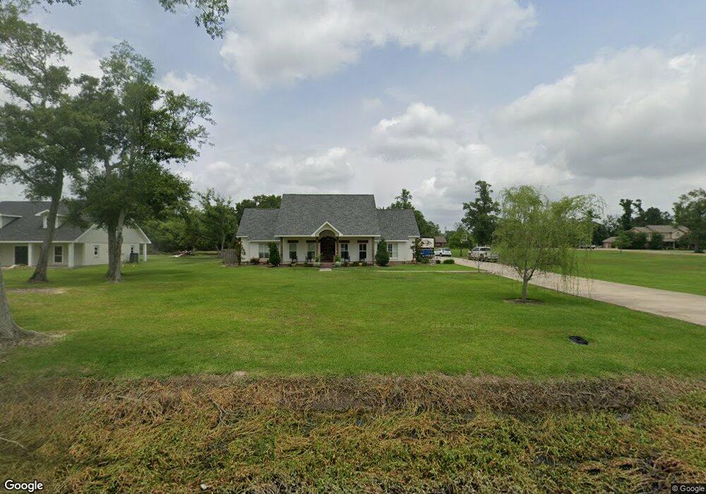
1593 Currie Dr Sulphur, LA 70665
Estimated Value: $444,000 - $566,000
4
Beds
3
Baths
2,944
Sq Ft
$174/Sq Ft
Est. Value
About This Home
This home is located at 1593 Currie Dr, Sulphur, LA 70665 and is currently estimated at $512,667, approximately $174 per square foot. 1593 Currie Dr is a home located in Calcasieu Parish with nearby schools including Cypress Cove Elementary School, W.W. Lewis Middle School, and Sulphur High School.
Ownership History
Date
Name
Owned For
Owner Type
Purchase Details
Closed on
Jul 8, 2015
Sold by
Monsour Tamara Lynn and Monsour Victor
Bought by
Constance Anthony Baptist and Terez Constance Keisha
Current Estimated Value
Purchase Details
Closed on
Mar 14, 2011
Sold by
Milner Martin Thomas and Milner Roxanne
Bought by
Monsour Tamara Lynn
Home Financials for this Owner
Home Financials are based on the most recent Mortgage that was taken out on this home.
Original Mortgage
$296,010
Interest Rate
5.06%
Mortgage Type
New Conventional
Create a Home Valuation Report for This Property
The Home Valuation Report is an in-depth analysis detailing your home's value as well as a comparison with similar homes in the area
Home Values in the Area
Average Home Value in this Area
Purchase History
| Date | Buyer | Sale Price | Title Company |
|---|---|---|---|
| Constance Anthony Baptist | $398,500 | None Available | |
| Monsour Tamara Lynn | $328,900 | None Available |
Source: Public Records
Mortgage History
| Date | Status | Borrower | Loan Amount |
|---|---|---|---|
| Previous Owner | Monsour Tamara Lynn | $296,010 |
Source: Public Records
Tax History Compared to Growth
Tax History
| Year | Tax Paid | Tax Assessment Tax Assessment Total Assessment is a certain percentage of the fair market value that is determined by local assessors to be the total taxable value of land and additions on the property. | Land | Improvement |
|---|---|---|---|---|
| 2024 | $2,582 | $30,490 | $160 | $30,330 |
| 2023 | $2,582 | $30,490 | $160 | $30,330 |
| 2022 | $2,527 | $30,330 | $0 | $30,330 |
| 2021 | $2,569 | $30,490 | $160 | $30,330 |
| 2020 | $3,014 | $27,460 | $160 | $27,300 |
| 2019 | $3,419 | $30,490 | $160 | $30,330 |
| 2018 | $2,612 | $30,490 | $160 | $30,330 |
| 2017 | $3,548 | $30,490 | $160 | $30,330 |
| 2016 | $3,733 | $30,490 | $160 | $30,330 |
| 2015 | $3,733 | $30,450 | $120 | $30,330 |
Source: Public Records
Map
Nearby Homes
- 1940 Currie Dr
- 3724 Thompson Rd
- 4108 Linda Ln
- 1265 Staci Ln
- 3584 Sierra Cir
- 0 Pete Seay Rd Unit SWL25003393
- 0 Pete Seay Rd Unit 189234
- 4331 Dorothy Jane Dr
- 2022 Gay Dr
- 4327 Dorothy Jane Dr
- 0 Lawton Dr Unit SWL21008795
- 1332 Lawton Dr
- 1617 Walker Rd
- 2375 Jane Dr
- 1474 Walker Rd
- 4191 Judy Dr
- Denton Plan at Mimosa Park
- Bellvue Plan at Mimosa Park
- Huntsville Plan at Mimosa Park
- Kingston Plan at Mimosa Park
- 1601 Currie Dr
- 1556 Currie Dr
- 1566 Currie Dr
- 1548 Currie Dr
- 1580 Currie Dr
- 1793 Currie Dr
- 3689 E Cabella Dr
- 1546 Currie Dr
- 1575 Currie Dr
- 1588 Currie Dr
- 1557 Currie Dr
- 1585 Currie Dr
- 3688 E Cabella Dr
- 1544 Currie Dr
- 0 Tbd Cabella Rd Unit 164381
- 1801 Currie Dr
- 3591 E Cabella Dr
- 3658 E Cabella Dr
- 1543 Currie Dr
- 3579 E Cabella Dr