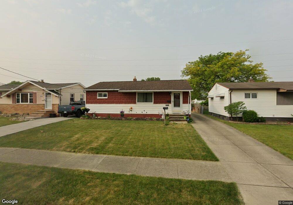
15931 Paulding Blvd Brookpark, OH 44142
Estimated Value: $180,723 - $233,000
3
Beds
1
Bath
912
Sq Ft
$222/Sq Ft
Est. Value
About This Home
This home is located at 15931 Paulding Blvd, Brookpark, OH 44142 and is currently estimated at $202,181, approximately $221 per square foot. 15931 Paulding Blvd is a home located in Cuyahoga County with nearby schools including Berea-Midpark Middle School, Berea-Midpark High School, and Huber Heights Preparatory Academy Parma Academy.
Ownership History
Date
Name
Owned For
Owner Type
Purchase Details
Closed on
Jun 19, 2013
Sold by
Beckstrom Herbert and Beckstrom Cecilia A
Bought by
Beckstrom David A and Chunyo Roberta G
Current Estimated Value
Purchase Details
Closed on
Jun 17, 1999
Sold by
Estate Fo Elizabeth Ann Beckstrom
Bought by
Beckstrom Herbert
Purchase Details
Closed on
Jan 1, 1975
Bought by
Beckstrom Herbert and Beckstrom E
Create a Home Valuation Report for This Property
The Home Valuation Report is an in-depth analysis detailing your home's value as well as a comparison with similar homes in the area
Home Values in the Area
Average Home Value in this Area
Purchase History
| Date | Buyer | Sale Price | Title Company |
|---|---|---|---|
| Beckstrom David A | $32,500 | Boulevard Title Agency | |
| Beckstrom Herbert | -- | -- | |
| Beckstrom Herbert | -- | -- |
Source: Public Records
Tax History
| Year | Tax Paid | Tax Assessment Tax Assessment Total Assessment is a certain percentage of the fair market value that is determined by local assessors to be the total taxable value of land and additions on the property. | Land | Improvement |
|---|---|---|---|---|
| 2024 | $2,897 | $57,435 | $12,880 | $44,555 |
| 2023 | $2,737 | $44,940 | $9,380 | $35,560 |
| 2022 | $2,718 | $44,940 | $9,380 | $35,560 |
| 2021 | $2,702 | $44,940 | $9,380 | $35,560 |
| 2020 | $2,437 | $35,670 | $7,460 | $28,210 |
| 2019 | $2,364 | $101,900 | $21,300 | $80,600 |
| 2018 | $2,226 | $35,670 | $7,460 | $28,210 |
| 2017 | $2,271 | $31,790 | $7,320 | $24,470 |
| 2016 | $2,253 | $31,790 | $7,320 | $24,470 |
| 2015 | $2,225 | $31,790 | $7,320 | $24,470 |
| 2014 | $2,225 | $33,460 | $7,700 | $25,760 |
Source: Public Records
Map
Nearby Homes
- 15995 Paulding Blvd
- 5952 Delores Blvd
- 6188 Barbara Ln
- 16159 Bowfin Blvd
- 6330 Ledgebrook Dr
- 6330 Sandfield Dr
- 6065 Mercer Dr
- 6377 Ledgebrook Dr
- 6386 Sandfield Dr
- 16379 Hummel Rd
- 6016 Gilmere Dr
- 14801 Larkfield Dr
- 6448 Delores Blvd
- 14761 Larkfield Dr
- 6095 Stark Dr
- 6103 Westbrook Dr
- 6014 Westbrook Dr
- 14396 Park Dr
- 6213 Siegler Dr
- 14024 Donald Dr
- 15911 Paulding Blvd
- 15951 Paulding Blvd
- 15889 Paulding Blvd
- 15971 Paulding Blvd
- 15863 Paulding Blvd
- 16090 Cynthia Dr
- 15960 Cynthia Dr
- 16100 Cynthia Dr
- 15920 Paulding Blvd
- 15930 Cynthia Dr
- 15898 Paulding Blvd
- 15841 Paulding Blvd
- 15942 Paulding Blvd
- 15874 Paulding Blvd
- 15960 Paulding Blvd
- 16140 Cynthia Dr
- 15900 Cynthia Dr
- 15848 Paulding Blvd
- 15980 Paulding Blvd
- 15819 Paulding Blvd
Your Personal Tour Guide
Ask me questions while you tour the home.