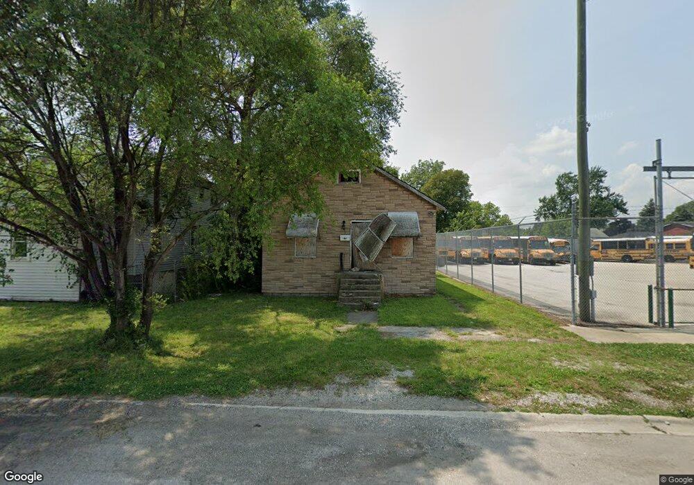
15938 Loomis Ave Harvey, IL 60426
Estimated Value: $69,388 - $105,000
2
Beds
1
Bath
416
Sq Ft
$216/Sq Ft
Est. Value
About This Home
This home is located at 15938 Loomis Ave, Harvey, IL 60426 and is currently estimated at $89,847, approximately $215 per square foot. 15938 Loomis Ave is a home located in Cook County with nearby schools including Brooks Middle School, Thornton Township High School, and Calvary Academy.
Ownership History
Date
Name
Owned For
Owner Type
Purchase Details
Closed on
Aug 23, 2007
Sold by
Givens Dyante
Bought by
Thomas Michael
Current Estimated Value
Home Financials for this Owner
Home Financials are based on the most recent Mortgage that was taken out on this home.
Original Mortgage
$89,000
Outstanding Balance
$55,482
Interest Rate
6.63%
Mortgage Type
Purchase Money Mortgage
Estimated Equity
$34,365
Purchase Details
Closed on
Apr 16, 2007
Sold by
Chicago Inv Ii Co
Bought by
Givens Dyante
Home Financials for this Owner
Home Financials are based on the most recent Mortgage that was taken out on this home.
Original Mortgage
$51,891
Interest Rate
6.2%
Mortgage Type
Purchase Money Mortgage
Purchase Details
Closed on
May 4, 2006
Sold by
Randol Judy and Hughes Judy
Bought by
Chicago Inv Ii Co and Chb Trust
Create a Home Valuation Report for This Property
The Home Valuation Report is an in-depth analysis detailing your home's value as well as a comparison with similar homes in the area
Home Values in the Area
Average Home Value in this Area
Purchase History
We collect this data history from publicly available records. To have your information removed, we recommend requesting removal directly through your county’s website.
| Date | Buyer | Sale Price | Title Company |
|---|---|---|---|
| Thomas Michael | $89,000 | Ticor Title Ins Co 1998 | |
| Givens Dyante | $35,000 | Stewart Title Of Illinois | |
| Chicago Inv Ii Co | $11,000 | Git |
Source: Public Records
Mortgage History
We collect this data history from publicly available records. To have your information removed, we recommend requesting removal directly through your county’s website.
| Date | Status | Borrower | Loan Amount |
|---|---|---|---|
| Open | Thomas Michael | $89,000 | |
| Previous Owner | Givens Dyante | $51,891 |
Source: Public Records
Tax History
| Year | Tax Paid | Tax Assessment Tax Assessment Total Assessment is a certain percentage of the fair market value that is determined by local assessors to be the total taxable value of land and additions on the property. | Land | Improvement |
|---|---|---|---|---|
| 2025 | $3,333 | $5,100 | $1,536 | $3,564 |
| 2024 | $3,333 | $5,100 | $1,536 | $3,564 |
| 2023 | $3,016 | $5,100 | $1,536 | $3,564 |
| 2022 | $3,016 | $3,709 | $1,299 | $2,410 |
| 2021 | $2,914 | $3,709 | $1,299 | $2,410 |
| 2020 | $2,994 | $3,709 | $1,299 | $2,410 |
| 2019 | $2,232 | $2,876 | $1,181 | $1,695 |
| 2018 | $2,178 | $2,876 | $1,181 | $1,695 |
| 2017 | $2,128 | $2,876 | $1,181 | $1,695 |
| 2016 | $1,974 | $3,050 | $1,063 | $1,987 |
| 2015 | $1,896 | $3,050 | $1,063 | $1,987 |
| 2014 | $1,891 | $3,050 | $1,063 | $1,987 |
| 2013 | $1,978 | $3,252 | $1,063 | $2,189 |
Source: Public Records
Map
Nearby Homes
- 16018 Loomis Ave
- 16130 Justine St
- 15725 Loomis Ave
- 16037 Marshfield Ave
- 15731 Lexington Ave
- 15736 Turlington Ave
- 16000 Marshfield Ave
- 16008 Marshfield Ave
- 15727 Turlington Ave
- 16236 Lathrop Ave
- 15805 Paulina St
- 16226 Ashland Ave
- 15708 Park Ave
- 16229 Marshfield Ave
- 15616 Loomis Ave
- 15612 Loomis Ave
- 16131 Hermitage Ave
- 15629 Ashland Ave
- 15627 Ashland Ave
- 16145 Hermitage Ave
- 15942 Loomis Ave
- 15945 Myrtle Ave
- 15935 Myrtle Ave
- 15935 Myrtle Ave
- 15947 Myrtle Ave
- 15937 Myrtle Ave
- 15941 Loomis Ave Unit 15945
- 15937 Loomis Ave
- 15937 Loomis Ave
- 16006 Loomis Ave
- 15925 Myrtle Ave
- 16001 Loomis Ave
- 16001 Loomis Ave
- 15933 Loomis Ave
- 15933 Loomis Ave
- 16005 Myrtle Ave
- 15929 Loomis Ave
- 15929 Loomis Ave
- 15927 Myrtle Ave
- 15927 Myrtle Ave
Your Personal Tour Guide
Ask me questions while you tour the home.