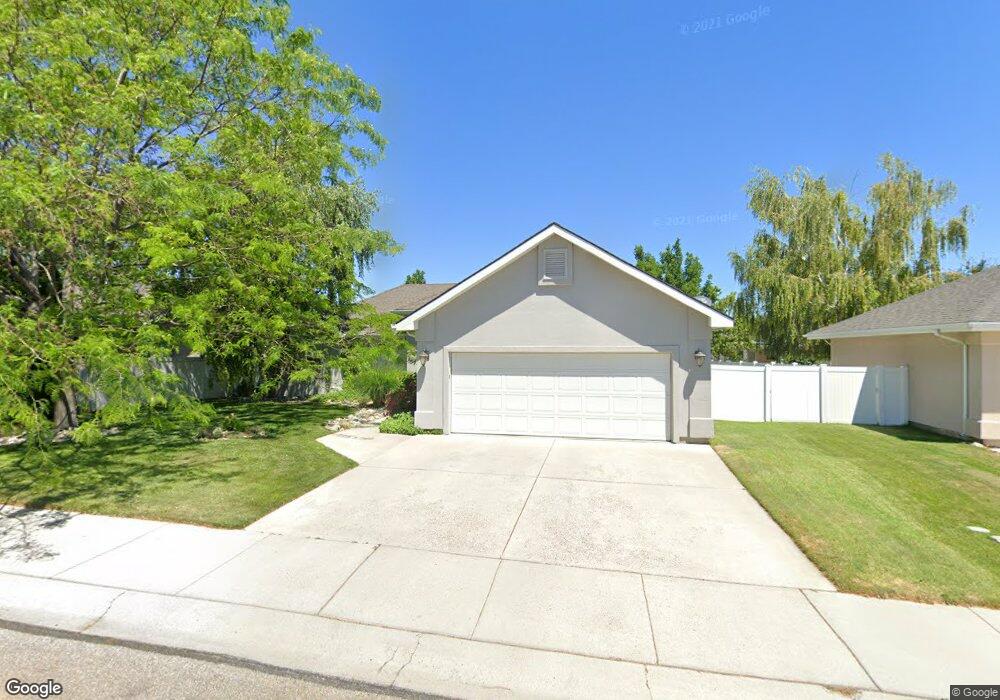
1594 Brookside Loop Twin Falls, ID 83301
Estimated Value: $344,000 - $400,000
3
Beds
2
Baths
1,480
Sq Ft
$249/Sq Ft
Est. Value
About This Home
This home is located at 1594 Brookside Loop, Twin Falls, ID 83301 and is currently estimated at $369,140, approximately $249 per square foot. 1594 Brookside Loop is a home located in Twin Falls County with nearby schools including Sawtooth Elementary School, Vera C. O'Leary Middle School, and Twin Falls Senior High School.
Ownership History
Date
Name
Owned For
Owner Type
Purchase Details
Closed on
Aug 23, 2016
Sold by
Busman John R
Bought by
Walker Robyn
Current Estimated Value
Home Financials for this Owner
Home Financials are based on the most recent Mortgage that was taken out on this home.
Original Mortgage
$178,200
Outstanding Balance
$141,953
Interest Rate
3.43%
Mortgage Type
New Conventional
Estimated Equity
$227,187
Create a Home Valuation Report for This Property
The Home Valuation Report is an in-depth analysis detailing your home's value as well as a comparison with similar homes in the area
Purchase History
| Date | Buyer | Sale Price | Title Company |
|---|---|---|---|
| Walker Robyn | -- | First American Title Twin Fa |
Source: Public Records
Mortgage History
| Date | Status | Borrower | Loan Amount |
|---|---|---|---|
| Open | Walker Robyn | $178,200 |
Source: Public Records
Tax History
| Year | Tax Paid | Tax Assessment Tax Assessment Total Assessment is a certain percentage of the fair market value that is determined by local assessors to be the total taxable value of land and additions on the property. | Land | Improvement |
|---|---|---|---|---|
| 2025 | $1,721 | $305,471 | $74,090 | $231,381 |
| 2024 | $1,705 | $305,471 | $74,090 | $231,381 |
| 2023 | $1,641 | $323,499 | $74,090 | $249,409 |
| 2022 | $2,091 | $307,652 | $56,869 | $250,783 |
| 2021 | $1,825 | $242,457 | $56,869 | $185,588 |
| 2020 | $1,522 | $199,489 | $48,989 | $150,500 |
| 2019 | $1,768 | $197,984 | $48,989 | $148,995 |
| 2018 | $1,796 | $190,124 | $37,563 | $152,561 |
| 2017 | $1,649 | $175,913 | $37,563 | $138,350 |
| 2016 | $1,569 | $156,581 | $0 | $0 |
| 2015 | $3,104 | $159,157 | $0 | $0 |
| 2012 | -- | $145,169 | $0 | $0 |
Source: Public Records
Map
Nearby Homes
- 1360 Lawndale Dr
- 1442 Stonecrest Ct
- 1436 Holly Dr
- 1205 Lawndale Dr
- 1840 Candleridge Dr
- 1605 Targhee Dr
- 1888 Candleridge Dr
- 1754 Targhee Dr
- 1827 Targhee Dr
- 1965 Candleridge Dr
- 1480 Pillar Cir
- 1517 Mountain View Dr
- 2024 Julie Ln
- 1509 Mountain View Dr
- 744 Northview Dr
- 1818 Granada Dr
- 450 Pole Line Rd Unit 53
- 450 Pole Line Rd Unit 84
- 1697 Tule Dr
- 532 Canyon Falls
- 1586 Brookside Loop
- 1598 Brookside Loop
- 1524 Busch Ct
- 1536 Busch Ct
- 1514 Busch Ct
- 1593 Brookside Loop
- 1582 Brookside Loop
- 1599 Brookside Loop
- 1575 Brookside Loop
- 1546 Busch Ct
- 1511 Busch Ct
- 1576 Brookside Loop
- 1523 Busch Ct
- 1519 Brookside Loop
- 1537 Brookside Loop
- 1509 Brookside Loop
- 1552 Busch Ct
- 1566 Brookside Loop
- 1541 Busch Ct
- 1558 Brookside Loop
Your Personal Tour Guide
Ask me questions while you tour the home.