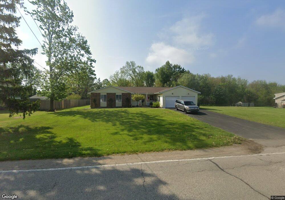
1594 Port Sheldon St Jenison, MI 49428
Estimated Value: $356,000 - $385,000
2
Beds
2
Baths
1,976
Sq Ft
$187/Sq Ft
Est. Value
About This Home
This home is located at 1594 Port Sheldon St, Jenison, MI 49428 and is currently estimated at $368,740, approximately $186 per square foot. 1594 Port Sheldon St is a home located in Ottawa County with nearby schools including Bursley School, Jenison Junior High School, and Jenison High School.
Ownership History
Date
Name
Owned For
Owner Type
Purchase Details
Closed on
Sep 14, 2016
Sold by
Schat John R and Schat Michelle M
Bought by
Schat John R and The John R Schat Trust
Current Estimated Value
Purchase Details
Closed on
Mar 31, 2003
Sold by
Schat John R and Schat Michelle H
Bought by
Schat John R and Schat Michelle H
Home Financials for this Owner
Home Financials are based on the most recent Mortgage that was taken out on this home.
Original Mortgage
$119,500
Interest Rate
5.94%
Mortgage Type
Balloon
Create a Home Valuation Report for This Property
The Home Valuation Report is an in-depth analysis detailing your home's value as well as a comparison with similar homes in the area
Home Values in the Area
Average Home Value in this Area
Purchase History
| Date | Buyer | Sale Price | Title Company |
|---|---|---|---|
| Schat John R | -- | Star Title Agency Llc | |
| Schat John R | -- | -- | |
| Schat John R | -- | -- |
Source: Public Records
Mortgage History
| Date | Status | Borrower | Loan Amount |
|---|---|---|---|
| Closed | Schat John R | $119,500 |
Source: Public Records
Tax History Compared to Growth
Tax History
| Year | Tax Paid | Tax Assessment Tax Assessment Total Assessment is a certain percentage of the fair market value that is determined by local assessors to be the total taxable value of land and additions on the property. | Land | Improvement |
|---|---|---|---|---|
| 2025 | $4,052 | $158,100 | $0 | $0 |
| 2024 | $3,725 | $132,400 | $0 | $0 |
| 2023 | $3,552 | $106,200 | $0 | $0 |
| 2022 | $3,681 | $106,900 | $0 | $0 |
| 2021 | $3,508 | $95,600 | $0 | $0 |
| 2020 | $3,476 | $92,100 | $0 | $0 |
| 2019 | $3,491 | $89,900 | $0 | $0 |
| 2018 | $3,315 | $91,600 | $0 | $0 |
| 2017 | $3,249 | $88,700 | $0 | $0 |
| 2016 | $3,241 | $83,300 | $0 | $0 |
| 2015 | $3,127 | $74,900 | $0 | $0 |
| 2014 | $3,127 | $72,600 | $0 | $0 |
Source: Public Records
Map
Nearby Homes
- 1433 Winifred St
- 1361 Carol Dr
- 1643 Laramy Ln
- 1306 Carol Dr
- 1355 Bent Tree Dr Unit 12
- 6451 12th Ave
- 1241 S Marymark Dr
- 1496 Eagle Shore Ct Unit 13
- 1519 Eagle Shore Ct Unit Lot 33
- 1481 Eagle Shore Ct Unit 39
- 1451 Eagle Shore Ct
- 6129 W Bay Ct
- 6025 Gleneagle Dr
- 7107 Westwood Dr
- 2101 Rosewood St
- 7165 Keystone Ct
- 1040 Castlebay Way Unit 19
- 1038 Castlebay Way Unit 18
- 1036 Castlebay Way Unit 17
- 950 Brentwood St
- 1590 Port Sheldon St
- 1578 Port Sheldon St
- 1585 Port Sheldon St
- 1579 Port Sheldon St
- 1579 Port Sheldon St Unit 1581
- 1598 Port Sheldon St
- 1598 Port Sheldon St Unit 1600
- 1576 Port Sheldon St Unit 1578
- 1583 Port Sheldon St Unit 1585
- 1577 Port Sheldon St
- 1575 Port Sheldon St
- 1600 Port Sheldon St
- 6487 15th Ave
- 6505 15th Ave
- 6469 15th Ave
- 1647 Port Sheldon St
- 1571 Port Sheldon St
- 1571 Port Sheldon St Unit 1573
- 1571 Port Sheldon St Unit 72
- 6537 15th Ave