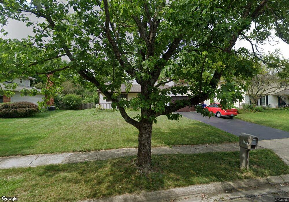
1594 Scottsdale Ave Columbus, OH 43235
Estimated Value: $429,000 - $457,000
4
Beds
3
Baths
2,400
Sq Ft
$182/Sq Ft
Est. Value
About This Home
This home is located at 1594 Scottsdale Ave, Columbus, OH 43235 and is currently estimated at $437,694, approximately $182 per square foot. 1594 Scottsdale Ave is a home located in Franklin County with nearby schools including Gables Elementary School, Ridgeview Middle School, and Centennial High School.
Ownership History
Date
Name
Owned For
Owner Type
Purchase Details
Closed on
Jun 24, 2011
Sold by
Catipon Ronnie B and The Rhoda S Catipon Revocable
Bought by
Sheikh Munir Uddin and Akhtar Nasim
Current Estimated Value
Home Financials for this Owner
Home Financials are based on the most recent Mortgage that was taken out on this home.
Original Mortgage
$103,800
Outstanding Balance
$71,187
Interest Rate
4.52%
Mortgage Type
New Conventional
Estimated Equity
$366,507
Purchase Details
Closed on
Nov 16, 2000
Sold by
Catipon Rhoda
Bought by
Catipon Rhoda S and Rhoda S Catipon Revocable Trus
Purchase Details
Closed on
Nov 20, 1978
Bought by
Catipon Ronnie B
Create a Home Valuation Report for This Property
The Home Valuation Report is an in-depth analysis detailing your home's value as well as a comparison with similar homes in the area
Home Values in the Area
Average Home Value in this Area
Purchase History
| Date | Buyer | Sale Price | Title Company |
|---|---|---|---|
| Sheikh Munir Uddin | $148,800 | Land & Mo | |
| Catipon Rhoda S | -- | -- | |
| Catipon Rhoda | -- | -- | |
| Catipon Ronnie B | -- | -- |
Source: Public Records
Mortgage History
| Date | Status | Borrower | Loan Amount |
|---|---|---|---|
| Open | Sheikh Munir Uddin | $103,800 |
Source: Public Records
Tax History Compared to Growth
Tax History
| Year | Tax Paid | Tax Assessment Tax Assessment Total Assessment is a certain percentage of the fair market value that is determined by local assessors to be the total taxable value of land and additions on the property. | Land | Improvement |
|---|---|---|---|---|
| 2024 | $4,997 | $121,140 | $40,740 | $80,400 |
| 2023 | $4,961 | $121,135 | $40,740 | $80,395 |
| 2022 | $6,978 | $98,390 | $28,350 | $70,040 |
| 2021 | $4,657 | $98,390 | $28,350 | $70,040 |
| 2020 | $4,663 | $98,390 | $28,350 | $70,040 |
| 2019 | $4,225 | $78,400 | $22,680 | $55,720 |
| 2018 | $3,750 | $78,400 | $22,680 | $55,720 |
| 2017 | $4,185 | $78,400 | $22,680 | $55,720 |
| 2016 | $3,618 | $54,610 | $18,170 | $36,440 |
| 2015 | $3,284 | $54,610 | $18,170 | $36,440 |
| 2014 | $3,292 | $54,610 | $18,170 | $36,440 |
| 2013 | $1,655 | $55,650 | $17,290 | $38,360 |
Source: Public Records
Map
Nearby Homes
- 1540 Slade Ave Unit 303
- 5363 Godown Rd
- 1246 Southport Dr
- 5485 Millington Rd
- 1284 Slade Ave
- 1297 Slade Ave
- 1213 Nantucket Ave
- 5773 Middlefield Dr
- 5111 Portland St
- 5111 Schuylkill St
- 5854 Aqua Bay Dr Unit 5854
- 5936 Aqua Bay Dr
- 5938 Aqua Bay Dr
- 1558 Denbigh Dr
- 1739 Paula Dr Unit 1739
- 1161 Bethel Rd Unit 103/104
- 962 Augusta Glen Dr
- 5624 Wigmore Dr Unit 50B
- 2179 Victoria Park Dr Unit 2179
- 5268 Captains Ct
- 1584 Scottsdale Ave
- 1606 Scottsdale Ave
- 1574 Scottsdale Ave
- 1616 Scottsdale Ave
- 1595 Scottsdale Ave
- 1605 Scottsdale Ave
- 1585 Scottsdale Ave
- 1615 Scottsdale Ave
- 1628 Scottsdale Ave
- 1575 Scottsdale Ave
- 0 W Case Rd
- 1605 W Case Rd
- 1627 Scottsdale Ave
- 1565 Scottsdale Ave
- 1593 West Case Rd
- 1552 Scottsdale Ave
- 1638 Scottsdale Ave
- 1592 Ramblewood Ave
- 1602 Ramblewood Ave
- 1582 Ramblewood Ave