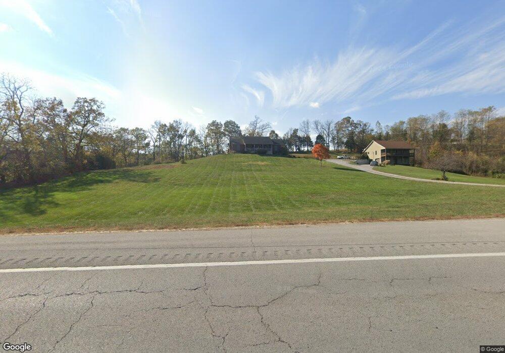
15945 Highway 127 S Owenton, KY 40359
Estimated Value: $237,000 - $444,000
--
Bed
--
Bath
--
Sq Ft
2.46
Acres
About This Home
This home is located at 15945 Highway 127 S, Owenton, KY 40359 and is currently estimated at $308,004. 15945 Highway 127 S is a home with nearby schools including Owen County Primary School, Maurice Bowling Middle School, and Owen County High School.
Ownership History
Date
Name
Owned For
Owner Type
Purchase Details
Closed on
Aug 31, 2017
Sold by
Ray Thomas and Ray Lulakay
Bought by
Winkle Jonathan K and Winkle Kara Brianne H
Current Estimated Value
Home Financials for this Owner
Home Financials are based on the most recent Mortgage that was taken out on this home.
Original Mortgage
$181,649
Outstanding Balance
$151,771
Interest Rate
3.92%
Mortgage Type
FHA
Estimated Equity
$156,233
Create a Home Valuation Report for This Property
The Home Valuation Report is an in-depth analysis detailing your home's value as well as a comparison with similar homes in the area
Home Values in the Area
Average Home Value in this Area
Purchase History
| Date | Buyer | Sale Price | Title Company |
|---|---|---|---|
| Winkle Jonathan K | $185,000 | Capital Title Llc |
Source: Public Records
Mortgage History
| Date | Status | Borrower | Loan Amount |
|---|---|---|---|
| Open | Winkle Jonathan K | $181,649 |
Source: Public Records
Tax History Compared to Growth
Tax History
| Year | Tax Paid | Tax Assessment Tax Assessment Total Assessment is a certain percentage of the fair market value that is determined by local assessors to be the total taxable value of land and additions on the property. | Land | Improvement |
|---|---|---|---|---|
| 2024 | $2,164 | $185,000 | $0 | $0 |
| 2023 | $2,185 | $185,000 | $0 | $0 |
| 2022 | $2,161 | $185,000 | $0 | $0 |
| 2021 | $2,163 | $185,000 | $10,000 | $175,000 |
| 2020 | $2,208 | $185,000 | $10,000 | $175,000 |
| 2019 | $2,213 | $185,000 | $0 | $0 |
| 2018 | $2,139 | $185,000 | $0 | $0 |
| 2017 | $2,025 | $178,400 | $0 | $0 |
| 2016 | $2,041 | $178,400 | $0 | $0 |
| 2015 | $2,017 | $178,400 | $178,400 | $0 |
| 2013 | $1,878 | $178,400 | $0 | $0 |
| 2012 | $1,878 | $178,400 | $0 | $0 |
Source: Public Records
Map
Nearby Homes
- 1035 Claxon Ridge Rd
- 1892 Unit 1900 McDonald Ferry
- 13955 Swallowfield Rd
- 1892,1900 McDonald Ferry Rd
- 2200 Kays Branch Rd
- 25.78 Acres McDonald Ferry Rd
- 00 Herman Green Rd
- 5275 Harmony Rd
- 5631 Gest Rd
- 355 Pennington Ln
- 520 Pennington Ln
- 2208 Indian Gap Rd
- 3169 Steele Branch Rd
- 607 Fallis-Gest Rd
- 940 Sawdridge Rd (Royce Ln)
- #18 Evanwood Estates
- Lot #14 Evanwood Dr
- 1008 Port Collins Rd
- 2460 Harp Pike
- 39 Wright Rd
- 15920 Highway 127 S
- 15935 Highway 127 S
- 16085 Hwy 127 S
- 15705 Highway 127 S
- 14790 Highway 127 S
- 14765 Highway 127 S
- 3290 Old Frankfort Pike
- 14805 Highway 127 S
- 3195 Old Frankfort Pike
- 3195 Old Frankfort Pike
- 15010 Hwy 127 S
- 15010 Highway 127 S
- 15010 U S 127
- 15280 Highway 127 S
- 15280 Hwy 127 S
- 14150 Highway 127 S
- 2890 Old Frankfort Pike
- 15920 U S 127
- 1355 Old Frankfort Pike
- 820 Old Frankfort Pike Unit FRANKFOR