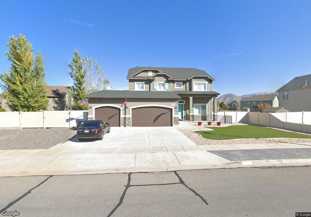
1595 E 100 S Unit RANDOL Spanish Fork, UT 84660
Estimated Value: $692,000 - $785,000
3
Beds
3
Baths
3,136
Sq Ft
$235/Sq Ft
Est. Value
About This Home
This home is located at 1595 E 100 S Unit RANDOL, Spanish Fork, UT 84660 and is currently estimated at $735,470, approximately $234 per square foot. 1595 E 100 S Unit RANDOL is a home located in Utah County with nearby schools including Sierra Bonita Elementary School, Diamond Fork Junior High School, and Mapleton Junior High School.
Ownership History
Date
Name
Owned For
Owner Type
Purchase Details
Closed on
Oct 8, 2021
Sold by
Rodgers Tera and Rodgers Gregory
Bought by
Tramell Landon Theone
Current Estimated Value
Home Financials for this Owner
Home Financials are based on the most recent Mortgage that was taken out on this home.
Original Mortgage
$520,000
Outstanding Balance
$474,192
Interest Rate
2.8%
Mortgage Type
New Conventional
Estimated Equity
$261,279
Purchase Details
Closed on
Apr 10, 2013
Sold by
Rodgers Tera
Bought by
Rodgers Tera and Rodgers Gregory
Home Financials for this Owner
Home Financials are based on the most recent Mortgage that was taken out on this home.
Original Mortgage
$287,170
Interest Rate
3.47%
Mortgage Type
New Conventional
Purchase Details
Closed on
Nov 16, 2009
Sold by
Sunny Ridge Plat F Llc
Bought by
Homes By Harmony Inc
Purchase Details
Closed on
Aug 20, 2008
Sold by
Jon Fullmer Construction Inc
Bought by
Far West Bank
Create a Home Valuation Report for This Property
The Home Valuation Report is an in-depth analysis detailing your home's value as well as a comparison with similar homes in the area
Home Values in the Area
Average Home Value in this Area
Purchase History
| Date | Buyer | Sale Price | Title Company |
|---|---|---|---|
| Tramell Landon Theone | -- | Utah First Title Ins Agcy | |
| Rodgers Tera | -- | Provo Land Title Co | |
| Rodgers Tera | -- | Provo Land Title Co | |
| Homes By Harmony Inc | -- | Provo Land Title Company | |
| Far West Bank | $2,530,000 | None Available |
Source: Public Records
Mortgage History
| Date | Status | Borrower | Loan Amount |
|---|---|---|---|
| Open | Tramell Landon Theone | $520,000 | |
| Previous Owner | Rodgers Tera | $287,170 |
Source: Public Records
Tax History Compared to Growth
Tax History
| Year | Tax Paid | Tax Assessment Tax Assessment Total Assessment is a certain percentage of the fair market value that is determined by local assessors to be the total taxable value of land and additions on the property. | Land | Improvement |
|---|---|---|---|---|
| 2025 | $3,153 | $363,935 | $238,200 | $423,500 |
| 2024 | $3,153 | $324,995 | $0 | $0 |
| 2023 | $3,235 | $333,850 | $0 | $0 |
| 2022 | $3,153 | $319,055 | $0 | $0 |
| 2021 | $2,653 | $429,600 | $142,200 | $287,400 |
| 2020 | $2,466 | $388,200 | $129,300 | $258,900 |
| 2019 | $2,202 | $364,600 | $121,200 | $243,400 |
| 2018 | $2,203 | $352,600 | $110,900 | $241,700 |
| 2017 | $2,061 | $177,375 | $0 | $0 |
| 2016 | $1,933 | $164,120 | $0 | $0 |
| 2015 | $1,949 | $163,515 | $0 | $0 |
| 2014 | $1,828 | $153,945 | $0 | $0 |
Source: Public Records
Map
Nearby Homes
- 882 N 1650 E Unit 265
- 858 N 1650 E Unit 266
- 857 N 1650 E Unit 267
- 1455 E 100 S
- 3687 E 1270 S
- 1658 Dover Dr
- 125 N 1430 E
- 1005 E 260 N Unit 20
- 66 Southgate Loop
- 551 S 1750 E
- 1102 E 120 S
- 563 S 1850 E
- 641 S 1700 E
- 2597 E 360 N Unit 16
- 1222 E 500 S
- 233 N 1120 E
- 1025 E 360 N Unit 5
- 1001 E 360 N Unit 7
- 1022 E 360 N Unit 27
- 991 E 360 N Unit 8
- 1595 E 100 S Unit SR 14F
- 1595 E 100 S Unit MASON
- 1595 E 100 S Unit HALEY
- 1595 E 100 S Unit MORRIS
- 1595 E 100 S Unit JAMEST
- 1595 E 100 S
- 1594 E 60 S
- 1599 E 100 S
- 1602 E 60 S
- 98 S 1650 E
- 82 S 1650 E
- 1622 E 60 S Unit SR 23F
- 1555 E 100 S
- 7953 Us Highway 6
- 13320 Us Highway 6
- 753 Us Highway 6 Unit 1
- 43 S 1590 E
- 38 S 1590 E
- 42 S 1650 E Unit SR25F
- 83 S 1650 E