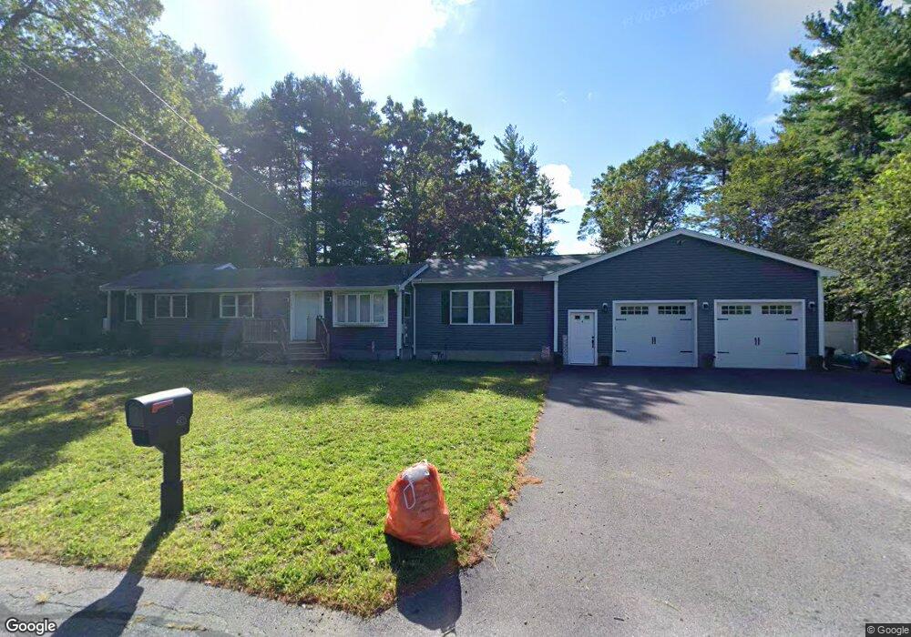
1595 Middleboro Ave East Taunton, MA 02718
Elliotts Corner NeighborhoodEstimated Value: $487,000 - $612,000
2
Beds
1
Bath
1,612
Sq Ft
$344/Sq Ft
Est. Value
About This Home
This home is located at 1595 Middleboro Ave, East Taunton, MA 02718 and is currently estimated at $554,924, approximately $344 per square foot. 1595 Middleboro Ave is a home located in Bristol County with nearby schools including East Taunton Elementary School, Joseph H. Martin, and Taunton High School.
Ownership History
Date
Name
Owned For
Owner Type
Purchase Details
Closed on
May 25, 2016
Sold by
Morasca Carmen D and Morasca Jeana M
Bought by
Morasca Carmen D and Morasca Jeana M
Current Estimated Value
Purchase Details
Closed on
Jun 15, 2005
Sold by
Morris Melissa and Reeve Mickey I
Bought by
Morasca Carmen D and Smith Jeana M
Home Financials for this Owner
Home Financials are based on the most recent Mortgage that was taken out on this home.
Original Mortgage
$287,100
Interest Rate
5.78%
Mortgage Type
Purchase Money Mortgage
Purchase Details
Closed on
Jun 1, 2001
Sold by
Gagne Edmund C and Gagne Priscilla M
Bought by
Reeve Mickey I and Morris Melissa
Home Financials for this Owner
Home Financials are based on the most recent Mortgage that was taken out on this home.
Original Mortgage
$97,425
Interest Rate
7.09%
Mortgage Type
Purchase Money Mortgage
Create a Home Valuation Report for This Property
The Home Valuation Report is an in-depth analysis detailing your home's value as well as a comparison with similar homes in the area
Home Values in the Area
Average Home Value in this Area
Purchase History
| Date | Buyer | Sale Price | Title Company |
|---|---|---|---|
| Morasca Carmen D | -- | -- | |
| Morasca Carmen D | $296,000 | -- | |
| Reeve Mickey I | $129,900 | -- |
Source: Public Records
Mortgage History
| Date | Status | Borrower | Loan Amount |
|---|---|---|---|
| Previous Owner | Morasca Carmen D | $287,100 | |
| Previous Owner | Reeve Mickey I | $97,425 | |
| Previous Owner | Reeve Mickey I | $42,662 | |
| Closed | Reeve Mickey I | $25,980 |
Source: Public Records
Tax History Compared to Growth
Tax History
| Year | Tax Paid | Tax Assessment Tax Assessment Total Assessment is a certain percentage of the fair market value that is determined by local assessors to be the total taxable value of land and additions on the property. | Land | Improvement |
|---|---|---|---|---|
| 2025 | $5,241 | $479,100 | $126,300 | $352,800 |
| 2024 | $4,879 | $436,000 | $126,300 | $309,700 |
| 2023 | $4,651 | $386,000 | $126,300 | $259,700 |
| 2022 | $4,469 | $339,100 | $105,200 | $233,900 |
| 2021 | $4,247 | $299,100 | $95,700 | $203,400 |
| 2020 | $3,598 | $242,100 | $95,700 | $146,400 |
| 2019 | $3,661 | $232,300 | $95,700 | $136,600 |
| 2018 | $3,414 | $217,200 | $96,600 | $120,600 |
| 2017 | $3,287 | $209,200 | $91,600 | $117,600 |
| 2016 | $3,175 | $202,500 | $88,900 | $113,600 |
| 2015 | $2,823 | $188,100 | $89,100 | $99,000 |
| 2014 | $2,710 | $185,500 | $89,100 | $96,400 |
Source: Public Records
Map
Nearby Homes
- 1 Aila Ct
- 492 Richmond St Unit B
- 1232 Middleboro Ave
- 1091 Middleboro Ave
- 6 Leonard St
- 5 Shamrock Ln
- 34 Oxbow Rd Unit 18-1
- 38 Oxbow Rd Unit 19-1
- 50 Oxbow Rd Unit 34-1
- 36 Oxbow Rd Unit 18-2
- 56 Oxbow Rd Unit 35-1
- 40 Oxbow Rd Unit 19-2
- 42 Oxbow Rd Unit 1
- 69 Oxbow Rd Unit 37-3
- 62 Oxbow Rd Unit 1
- 61 Oxbow Rd Unit 36-1
- 48 Oxbow Rd Unit 34-2
- 63 Oxbow Rd Unit 36-2
- 0 Oxbow Rd Unit 20-3
- 0 Oxbow Rd Unit 5-3 73420102
- 1605 Middleboro Ave
- 1577 Middleboro Ave
- 1577 Middleboro Ave Unit 1577
- 1577 Middleboro Ave
- 1577 Middleboro Ave Unit 1
- 1582 Middleboro Ave
- 1567 Middleboro Ave
- 1600 Middleboro Ave
- 1607 Middleboro Ave
- 1611 Middleboro Ave
- 1562 Middleboro Ave
- 1545 Middleboro Ave
- 1623 Middleboro Ave
- 1620 Middleboro Ave
- 1548 Middleboro Ave
- 17 Birchwood Dr
- 1622 Middleboro Ave
- 27 Birchwood Dr
- 1529 Middleboro Ave
- 37 Birchwood Dr