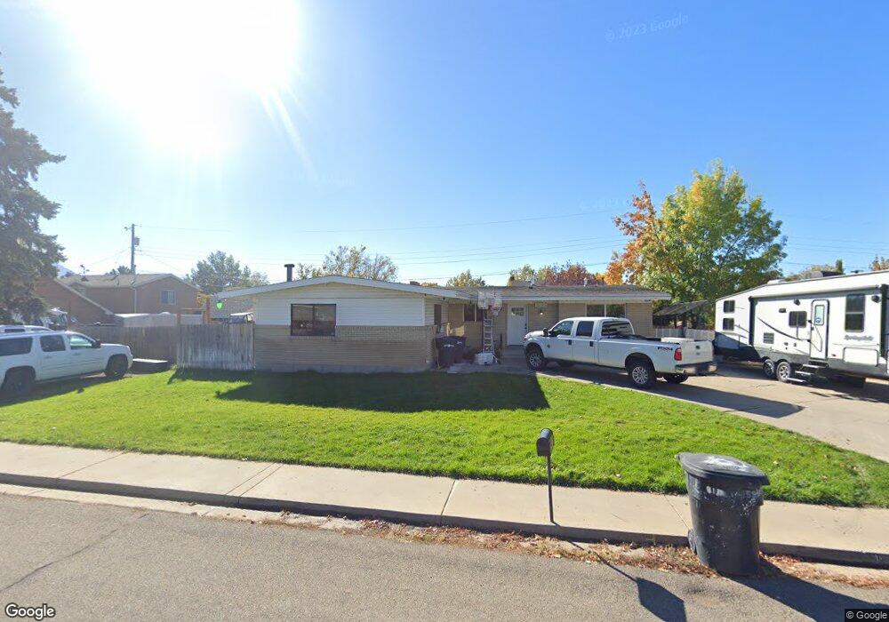
1595 W 1320 N Provo, UT 84604
Grandview South NeighborhoodEstimated Value: $575,801 - $651,000
4
Beds
3
Baths
2,984
Sq Ft
$202/Sq Ft
Est. Value
About This Home
This home is located at 1595 W 1320 N, Provo, UT 84604 and is currently estimated at $602,200, approximately $201 per square foot. 1595 W 1320 N is a home located in Utah County with nearby schools including Westridge Elementary School, Dixon Middle School, and Provo High School.
Ownership History
Date
Name
Owned For
Owner Type
Purchase Details
Closed on
Oct 29, 2015
Sold by
Curtis Julie A
Bought by
Real Casey Ron and Real Kristen Lyn
Current Estimated Value
Home Financials for this Owner
Home Financials are based on the most recent Mortgage that was taken out on this home.
Original Mortgage
$265,109
Outstanding Balance
$208,237
Interest Rate
3.75%
Mortgage Type
FHA
Estimated Equity
$393,963
Purchase Details
Closed on
Mar 7, 2014
Sold by
Curtis Dean H and Curtis Julie A
Bought by
Curtis Julie A
Purchase Details
Closed on
Oct 18, 2011
Sold by
Morris Scott A and Morris Trish
Bought by
Curtis Dean H and Curtis Julie A
Purchase Details
Closed on
Nov 15, 2000
Sold by
M&M Morris Properties Lc
Bought by
Morris Scott A and Morris Patricia Ann
Create a Home Valuation Report for This Property
The Home Valuation Report is an in-depth analysis detailing your home's value as well as a comparison with similar homes in the area
Home Values in the Area
Average Home Value in this Area
Purchase History
| Date | Buyer | Sale Price | Title Company |
|---|---|---|---|
| Real Casey Ron | -- | First American | |
| Curtis Julie A | -- | None Available | |
| Curtis Dean H | -- | Empire Land Title Inc | |
| Morris Scott A | -- | Fidelity Land & Title |
Source: Public Records
Mortgage History
| Date | Status | Borrower | Loan Amount |
|---|---|---|---|
| Open | Real Casey Ron | $265,109 |
Source: Public Records
Tax History Compared to Growth
Tax History
| Year | Tax Paid | Tax Assessment Tax Assessment Total Assessment is a certain percentage of the fair market value that is determined by local assessors to be the total taxable value of land and additions on the property. | Land | Improvement |
|---|---|---|---|---|
| 2025 | $2,837 | $295,130 | $184,800 | $351,800 |
| 2024 | $2,837 | $279,235 | $0 | $0 |
| 2023 | $2,880 | $279,455 | $0 | $0 |
| 2022 | $2,757 | $269,720 | $0 | $0 |
| 2021 | $2,118 | $361,400 | $117,300 | $244,100 |
| 2020 | $2,041 | $326,500 | $106,600 | $219,900 |
| 2019 | $1,911 | $317,900 | $106,600 | $211,300 |
| 2018 | $1,743 | $294,100 | $99,000 | $195,100 |
| 2017 | $1,539 | $142,670 | $0 | $0 |
| 2016 | $1,560 | $134,805 | $0 | $0 |
| 2015 | $1,393 | $121,715 | $0 | $0 |
| 2014 | $1,158 | $105,435 | $0 | $0 |
Source: Public Records
Map
Nearby Homes