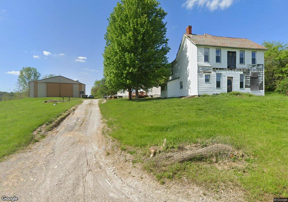
15955 Yoker Rd Cumberland, OH 43732
Estimated Value: $442,000 - $599,390
5
Beds
1
Bath
1,766
Sq Ft
$295/Sq Ft
Est. Value
About This Home
This home is located at 15955 Yoker Rd, Cumberland, OH 43732 and is currently estimated at $520,695, approximately $294 per square foot. 15955 Yoker Rd is a home with nearby schools including New Concord Elementary School, East Muskingum Middle School, and Larry Miller Intermediate Elementary School.
Ownership History
Date
Name
Owned For
Owner Type
Purchase Details
Closed on
Jan 30, 2004
Sold by
Pizzino James and Pizzino Diane
Bought by
Taulbee Curtis W
Current Estimated Value
Purchase Details
Closed on
May 13, 1998
Sold by
Moore Marilyn L
Bought by
Pizzino James and Pizzino Diane
Home Financials for this Owner
Home Financials are based on the most recent Mortgage that was taken out on this home.
Original Mortgage
$156,768
Interest Rate
7.25%
Mortgage Type
New Conventional
Create a Home Valuation Report for This Property
The Home Valuation Report is an in-depth analysis detailing your home's value as well as a comparison with similar homes in the area
Home Values in the Area
Average Home Value in this Area
Purchase History
| Date | Buyer | Sale Price | Title Company |
|---|---|---|---|
| Taulbee Curtis W | $175,000 | -- | |
| Pizzino James | $195,961 | -- |
Source: Public Records
Mortgage History
| Date | Status | Borrower | Loan Amount |
|---|---|---|---|
| Previous Owner | Pizzino James | $156,768 |
Source: Public Records
Tax History Compared to Growth
Tax History
| Year | Tax Paid | Tax Assessment Tax Assessment Total Assessment is a certain percentage of the fair market value that is determined by local assessors to be the total taxable value of land and additions on the property. | Land | Improvement |
|---|---|---|---|---|
| 2024 | $5,313 | $160,160 | $109,830 | $50,330 |
| 2023 | $3,812 | $107,275 | $65,695 | $41,580 |
| 2022 | $3,727 | $107,275 | $65,695 | $41,580 |
| 2021 | $3,681 | $107,275 | $65,695 | $41,580 |
| 2020 | $3,789 | $107,275 | $65,695 | $41,580 |
| 2019 | $3,769 | $107,275 | $65,695 | $41,580 |
| 2018 | $3,756 | $107,275 | $65,695 | $41,580 |
| 2017 | $3,585 | $96,635 | $55,090 | $41,545 |
| 2016 | $3,591 | $96,640 | $55,090 | $41,550 |
| 2015 | $3,660 | $96,640 | $55,090 | $41,550 |
| 2013 | $2,240 | $96,640 | $55,090 | $41,550 |
Source: Public Records
Map
Nearby Homes
- 54845 Huhn Ln
- 0 Red Lane Rd
- 52110 Spencer Rd
- 3446 Clay Pike Rd
- 52021 Spencer Rd
- 55289 Iowa Rd
- 468 Carl St
- 57881 Marlatt Rd
- 0 S Leedom Rd
- 60040 Bliss Rd
- 59915 Craig Rd
- 4896 High Hill Rd
- 0 Richards Rd Unit 5161895
- 9797 Brick Church Rd
- 1705 S Cove Ln
- 2043 Southern Rd
- 0 Maple Ln
- 60936 Patch Rd
- 61220 Kadon Dr
- Lot 18 & 19 Greenbriar Dr