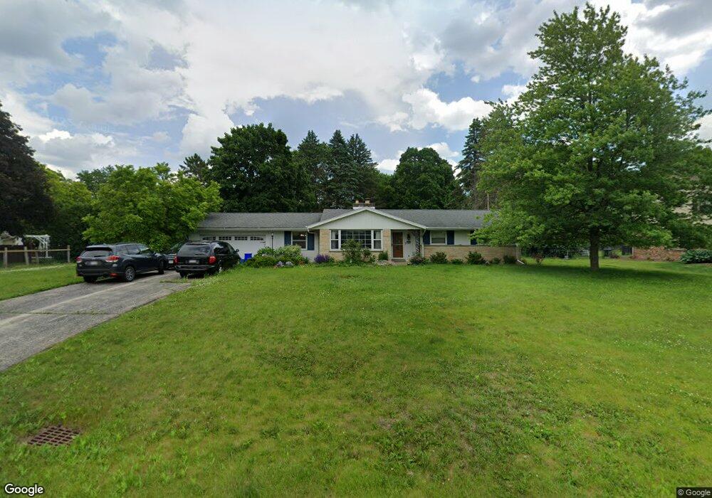
15965 Siesta Ln Brookfield, WI 53005
Estimated Value: $456,000 - $486,000
3
Beds
2
Baths
1,759
Sq Ft
$269/Sq Ft
Est. Value
About This Home
This home is located at 15965 Siesta Ln, Brookfield, WI 53005 and is currently estimated at $473,421, approximately $269 per square foot. 15965 Siesta Ln is a home located in Waukesha County with nearby schools including Dixon Elementary School, Wisconsin Hills Middle School, and Brookfield Central High School.
Ownership History
Date
Name
Owned For
Owner Type
Purchase Details
Closed on
Jun 15, 1998
Sold by
Heaps Jack and Heaps Reve A
Bought by
Devine Peter G and Devine Patricia A
Current Estimated Value
Home Financials for this Owner
Home Financials are based on the most recent Mortgage that was taken out on this home.
Original Mortgage
$169,100
Outstanding Balance
$34,478
Interest Rate
7.27%
Mortgage Type
Purchase Money Mortgage
Estimated Equity
$438,943
Create a Home Valuation Report for This Property
The Home Valuation Report is an in-depth analysis detailing your home's value as well as a comparison with similar homes in the area
Home Values in the Area
Average Home Value in this Area
Purchase History
| Date | Buyer | Sale Price | Title Company |
|---|---|---|---|
| Devine Peter G | $178,000 | -- |
Source: Public Records
Mortgage History
| Date | Status | Borrower | Loan Amount |
|---|---|---|---|
| Open | Devine Peter G | $169,100 |
Source: Public Records
Tax History Compared to Growth
Tax History
| Year | Tax Paid | Tax Assessment Tax Assessment Total Assessment is a certain percentage of the fair market value that is determined by local assessors to be the total taxable value of land and additions on the property. | Land | Improvement |
|---|---|---|---|---|
| 2024 | $3,881 | $353,900 | $125,000 | $228,900 |
| 2023 | $3,876 | $353,900 | $125,000 | $228,900 |
| 2022 | $3,998 | $285,100 | $120,000 | $165,100 |
| 2021 | $4,229 | $285,100 | $120,000 | $165,100 |
| 2020 | $5,004 | $285,100 | $120,000 | $165,100 |
| 2019 | $4,700 | $285,100 | $120,000 | $165,100 |
| 2018 | $4,390 | $285,100 | $130,000 | $155,100 |
| 2017 | $4,696 | $285,100 | $130,000 | $155,100 |
| 2016 | $4,654 | $285,100 | $130,000 | $155,100 |
| 2015 | $5,041 | $285,100 | $130,000 | $155,100 |
| 2014 | $4,608 | $285,100 | $130,000 | $155,100 |
| 2013 | $4,608 | $285,100 | $130,000 | $155,100 |
Source: Public Records
Map
Nearby Homes
- 1775 Melody Ln
- 16425 Alverno Dr
- 15260 Marilyn Dr
- 2285 N 166th St
- 16205 Choctaw Trail
- 15300 Fieldstone Dr
- 15555 Esser Ct
- 15305 Cascade Dr
- 2365 N Calhoun Rd
- 14625 Club Dr
- 2415 Walnut Grove Ct Unit B
- 1840 Lone Oak Cir E
- 1134 Pilgrim Pkwy Unit 1134
- 15430 W Burleigh Rd
- 950 Pilgrim Pkwy Unit D
- 14220 Hillside Rd
- 1005 Lone Tree Rd
- 2975 River Birch Dr Unit C
- 820 Pilgrim Pkwy Unit C
- 17849 Nassau Dr Unit Bldg EC2
- 15995 Siesta Ln
- 2195 Pilgrim Pkwy
- 2165 Pilgrim Pkwy
- 15995 Cornell Ct
- 16025 Siesta Ln
- 15980 Cornell Ct
- 2135 Pilgrim Pkwy W
- 2135 Pilgrim Pkwy
- 2235 Pilgrim Pkwy
- 16040 Siesta Ln
- 2115 Pilgrim Pkwy
- 15950 Fernwood Ln
- 2115 Pilgrim Pkwy W
- 16045 Siesta Ln
- 16035 Cornell Ct
- 15990 Fernwood Ln
- 15920 Fernwood Ln
- 2210 Pilgrim Pkwy
- 2180 Pilgrim Pkwy
- 16010 Cornell Ct