$92,500
SOLD MAY 23, 2024

15966 Low Gap Wc 100 Rd West Fork, AR 72774

8 Acres
$11,753 Price per Acre
342,817 Sq Ft Lot

Recently Sold

4% Below List Price

2 Days on Market

Highlights

  • Seasonal View
  • Partially Wooded Lot
  • Level Lot

About This Lot

As of May 2024

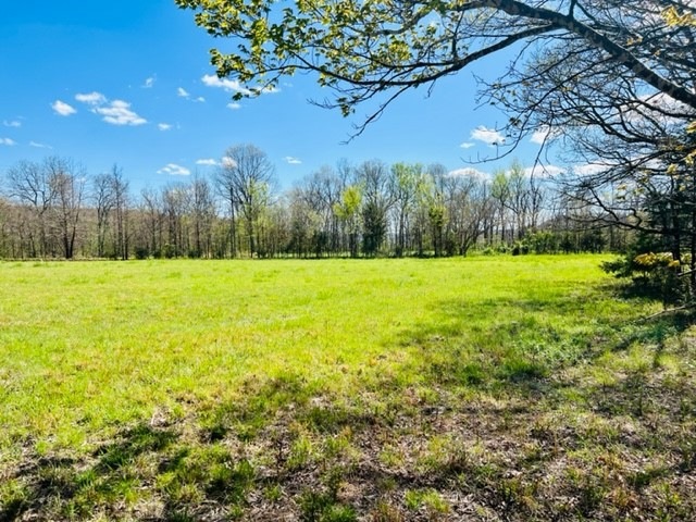
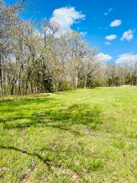
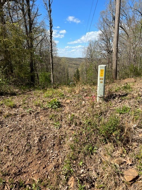
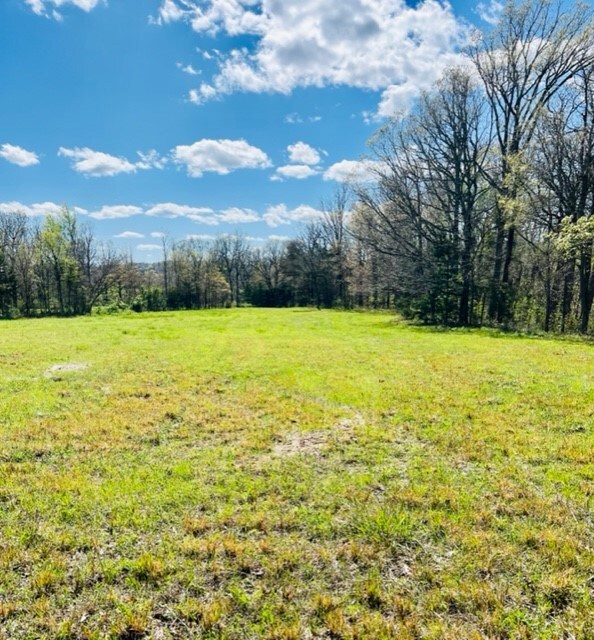
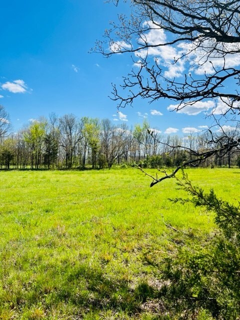
The high point of 1875’ elevation provides wonderful woodland view opportunities for your future 7.87 acres homesite. And 1300+ ft of County Road frontage offers you so much flexibility for your construction project. Open level greenspace merges into a woodland with dogwood blossoms creating beauty and inspiration. Ozarks Electric line is located on the property and Washington Water Authority water line is buried along Low Gap County Road frontage also. Located approximately 15 minutes from I49 at Exit 53. Affordable an appealing for your enjoyment!

Last Agent to Sell the Property

Jan Newlin

Newlin Realty Company Brokerage Phone: 479-839-2788 License #PB00008437

Last Buyer's Agent

Jennifer M Sims

Lindsey & Associates Inc License #EB00081886

Lindsey & Associates Inc

Property Details

Property Type

  • Land

Est. Annual Taxes

  • $842

Lot Details

  • 7.87 Acre Lot
  • Rural Setting
  • South Facing Home
  • Level Lot
  • Open Lot
  • Cleared Lot
  • Partially Wooded Lot
  • Zoning described as Agricultural

Home Design

  • Mixed Use

Utilities

  • Natural Gas Not Available
  • Water Tap or Transfer Fee
  • Well Required
  • Septic Needed
  • Fiber Optics Available

Additional Features

  • Seasonal Views
  • Outside City Limits

Property Details

Property Type

Land

Est. Annual Taxes

$842

Lot Details

0

Listing Details

  • Property Sub Type: Mixed Use
  • Prop. Type: Land
  • Lot Size Acres: 7.87
  • Road Frontage Type: Public Road, Right of Way
  • Road Surface Type: Gravel
  • Subdivision Name: .
  • Directions: Hwy 71 south of West Fork and the Brentwood Rest Area, then right on Washington Co. Rd 45 for 2.9 miles and Right on WC# 100 (aka Low Gap Road) approx. 500 ft on the left where property begins and extends along the left side of road frontage for approx. 1300 ft.
  • ResoPropertyType: Land
  • Property Sub Type Additional: Mixed Use
  • Attribution Contact: 479-839-2788
  • Special Features: VirtualTour

Interior Features

  • Possible Use: Mixed Use, Pasture, Recreational

Exterior Features

  • Fencing: None
  • Lot Features: Cleared, Not In Subdivision, Outside City Limits, Open Lot, Other, Rural Lot, Sloped, See Remarks, Views, Level, Steep Slope, Wooded
  • Topography: Cleared,Level,Sloping
  • View: Seasonal View
  • View: Yes
  • Direction Faces: South

Utilities

  • Electricity On Property: Yes
  • Sewer: Septic Needed
  • Utilities: Fiber Optic Available, Natural Gas Not Available, Electricity Available
  • Water Source: Not Connected (nearby), Public, Other, Rural, See Remarks, Well Needed, Water Tap Fee

Schools

  • Junior High Dist: West Fork

Lot Info

  • Zoning Description: Agricultural
  • Zoning: N
  • ResoLotSizeUnits: Acres

Tax Info

  • Tax Annual Amount: 842.0
  • Tax Block: .
  • Tax Lot: .

Map

Range of Values:

Collateral Analytics

Collateral Analytics Collateral Analytics AVMs (Automated Valuation Model) employ a number of statistical approaches combined with neighborhood-specific comparable selection guarantees the most up-to-date and precise valuations.

Not Available

Collateral Analytics does not have data for the current month. Please view the chart for historical values.

ICE

ICE Mortgage Technology ICE Mortgage Technology’s AVM (Automated Valuation Model) is a state-of-the-art online residential property valuation tool that provides a quick and accurate estimate of the value of almost any home in the U.S.

Not Available

ICE Mortgage Technology does not have data for the current month. Please view the chart for historical values.

First American

First American First American Data & Analytics’ next-generation AVM combines unrivaled data assets with a blended ensemble of valuation models to produce highly accurate, reliable valuations you can trust.

Not Available

First American does not have data for the current month. Please view the chart for historical values.

Quantarium

Quantarium Quantarium’s valuation service, repeatedly proven the industry’s most accurate and comprehensive, is supercharged with a self-learning and auto-tuning AI engine that continually becomes smarter and more accurate as it processes daily inputs from the industry’s leading RE data lake.

Not Available

Quantarium does not have data for the current month. Please view the chart for historical values.

Average Value
Not Available
List Price
Sold Price
Create a Home Valuation Report for This Property
The Home Valuation Report is an in-depth analysis detailing your home's value as well as a comparison with similar homes in the area

Home Values in the Area

Source: Public Records

Average Home Value in this Area


Source: Public Records

Property History

Date Event Price Change Sq Ft Price
05/23/2024 05/23/24 Sold $92,500 -3.6% --
04/26/2024 04/26/24 Pending -- -- --
04/23/2024 04/23/24 For Sale $96,000 -- --
Source: Northwest Arkansas Board of REALTORS®

Similar Property in West Fork, AR

  • Tract B TBD Wooton Rd, West Fork, AR 72774

    $99,000

    • Land
    • 7 Acres
    • $14,023 per Acre
    • Tract B TBD Wooton Rd
    • West Fork, AR

    This 7 acres has exceptional views and a great building site for your dream home! While being located in a peaceful secluded setting, this piece of land is located just 5 minutes from I-49, 6 minutes from downtown West Fork, 15 minutes from downtown Fayetteville and just 20 minutes from Devil's Den State Park, allowing for multiple ways to enjoy what NWA has to offer! Schedule your showing today!

    Shea Hamm Keller Williams Market Pro Realty

    Section Image

Source: Northwest Arkansas Board of REALTORS®

MLS Number: 1273075

Northwest Arkansas Board of REALTORS®