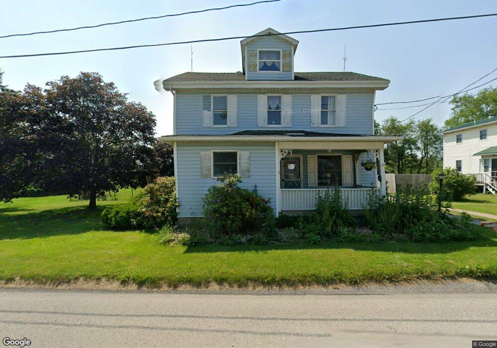
15969 Route 119 Hwy N Marchand, PA 15758
Estimated Value: $186,412 - $234,000
4
Beds
2
Baths
1,983
Sq Ft
$105/Sq Ft
Est. Value
About This Home
This home is located at 15969 Route 119 Hwy N, Marchand, PA 15758 and is currently estimated at $208,103, approximately $104 per square foot. 15969 Route 119 Hwy N is a home located in Indiana County with nearby schools including Punxsutawney Area High School and Sawmill Road School.
Ownership History
Date
Name
Owned For
Owner Type
Purchase Details
Closed on
Jan 5, 2022
Sold by
Neal Denis E and Neal Deborah J
Bought by
Syster Grant and Syster Camie
Current Estimated Value
Home Financials for this Owner
Home Financials are based on the most recent Mortgage that was taken out on this home.
Original Mortgage
$168,795
Outstanding Balance
$155,586
Interest Rate
3.12%
Mortgage Type
New Conventional
Estimated Equity
$52,517
Purchase Details
Closed on
Nov 6, 2015
Sold by
Titus William G and Titus Katherine S
Bought by
Neal Denis E and Neal Deborah J
Home Financials for this Owner
Home Financials are based on the most recent Mortgage that was taken out on this home.
Original Mortgage
$80,000
Interest Rate
3.87%
Mortgage Type
New Conventional
Create a Home Valuation Report for This Property
The Home Valuation Report is an in-depth analysis detailing your home's value as well as a comparison with similar homes in the area
Home Values in the Area
Average Home Value in this Area
Purchase History
| Date | Buyer | Sale Price | Title Company |
|---|---|---|---|
| Syster Grant | $165,000 | None Available | |
| Neal Denis E | $115,000 | National Advantage Settlemen |
Source: Public Records
Mortgage History
| Date | Status | Borrower | Loan Amount |
|---|---|---|---|
| Open | Syster Grant | $168,795 | |
| Previous Owner | Neal Denis E | $80,000 |
Source: Public Records
Tax History Compared to Growth
Tax History
| Year | Tax Paid | Tax Assessment Tax Assessment Total Assessment is a certain percentage of the fair market value that is determined by local assessors to be the total taxable value of land and additions on the property. | Land | Improvement |
|---|---|---|---|---|
| 2025 | $2,250 | $145,600 | $12,600 | $133,000 |
| 2024 | $2,161 | $145,600 | $12,600 | $133,000 |
| 2023 | $12,639 | $145,600 | $12,600 | $133,000 |
| 2022 | $12,221 | $145,600 | $12,600 | $133,000 |
| 2021 | $1,991 | $145,600 | $12,600 | $133,000 |
| 2020 | $1,891 | $145,600 | $12,600 | $133,000 |
| 2018 | $1,933 | $145,600 | $12,600 | $133,000 |
| 2017 | $2,417 | $145,600 | $12,600 | $133,000 |
| 2015 | -- | $9,990 | $840 | $9,150 |
| 2014 | -- | $9,990 | $840 | $9,150 |
Source: Public Records
Map
Nearby Homes
- 37 Engle Dr
- 209 Locust Rd
- 17895 Route 119 Hwy N
- 599 Wright Rd
- 4561 Route 210 Hwy
- 568 Rishell Rd
- 53 Hurd Rd
- 5286 Pollock Rd
- 170 Dunmire Rd
- 581 Yates Rd
- 2111 Braughler Rd
- 294 Sprankle Rd
- 95 Byler Rd
- 2612 Canoe Ridge Rd
- 129 Beyer Rd
- 24 Upper Clinton St
- 93 Upper Clinton St
- 4965 Juneau Rd
- 214 Upper Clinton St
- LOT # 3 Calvary Ln
- 15985 Route 119 Hwy N
- 15951 Route 119 Hwy N
- 15780 Route 119 Hwy N
- 16064 Route 119 Hwy N
- 15921 Route 119 Hwy N
- 15905 Route 119 Hwy N
- 15898 Route 119 Hwy N
- 15871 Route 119 Hwy N
- 16101 Route 119 Hwy N
- 16100 Route 119 Hwy N
- 16143 Route 119 Hwy N
- 16179 Route 119 Hwy N
- 16166 Route 119 Hwy N
- 15740 Route 119 Hwy N
- 16188 Route 119 Hwy N
- 15722 Route 119 Hwy N
- 16212 Route 119 Hwy N
- 16248 Route 119 Hwy N
- 15706 Route 119 Hwy N
- 16309 Route 119 Hwy N