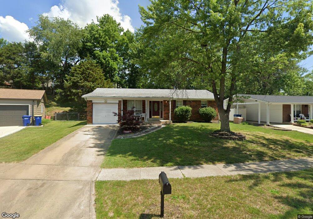
1597 Codorniz Ln Fenton, MO 63026
Estimated Value: $272,000 - $287,000
3
Beds
2
Baths
1,105
Sq Ft
$254/Sq Ft
Est. Value
About This Home
This home is located at 1597 Codorniz Ln, Fenton, MO 63026 and is currently estimated at $281,012, approximately $254 per square foot. 1597 Codorniz Ln is a home located in St. Louis County with nearby schools including Kellison Elementary School, Rockwood South Middle School, and Rockwood Summit Senior High School.
Ownership History
Date
Name
Owned For
Owner Type
Purchase Details
Closed on
Nov 21, 2024
Sold by
Borgard Michael Glenn
Bought by
Borgard Michael Glenn
Current Estimated Value
Home Financials for this Owner
Home Financials are based on the most recent Mortgage that was taken out on this home.
Original Mortgage
$188,500
Outstanding Balance
$181,546
Interest Rate
5.41%
Mortgage Type
New Conventional
Estimated Equity
$99,466
Purchase Details
Closed on
Apr 23, 2007
Sold by
Edwards Eddie E and Edwards Emanuel Matthew
Bought by
Borgard Glenn and Borgard Shirley D
Home Financials for this Owner
Home Financials are based on the most recent Mortgage that was taken out on this home.
Original Mortgage
$121,425
Interest Rate
6.1%
Mortgage Type
Purchase Money Mortgage
Purchase Details
Closed on
Jan 16, 1997
Sold by
Burkhart Sharon A
Bought by
Burkhart Randy D
Create a Home Valuation Report for This Property
The Home Valuation Report is an in-depth analysis detailing your home's value as well as a comparison with similar homes in the area
Home Values in the Area
Average Home Value in this Area
Purchase History
| Date | Buyer | Sale Price | Title Company |
|---|---|---|---|
| Borgard Michael Glenn | -- | Chesterfield Title Agency | |
| Borgard Michael Glenn | -- | Chesterfield Title Agency | |
| Borgard Glenn | $161,900 | None Available | |
| Burkhart Randy D | -- | -- |
Source: Public Records
Mortgage History
| Date | Status | Borrower | Loan Amount |
|---|---|---|---|
| Open | Borgard Michael Glenn | $188,500 | |
| Closed | Borgard Michael Glenn | $188,500 | |
| Previous Owner | Borgard Glenn | $121,425 |
Source: Public Records
Tax History Compared to Growth
Tax History
| Year | Tax Paid | Tax Assessment Tax Assessment Total Assessment is a certain percentage of the fair market value that is determined by local assessors to be the total taxable value of land and additions on the property. | Land | Improvement |
|---|---|---|---|---|
| 2025 | $3,426 | $50,330 | $21,850 | $28,480 |
| 2024 | $3,426 | $45,880 | $18,030 | $27,850 |
| 2023 | $3,423 | $45,880 | $18,030 | $27,850 |
| 2022 | $3,131 | $39,080 | $18,030 | $21,050 |
| 2021 | $3,107 | $39,080 | $18,030 | $21,050 |
| 2020 | $2,922 | $35,320 | $15,500 | $19,820 |
| 2019 | $2,931 | $35,320 | $15,500 | $19,820 |
| 2018 | $2,698 | $31,180 | $11,670 | $19,510 |
| 2017 | $2,677 | $31,180 | $11,670 | $19,510 |
| 2016 | $2,425 | $28,500 | $9,770 | $18,730 |
| 2015 | $2,375 | $28,500 | $9,770 | $18,730 |
| 2014 | $2,349 | $27,470 | $6,440 | $21,030 |
Source: Public Records
Map
Nearby Homes
- 1564 Codorniz Ln
- 1221 Newport Landing Dr
- 1405 Durango Ln Unit 3
- 1222 Perdiz Ln
- 1401 Windrider Ct
- 1218 Feliz Ln
- 1185 Scheel Ln
- 1376 Remington Oaks Terrace
- 1305 Trails Dr
- 1881 San Pedro Ln
- 1883 San Lucas Ln
- 1406 Hawkins Meadow Dr
- 1310 Spring Lilly Dr
- 1050 Little Brennen Ct
- 1009 Remington Oaks Ct
- 18 Cedar Trail Ct
- 1095 Hawkins Rd
- 944 San Luis Dr
- 1362 Hillsboro Rd
- 1201 Diamond Valley Dr
- 1593 Codorniz Ln
- 1599 Codorniz Ln
- 1589 Codorniz Ln
- 1252 Newport Landing Dr
- 1248 Newport Landing Dr
- 1256 Newport Landing Dr
- 1596 Codorniz Ln
- 1290 Perdiz Ln
- 1244 Newport Landing Dr
- 1585 Codorniz Ln
- 1286 Perdiz Ln
- 1260 Newport Landing Dr
- 1590 Codorniz Ln
- 1273 Perdiz Ln
- 1282 Perdiz Ln
- 1240 Newport Landing Dr
- 1581 Codorniz Ln
- 1584 Codorniz Ln
- 1264 Newport Landing Dr
- 1327 Piedras Pkwy