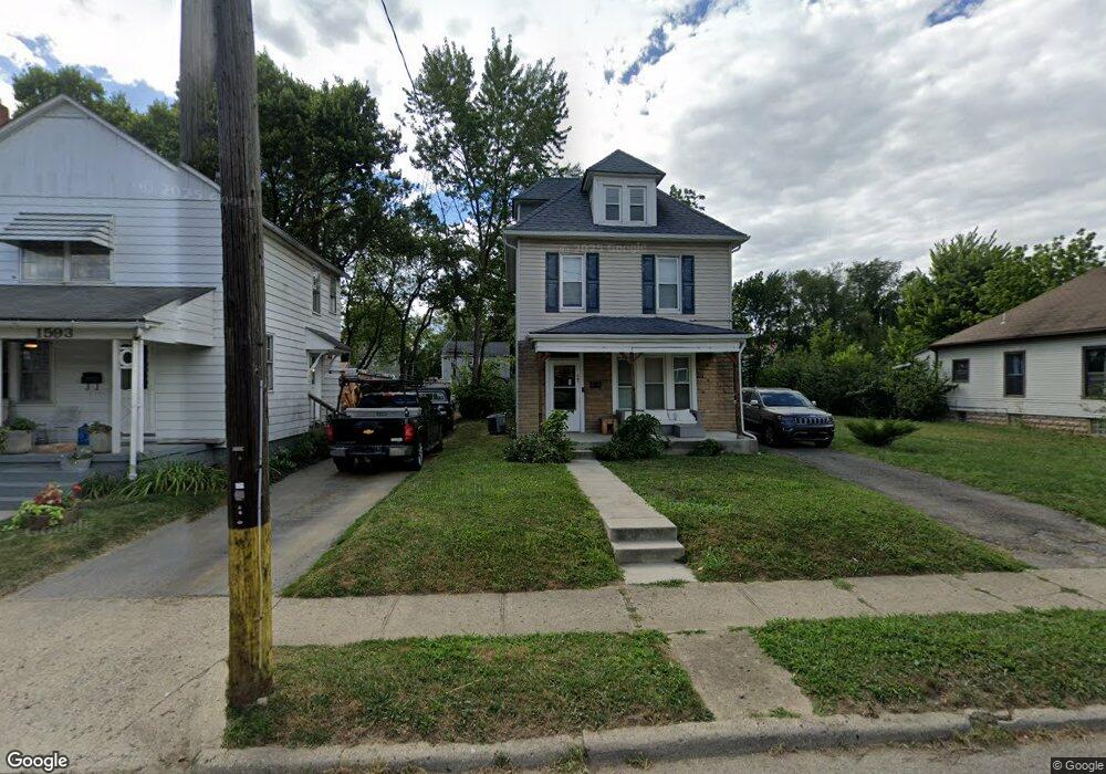
1597 N Star Ave Columbus, OH 43212
Fifth by Northwest NeighborhoodEstimated Value: $397,559 - $465,000
3
Beds
1
Bath
1,296
Sq Ft
$341/Sq Ft
Est. Value
About This Home
This home is located at 1597 N Star Ave, Columbus, OH 43212 and is currently estimated at $442,140, approximately $341 per square foot. 1597 N Star Ave is a home located in Franklin County with nearby schools including Cranbrook Elementary School, Ridgeview Middle School, and Centennial High School.
Ownership History
Date
Name
Owned For
Owner Type
Purchase Details
Closed on
Jul 6, 2023
Sold by
North Star At 5Th Ave Llc
Bought by
Robinson Robyn N
Current Estimated Value
Purchase Details
Closed on
Jun 8, 2020
Sold by
Robinson Robyn N
Bought by
North Star At 5Th Ave Llc
Purchase Details
Closed on
Aug 2, 2003
Sold by
Jackson Charles W and Jackson Althea
Bought by
Robinson Robyn N
Purchase Details
Closed on
Sep 16, 1977
Bought by
Jackson Charles W
Create a Home Valuation Report for This Property
The Home Valuation Report is an in-depth analysis detailing your home's value as well as a comparison with similar homes in the area
Home Values in the Area
Average Home Value in this Area
Purchase History
| Date | Buyer | Sale Price | Title Company |
|---|---|---|---|
| Robinson Robyn N | -- | None Listed On Document | |
| North Star At 5Th Ave Llc | -- | None Available | |
| Robinson Robyn N | $85,000 | -- | |
| Jackson Charles W | -- | -- |
Source: Public Records
Tax History Compared to Growth
Tax History
| Year | Tax Paid | Tax Assessment Tax Assessment Total Assessment is a certain percentage of the fair market value that is determined by local assessors to be the total taxable value of land and additions on the property. | Land | Improvement |
|---|---|---|---|---|
| 2024 | $5,664 | $123,590 | $64,400 | $59,190 |
| 2023 | $5,695 | $123,590 | $64,400 | $59,190 |
| 2022 | $4,684 | $88,140 | $29,020 | $59,120 |
| 2021 | $4,692 | $88,140 | $29,020 | $59,120 |
| 2020 | $4,699 | $88,140 | $29,020 | $59,120 |
| 2019 | $4,406 | $70,850 | $29,020 | $41,830 |
| 2018 | $3,799 | $70,850 | $29,020 | $41,830 |
| 2017 | $4,405 | $70,850 | $29,020 | $41,830 |
| 2016 | $3,768 | $56,880 | $27,480 | $29,400 |
| 2015 | $3,420 | $56,880 | $27,480 | $29,400 |
| 2014 | $3,429 | $56,880 | $27,480 | $29,400 |
| 2013 | $1,611 | $54,180 | $26,180 | $28,000 |
Source: Public Records
Map
Nearby Homes
- 1655-1657 Ashland Ave
- 1661 Ashland Ave Unit 663
- 1733 Elmwood Ave
- 1459 Elmwood Ave Unit 1459
- 1561 Glenn Ave
- 1782 Wyandotte Rd
- 1364 W 7th Ave
- 00 W 7th Ave
- 1475 W 3rd Ave Unit 204
- 1398 Lower Green Cir Unit 1398
- 2015 W 5th Ave Unit 211
- 2015 W 5th Ave Unit 102
- 2015 W 5th Ave Unit 108
- 1313 Lincoln Rd
- 1631 Roxbury Rd Unit F3
- 1631 Roxbury Rd Unit B6
- 1126 King Ave Unit 128
- 1297 Doten Ave
- 2110 Northwest Blvd
- 1225 Eastview Ave
- 1593 N Star Ave
- 1602 Ashland Ave Unit 604
- 1610 Ashland Ave Unit 612
- 1587 N Star Ave
- 1607 N Star Ave
- 1596 Ashland Ave Unit 598
- 1598 Ashland Ave
- 1611 N Star Ave
- 1620 Ashland Ave
- 1615 N Star Ave
- 1588 Ashland Ave Unit 590
- 1624 Ashland Ave
- 1619 N Star Ave Unit 623
- 1626 Ashland Ave
- 1627 N Star Ave
- 1600 N Star Rd
- 1564 N Star Ave
- 1600 N Star Ave
- 1632 Ashland Ave
- 1591 Ashland Ave