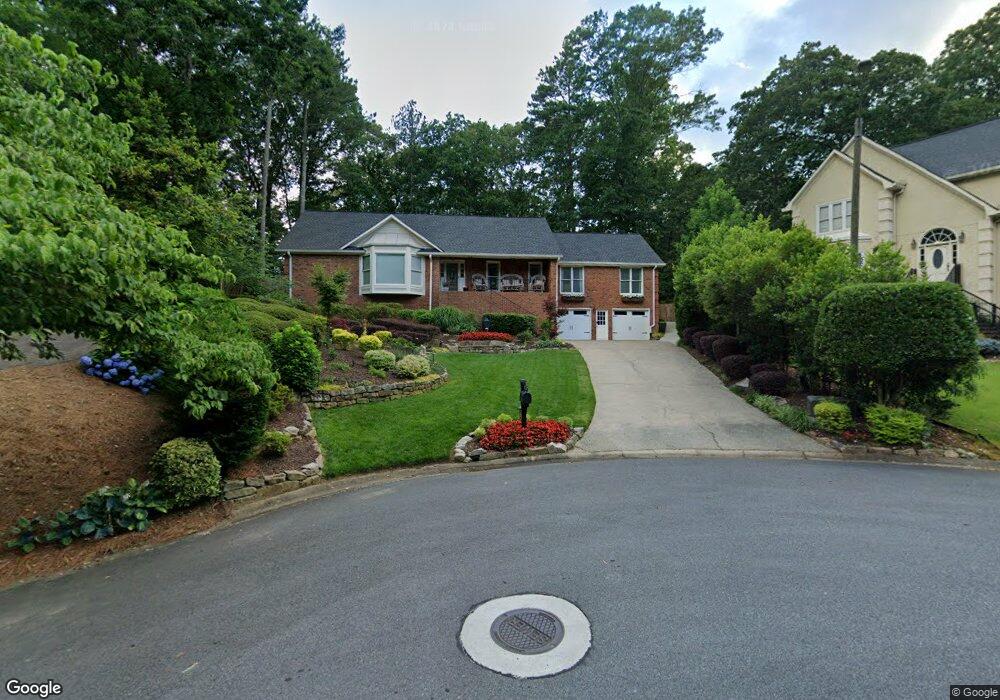
1597 Sandpoint Dr NE Unit 2 Roswell, GA 30075
East Cobb NeighborhoodEstimated Value: $672,000 - $747,000
4
Beds
4
Baths
2,576
Sq Ft
$268/Sq Ft
Est. Value
About This Home
This home is located at 1597 Sandpoint Dr NE Unit 2, Roswell, GA 30075 and is currently estimated at $691,371, approximately $268 per square foot. 1597 Sandpoint Dr NE Unit 2 is a home located in Cobb County with nearby schools including Tritt Elementary School, Hightower Trail Middle School, and Pope High School.
Ownership History
Date
Name
Owned For
Owner Type
Purchase Details
Closed on
Mar 30, 1998
Sold by
Wrightsman Everett E and Wrightsman Janine
Bought by
Ball Celithia N and Ball Roderick
Current Estimated Value
Home Financials for this Owner
Home Financials are based on the most recent Mortgage that was taken out on this home.
Original Mortgage
$189,900
Interest Rate
7.04%
Mortgage Type
New Conventional
Create a Home Valuation Report for This Property
The Home Valuation Report is an in-depth analysis detailing your home's value as well as a comparison with similar homes in the area
Home Values in the Area
Average Home Value in this Area
Purchase History
| Date | Buyer | Sale Price | Title Company |
|---|---|---|---|
| Ball Celithia N | $199,900 | -- |
Source: Public Records
Mortgage History
| Date | Status | Borrower | Loan Amount |
|---|---|---|---|
| Previous Owner | Ball Celithia N | $189,900 |
Source: Public Records
Tax History Compared to Growth
Tax History
| Year | Tax Paid | Tax Assessment Tax Assessment Total Assessment is a certain percentage of the fair market value that is determined by local assessors to be the total taxable value of land and additions on the property. | Land | Improvement |
|---|---|---|---|---|
| 2025 | $6,369 | $276,848 | $80,000 | $196,848 |
| 2024 | $5,827 | $251,604 | $64,000 | $187,604 |
| 2023 | $4,397 | $210,692 | $42,000 | $168,692 |
| 2022 | $4,979 | $210,692 | $42,000 | $168,692 |
| 2021 | $4,294 | $179,392 | $40,000 | $139,392 |
| 2020 | $4,294 | $179,392 | $40,000 | $139,392 |
| 2019 | $4,029 | $167,268 | $34,400 | $132,868 |
| 2018 | $4,029 | $167,268 | $34,400 | $132,868 |
| 2017 | $3,408 | $143,340 | $36,400 | $106,940 |
| 2016 | $3,415 | $143,340 | $36,400 | $106,940 |
| 2015 | $2,776 | $111,776 | $32,000 | $79,776 |
| 2014 | $2,795 | $111,776 | $0 | $0 |
Source: Public Records
Map
Nearby Homes
- 2661 Sandpoint Way NE
- 2779 Horseshoe Knoll Ln NE
- 2482 N Forest Dr
- 2696 Long Lake Terrace NE
- 2743 Chimney Springs Dr
- 2990 Mountain Trace NE
- 5108 Nicolet Ct
- 2859 Tynewick Dr NE
- 2655 Boulder Creek Dr NE
- 110 Boulder Dr
- 3025 Creek Ct NE
- 4586 Hunting Hound Ln
- 2281 Fox Hound Pkwy
- 4574 Woodland Cir NE
- 2212 Heritage Trace View
- 2993 Byrons Green Ct
- 2709 Huckleberry Path
- 2719 Huckleberry Path Unit 21
- 1593 Sandpoint Dr NE Unit 2
- 1598 Sandpoint Dr NE
- 2707 Huckleberry Path Unit 21
- 1516 Stonebrook Place NE
- 2573 Old Orchard Trail Unit 23A
- 1596 Sandpoint Dr NE
- 2720 Huckleberry Path
- 2571 Old Orchard Trail Unit 23A
- 1591 Sandpoint Dr NE Unit 2
- 2738 Old Mill Trail Unit 21
- 1508 Stonebrook Place NE
- 1525 Stonebrook Place NE
- 0 Huckleberry Path
- 1526 Stonebrook Place NE
- 1524 Stonebrook Place NE Unit 2
- 2710 Huckleberry Path
- 2710 Huckleberry Path Unit 21
- 1589 Sandpoint Dr NE