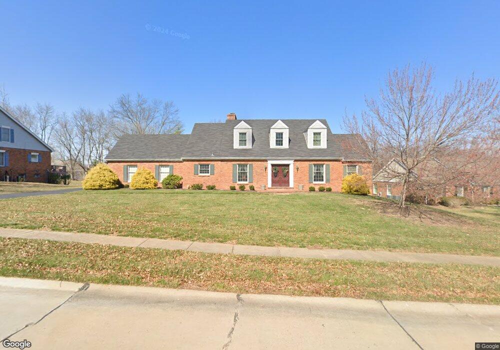
15973 Wetherburn Rd Chesterfield, MO 63017
Estimated Value: $699,000 - $782,994
4
Beds
5
Baths
2,974
Sq Ft
$247/Sq Ft
Est. Value
About This Home
This home is located at 15973 Wetherburn Rd, Chesterfield, MO 63017 and is currently estimated at $733,999, approximately $246 per square foot. 15973 Wetherburn Rd is a home located in St. Louis County with nearby schools including Kehrs Mill Elementary, Crestview Middle School, and Marquette Sr. High School.
Ownership History
Date
Name
Owned For
Owner Type
Purchase Details
Closed on
Jun 15, 2006
Sold by
Joest Karen E
Bought by
Cozzoni Michael G and Cozzoni Constance F
Current Estimated Value
Home Financials for this Owner
Home Financials are based on the most recent Mortgage that was taken out on this home.
Original Mortgage
$215,000
Outstanding Balance
$126,332
Interest Rate
6.56%
Mortgage Type
Fannie Mae Freddie Mac
Estimated Equity
$607,667
Create a Home Valuation Report for This Property
The Home Valuation Report is an in-depth analysis detailing your home's value as well as a comparison with similar homes in the area
Home Values in the Area
Average Home Value in this Area
Purchase History
| Date | Buyer | Sale Price | Title Company |
|---|---|---|---|
| Cozzoni Michael G | $488,000 | Ort |
Source: Public Records
Mortgage History
| Date | Status | Borrower | Loan Amount |
|---|---|---|---|
| Open | Cozzoni Michael G | $215,000 |
Source: Public Records
Tax History Compared to Growth
Tax History
| Year | Tax Paid | Tax Assessment Tax Assessment Total Assessment is a certain percentage of the fair market value that is determined by local assessors to be the total taxable value of land and additions on the property. | Land | Improvement |
|---|---|---|---|---|
| 2025 | $7,940 | $123,640 | $42,600 | $81,040 |
| 2024 | $7,940 | $113,780 | $36,920 | $76,860 |
| 2023 | $7,933 | $113,780 | $36,920 | $76,860 |
| 2022 | $7,363 | $98,060 | $36,920 | $61,140 |
| 2021 | $7,309 | $98,060 | $36,920 | $61,140 |
| 2020 | $7,142 | $91,350 | $30,910 | $60,440 |
| 2019 | $7,171 | $91,350 | $30,910 | $60,440 |
| 2018 | $6,801 | $81,680 | $22,080 | $59,600 |
| 2017 | $6,639 | $81,680 | $22,080 | $59,600 |
| 2016 | $6,642 | $78,590 | $22,080 | $56,510 |
| 2015 | $6,508 | $78,590 | $22,080 | $56,510 |
| 2014 | $5,856 | $68,940 | $19,290 | $49,650 |
Source: Public Records
Map
Nearby Homes
- 155 Forest Club Dr
- 15921 Picardy Crest Ct
- 9 Picardy Hill Dr
- 10 Forest Club Dr
- 15740 Tambour Ct
- 925 Camargo Dr
- 233 Whiting Ln
- 2300 Sterling Pointe Dr
- 2259 Sycamore Dr
- 927 Claytonbrook Dr Unit 3
- 917 Claytonbrook Dr Unit 3
- 920 Claytonbrook Dr Unit 3
- 922 Claytonbrook Dr Unit 2
- 910 Claytonbrook Dr Unit 1
- 2428 Powders Mill Dr
- 16648 Kehrsgrove Dr
- 312 Clayton Crossing Dr Unit 304
- 16078 Meadow Oak Dr
- 2242 Whitney Pointe Dr
- 2639 Sun Meadow Dr
- 15985 Wetherburn Rd
- 15967 Wetherburn Rd
- 15968 Downall Green Dr
- 15976 Downall Green Dr
- 15972 Wetherburn Rd
- 15978 Wetherburn Rd
- 15993 Wetherburn Rd
- 15966 Wetherburn Rd
- 15982 Downall Green Dr
- 15990 Wetherburn Rd
- 2670 Clarkson Rd
- 15960 Wetherburn Rd
- 15953 Wetherburn Rd
- 15961 Downall Green Dr
- 15969 Downall Green Dr
- 2750 Clarkson Rd
- 15975 Downall Green Dr
- 15988 Downall Green Dr
- 15952 Wetherburn Rd
- 15981 Downall Green Dr